Old Maps of Chatham County, North Carolina for Academic Research
Study the evolution of Chatham County with 129 high-resolution historic maps. Whether you're teaching, researching, or modeling changes in land use, these maps provide essential visual documentation of urban, environmental, and geographic change.
- Analyze long-term change: Track patterns in development, transportation, and natural features.
- Ideal for environmental or urban studies: Support academic projects with primary historical map data.
- Use in the classroom or lab: Educators and researchers rely on these maps to bring historical context to life.
These maps are a powerful tool for teaching, research, and visualizing how Chatham County has changed over the decades.
Chatham County, NC maps
(129)- 1943 Map of Durham South
 1943 Durham South1943 Print · USGSDurham and its southern reaches are captured here in the early 1940s, showing a tobacco-and-rail landscape at its peak. Genealogists and local historians can trace legacy sites like Beechwood Cem, Lowes Grove, and Roger Grove Ch.2 unique versions available
 - 1951 Map of Farrington, 1952 Print
 1951 Farrington1952 Print · USGSChatham County’s Piedmont landscape is captured here in the early fifties, showing the rural crossroads and river bottomlands before major modernization. Local researchers can trace family landmarks like Manns Chapel Cem, Farrington, and the remote Bells Sch along the New Hope River.3 unique versions available
 - 1951 Map of Durham South, 1953 Print
 1951 Durham South1953 Print · USGSThe mid-century landscape south of Durham shows a region on the cusp of modernization as the airport and highway networks began to expand. Genealogists and historians can locate rural landmarks such as Pearsontown, Lowes Grove, and Holland Chapel among the busy rail corridors of the Norfolk Southern.3 unique versions available
 - 1953 Map of Raleigh, 1965 Print
 1953 Raleigh1965 Print · USGSCentral North Carolina in the early sixties shows a landscape of growing towns and military hubs before the full expansion of the interstate system. Genealogists can trace family footprints across the Piedmont through Wake Forest, Siler City, and the large Fort Bragg Military Reservation.4 unique versions available
 - 1954 Map of Raleigh
 1954 Raleigh1954 Print · USGSThe North Carolina Piedmont and Sandhills are captured in the mid-fifties during a period of steady regional growth. Genealogists and historians can trace the development of towns like Siler City or locate landmarks such as Falls of Neuse and Camp Mackall.
 - 1968 Map of White Cross, 1969 Print
 1968 White Cross1969 Print · USGSOrange County's rural crossroads and family settlements are captured here in the late sixties as the region maintained its agrarian character. Researchers can trace historic church sites like Alston Grove Ch and locate family landmarks from Thompson Mtn to Orange Grove.2 unique versions available
 - 1968 Map of Bynum, 1970 Print
 1968 Bynum1970 Print · USGSChatham County’s rural riverfront comes to life in this late sixties survey of the Haw River valley and its surrounding hill country. Genealogists and historians can trace family roots through a dense concentration of local landmarks like Cedar Grove Ch, Gum Springs, and Hunter.
 - 1968 Map of Coleridge, 1973 Print
 1968 Coleridge1973 Print · USGSRandolph and Chatham Counties are captured here in the late sixties as the rural Piedmont landscape maintained its traditional crossroads character. Genealogists and local historians can trace family-named sites like Browns Crossroads and local sanctuaries such as New Lambert Chapel and Jordan Grove Church.
 - 1968 Map of Bennett, 1973 Print
 1968 Bennett1973 Print · USGSThe rural tri-county borderlands of Chatham, Randolph, and Moore counties are captured here in the late sixties. Researchers can trace family roots through numerous local landmarks like Maple Springs Ch, Mt Zion Ch, and the settlement at Bennett.
 - 1969 Map of Siler City, 1973 Print
 1969 Siler City1973 Print · USGSChatham County's industrial and rural character is on full display during the late sixties as Siler City expands along the rail lines. Local historians can trace family landmarks like Mt Vernon Springs Ch, the Old Railroad Grade, and Palmers Chapel.2 unique versions available
 - 1969 Map of New Hope Dam, 1973 Print
 1969 New Hope Dam1973 Print · USGSChatham County is captured during the late sixties at a critical turning point as the New Hope Dam project begins to reshape the river valleys. Researchers can trace land tracts near Griffins Crossroads or locate old community hubs like Seaforth and Merry Oaks before the waters rose.2 unique versions available
 - 1970 Map of Goldston, 1972 Print
 1970 Goldston1972 Print · USGSChatham and Moore counties meet along the Deep River in the early seventies, where rail lines and river bends shaped local life. Genealogists can trace family footprints at Walters Sch, Mt Herman Ch, and the rural community of Goldston.3 unique versions available
 - 1970 Map of Pittsboro, 1973 Print
 1970 Pittsboro1973 Print · USGSPittsboro and the surrounding Chatham County countryside are captured here in the early seventies, showing a town defined by its local schools and historic rural churches. Genealogists can locate family landmarks such as Old Rock Spring Ch, Horton High Sch, and the winding Rocky River.2 unique versions available
 - 1970 Map of Colon, 1973 Print
 1970 Colon1973 Print · USGSLee and Chatham counties are shown at a time of local industrial and transit expansion in the early 1970s. Trace family roots and local history through features like Colon, the Farmville Cem, and numerous Claypits along the SEABOARD COAST LINE.2 unique versions available
 - 1970 Map of Bear Creek, 1973 Print
 1970 Bear Creek1973 Print · USGSChatham and Moore counties were predominantly rural in the early 1970s, defined by a network of Baptist and Methodist congregations and quiet railway crossings. Researchers can trace the path of the SOUTHERN line through Bear Creek or find the Old Railroad Grade near Harpers Crossroads.2 unique versions available
 - 1970 Map of Moncure, 1973 Print
 1970 Moncure1973 Print · USGSThe confluence of the Deep and Haw Rivers defines this Chatham County landscape in the early seventies as industrial growth meets rural tradition. Trace the rail lines of the Seaboard Coast Line and find landmarks like Rose Hill Ch or the Copper Mine.2 unique versions available
 - 1970 Map of Siler City NE, 1973 Print
 1970 Siler City NE1973 Print · USGSChatham County’s rural river valleys and ridges are captured here during the early seventies. Genealogists can locate family landmarks like Evans Chapel, Landrum, and the many country churches such as Meronies Ch and Sandy Branch Ch that anchor the landscape.2 unique versions available
 - 1973 Map of Green Level, 1975 Print
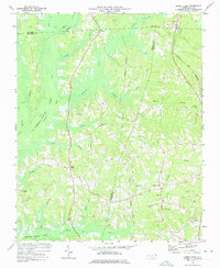 1973 Green Level1975 Print · USGSThe North Carolina Piedmont is captured here during the mid-seventies, showing the early stages of Lake B Everett Jordan. Researchers can trace old family landmarks and community hubs like Green Level, Marthas Chapel, and O'Kellys Ch.2 unique versions available
 - 1974 Map of Silk Hope, 1976 Print
 1974 Silk Hope1976 Print · USGSChatham County in the 1970s remains a landscape of quiet rural settlements and established country churches. Genealogists can locate family landmarks like Mt Vernon Ch and Emmaus Ch or trace the early paths of Terrells Creek and Cattail Creek.
 - 1974 Map of Crutchfield Crossroads, 1976 Print
 1974 Crutchfield Crossroads1976 Print · USGSThe rural border of Alamance and Chatham counties is captured here in the mid-seventies, showing a landscape of timber, small farms, and deep-rooted congregations. Genealogists and historians can trace family locations near Crutchfield Crossroads or churches like Piney Grove Ch and Pleasant Grove Ch.2 unique versions available
 - 1974 Map of New Hill, 1977 Print
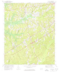 1974 New Hill1977 Print · USGSWake County was undergoing significant landscape changes in the 1970s as new water projects and rail lines intersected. Genealogists and local historians can trace family locations near Olive Chapel, Friendship, and the Pleasant Plains Sch before the rising waters of B Everett Jordan Lake altered the terrain.4 unique versions available
 - 1974 Map of Cokesbury, 1977 Print
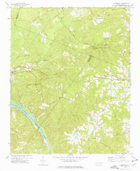 1974 Cokesbury1977 Print · USGSHarnett and Wake counties show a landscape of rural crossroads and river drainage during the mid-seventies. Trace the Norfolk Southern rail corridor or locate family landmarks like Prince Chapel and the Buckhorn Dam.4 unique versions available
 - 1974 Map of Liberty, 1977 Print
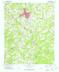 1974 Liberty1977 Print · USGSRandolph County in the 1970s remains a landscape of traditional crossroads communities and rural churches centered on Liberty and Staley. Genealogists and local historians can trace family locations through sites like Old Mc Masters Cem, Fairview Cem, and the Eastern Randolph High Sch.
 - 1978 Map of Farrington
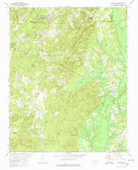 1978 Farrington1978 Print · USGSChatham County’s rural landscape underwent a major change in the late 1970s as the B. Everett Jordan Lake reservoir began to reshape the river valleys. Local historians can trace old community ties at Farrington, find the Triangle Sch, and locate ancestral sites like Manns Chapel Cem.2 unique versions available
 - 1984 Map of Chapel Hill, 1985 Print
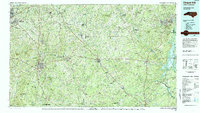 1984 Chapel Hill1985 Print · USGSNorth Carolina’s Piedmont and the northern reaches of the Uwharrie Mountains are captured here in the mid-eighties. Genealogists can trace family roots through rural landmarks like Union Chapel or locate old rail stops along the Seaboard line.
Showing maps 1-25 of 129
Top cities of Chatham County
Frequently asked questions
- What are the different types of historical maps available for Chatham County?
- What is the oldest map of Chatham County?
- Where can I purchase historical maps of Chatham County for my home or office?
- Where can I download high-res historical maps of Chatham County?
- Are there historical topographic maps available for Chatham County?
- Is there historical aerial imagery available for Chatham County?
- Where are historical maps of Chatham County sourced from?