2020s Maps of Hertford County, North Carolina
Explore 18 historic maps of Hertford County from the 2020s. These maps offer a rare glimpse into what life looked like during the 2020s — showing old roads, neighborhoods, homes, and landmarks that have changed or disappeared over time.
Whether you're researching your family's past, planning a metal detecting trip, or studying how Hertford County's landscape evolved across the 2020s, these high-resolution maps are a powerful tool for exploring the history of this region.
- Focus on a specific era: All maps on this page are from the 2020s, giving you a focused view of this time period.
- See what’s changed: Compare century-old streets, trails, and buildings to today's modern landscape using overlays and satellite layers.
- Research with precision: Use these maps for genealogy, historical research, land use analysis, or educational projects.
- View, download, or print: Maps are fully viewable online in high resolution, and can be downloaded or printed for your own records.
Start exploring Hertford County's history through authentic maps from the 2020s. This is your window into the past.
Hertford County, NC maps
(18)- 2021 Map of Kelford, 2021 Print
 2021 Kelford2021 Print · USGSCovers Hertford County, including Aulander, Lewiston Woodville, and other nearby areas
 - 2022 Map of Powellsville, 2022 Print
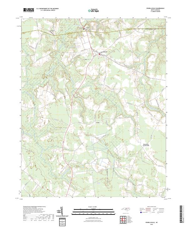 2022 Powellsville2022 Print · USGSThe coastal plain of North Carolina is captured here in recent years, revealing a landscape of dense swamps and rural crossroads. Local historians can trace family-named roads and remote landmarks like Pell Mell Pocosin, Buzzards Crossroads, and Stony Creek Cem.
 - 2022 Map of Ahoskie, 2022 Print
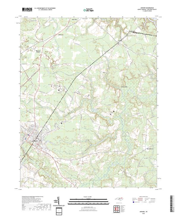 2022 Ahoskie2022 Print · USGSCoastal plain wetlands and small rural settlements dominate this part of Hertford County during the early 2020s. Researchers can locate family landmarks such as Brinkley Cem and Willoughby Cem or trace old water-powered sites at Dildys Mill.
 - 2022 Map of Colerain, 2022 Print
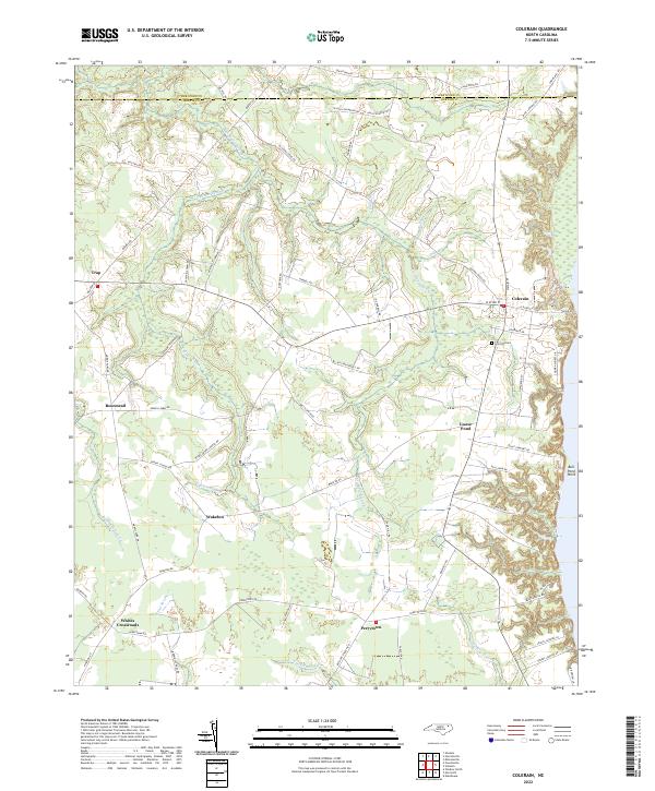 2022 Colerain2022 Print · USGSBertie County's coastal plain and swamp-heavy interior are shown here in the 2020s. Genealogists and historians can locate rural crossroads like Trap and Whites Crossroads alongside notable landmarks like Hillcrest Cem and Goose Pond.
 - 2022 Map of Harrellsville, 2022 Print
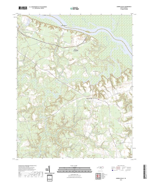 2022 Harrellsville2022 Print · USGSThe riverine lowlands of Hertford County are captured here in the early twenty-first century as they border the Chowan River. Researchers can trace the layout of Harrellsville and locate rural landmarks such as Pilands Crossroads and Pettys Shore.
 - 2022 Map of Winton, 2022 Print
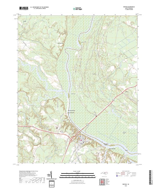 2022 Winton2022 Print · USGSThe riverside town of Winton and the surrounding Hertford County wetlands are detailed in this recent survey. Researchers can trace local genealogy at the Winton Baptist Church Cem or explore the riverfront at Tunis and Chowan Beach.
 - 2022 Map of Valhalla, 2022 Print
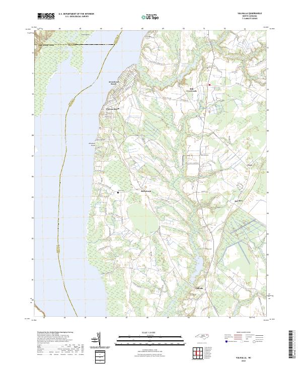 2022 Valhalla2022 Print · USGSCoastal plains and riverfront settlements define this portion of Chowan County in the early twenty-first century. Genealogists and local historians can trace family locations near Rockyhock, Valhalla, and Nixon Cem or explore the residential layouts of Arrowhead Beach.
 - 2022 Map of Mintonsville, 2022 Print
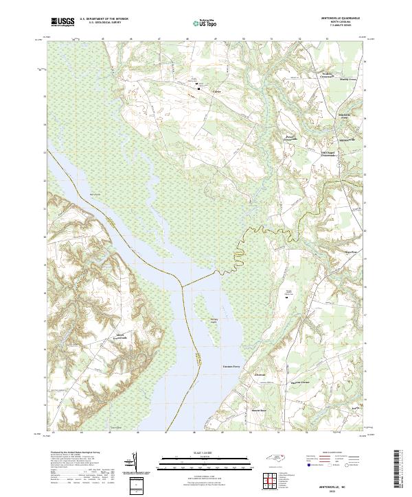 2022 Mintonsville2022 Print · USGSCoastal North Carolina's riverine landscape comes alive in this contemporary record of the Chowan River borderlands. Genealogists and historians can locate family burial sites like the Hofler Family Cem and trace old routes through Mitchells Fork and Old Chapel Crossroads.
 - 2022 Map of Gatesville, 2022 Print
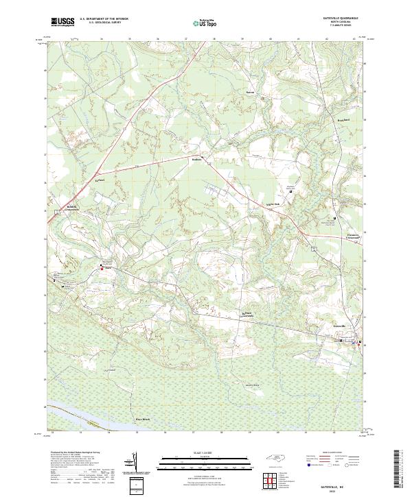 2022 Gatesville2022 Print · USGSGates County at the start of the 2020s shows a landscape of crossroads settlements and coastal wetlands. Researchers can trace family history through local sites like the Gatesville Cem, the Gates County Courthouse, and the Eure Baptist Church Cem.
 - 2022 Map of Union, 2022 Print
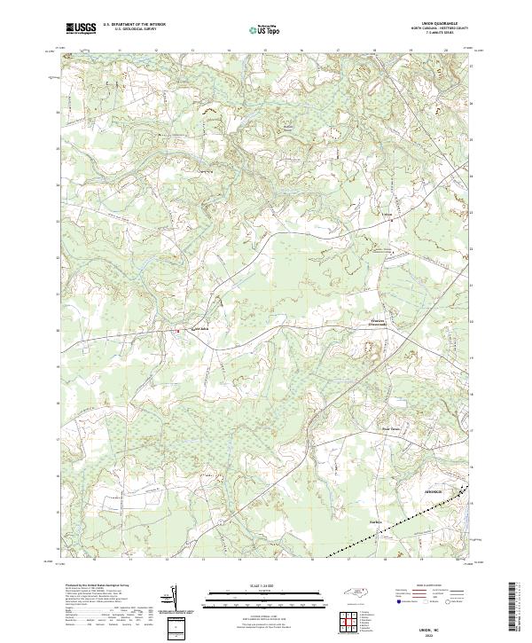 2022 Union2022 Print · USGSHertford County at the start of the 2020s remains a landscape shaped by its winding waterways and rural settlements. Researchers can trace local landmarks like Fraziers Crossroads, Poor Town, and the sprawling campus of Roanoke-Chowan Community College.
 - 2022 Map of Murfreesboro, 2022 Print
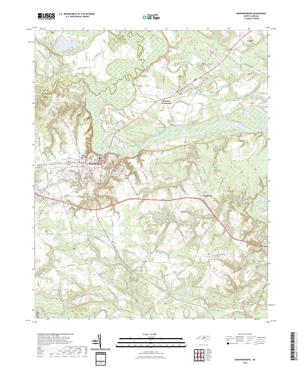 2022 Murfreesboro2022 Print · USGSThe northern coastal plain of North Carolina comes into focus here during the early twenty-first century. Genealogists and local historians can trace the town layouts of Murfreesboro and Como, locate the historic Riverside Cem, and follow the winding course of the Meherrin River.
 - 2022 Map of Woodland, 2022 Print
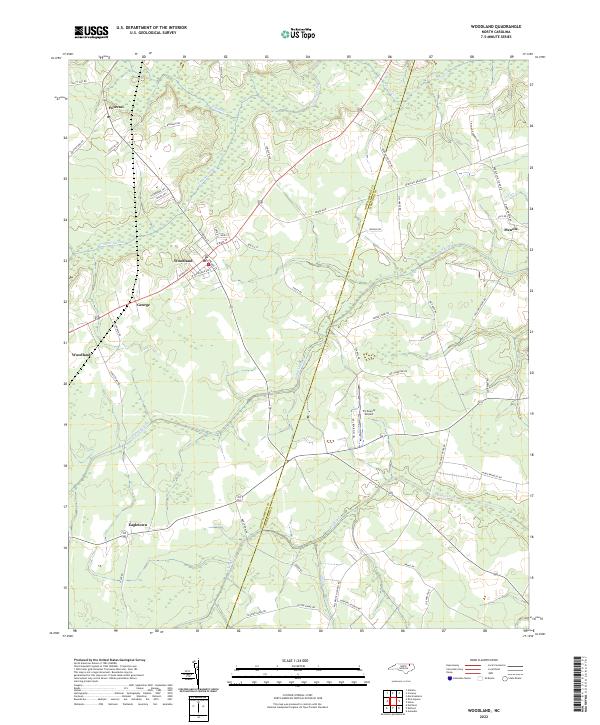 2022 Woodland2022 Print · USGSWoodland and the surrounding coastal plain of Northampton County are captured here in the early 2020s. Genealogists can trace family landmarks along Baughan Rd and Jim Hardy Rd, or locate ancestral sites near Potecasi and Eagletown.
 - 2022 Map of Kelford, 2022 Print
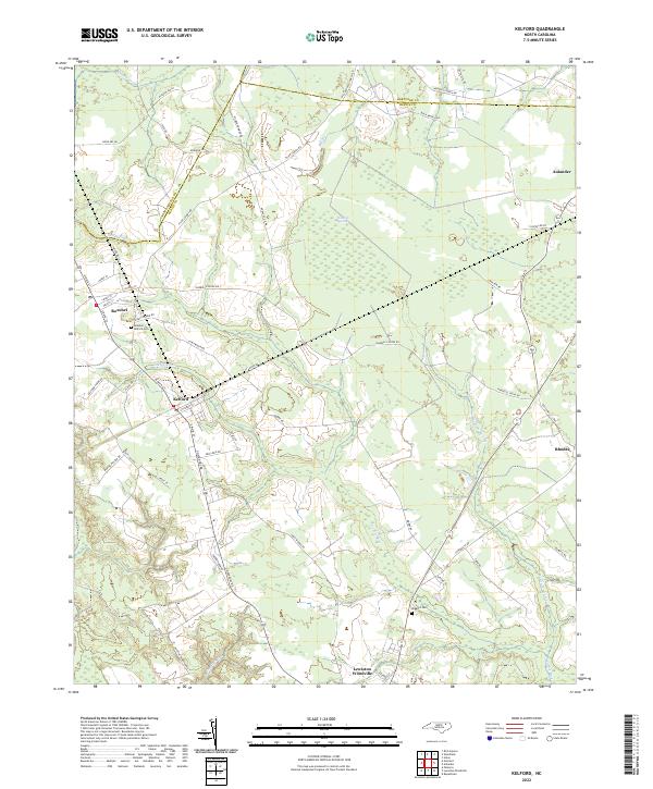 2022 Kelford2022 Print · USGSThe rural landscapes of Bertie and Hertford Counties are detailed in the early 2020s, showing the agricultural heart of northeastern North Carolina. Researchers can locate family landmarks like the Hoggard Cem or trace the drainage of the Cashie River near Roxobel.
 - 2022 Map of Aulander, 2022 Print
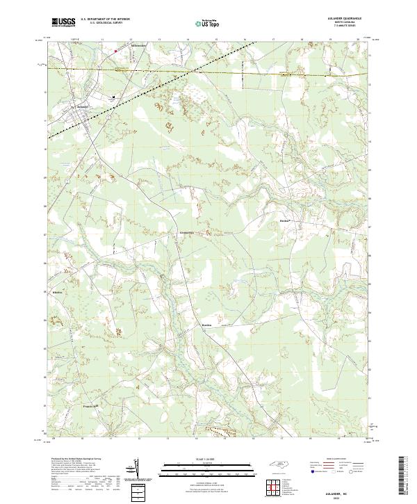 2022 Aulander2022 Print · USGSBertie and Hertford Counties are shown here in the early 2020s, a landscape defined by traditional rural settlements and vast wetlands. Researchers can trace family sites and local geography near Aulander, Eastview Cem, and the waters of Hearts Delight Pocosin.
 - 2022 Map of Conway, 2022 Print
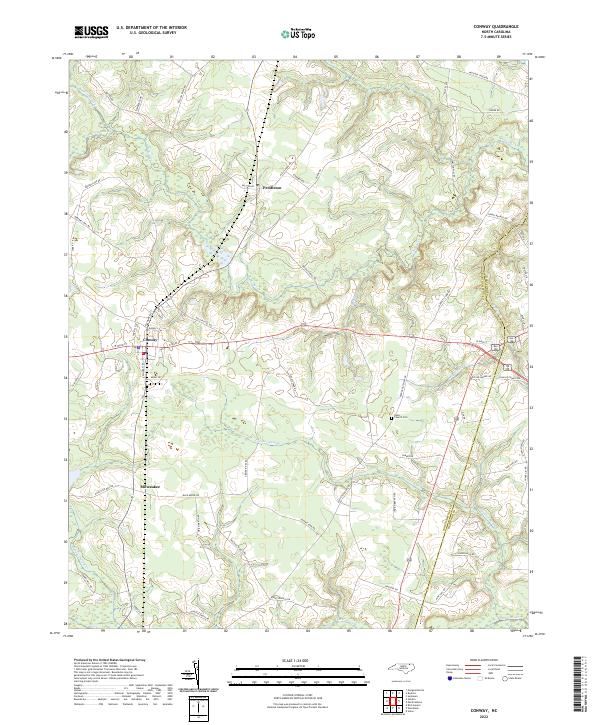 2022 Conway2022 Print · USGSConway and its neighboring rural communities are shown in this contemporary study of the North Carolina Coastal Plain. Researchers can trace family history through sites like Nebo Church Cem or follow the paths of Panther Swamp and Potecasi Cr.
 - 2022 Map of Sunbeam, 2022 Print
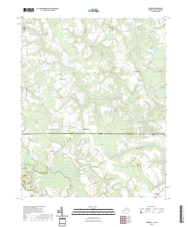 2022 Sunbeam2022 Print · USGSThe Virginia and North Carolina borderlands come alive in this recent survey of Southampton and Hertford counties. Researchers can trace local lineage through Hollywood Cemetery and Barnes Church while exploring the banks of the Meherrin River.
 - 2022 Map of Boykins, 2022 Print
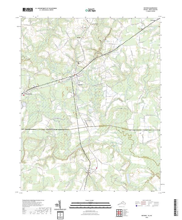 2022 Boykins2022 Print · USGSThe Virginia and North Carolina borderlands come into focus in this contemporary survey of the Meherrin River valley. Researchers can trace local history through old road networks and landmarks like Beechwood Cem, Mann Airport, and the rail-oriented town of Boykins.
 - 2022 Map of Riverdale, 2022 Print
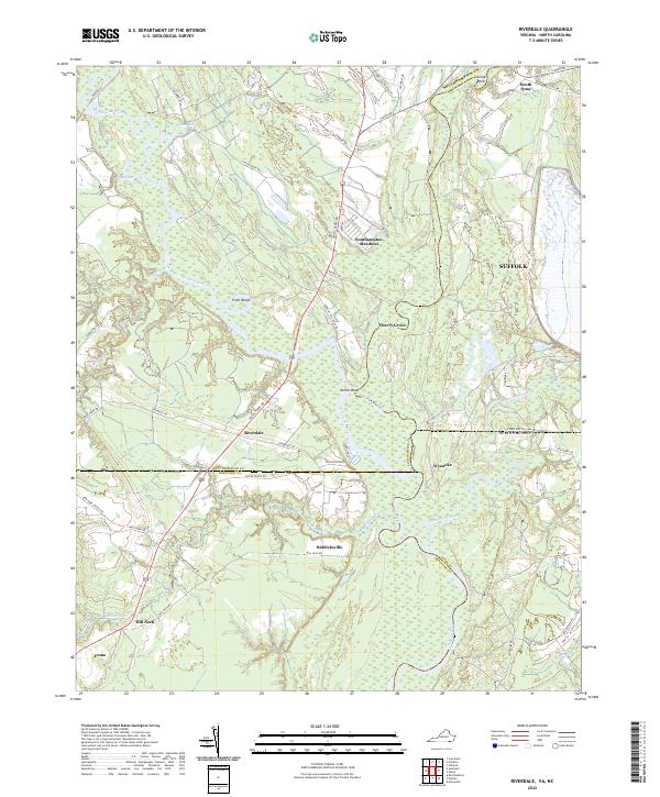 2022 Riverdale2022 Print · USGSThe Virginia-North Carolina border comes alive in this 2022 survey, showcasing the confluence of the Nottoway River and Blackwater River. Genealogists can trace family locations across the state line near Riddicksville, South Quay, and the river crossing at Riverdale.
End of results
Showing maps 1-18 of 18
Top cities of Hertford County
- Ahoskie historical maps
- Murfreesboro historical maps
- Winton historical maps
- Cofield historical maps
- Harrellsville historical maps
- Como historical maps
Frequently asked questions
- What are the different types of historical maps available for Hertford County?
- What is the oldest map of Hertford County?
- Where can I purchase historical maps of Hertford County for my home or office?
- Where can I download high-res historical maps of Hertford County?
- Are there historical topographic maps available for Hertford County?
- Is there historical aerial imagery available for Hertford County?
- Where are historical maps of Hertford County sourced from?