Old Maps of Hertford County, North Carolina for Academic Research
Study the evolution of Hertford County with 129 high-resolution historic maps. Whether you're teaching, researching, or modeling changes in land use, these maps provide essential visual documentation of urban, environmental, and geographic change.
- Analyze long-term change: Track patterns in development, transportation, and natural features.
- Ideal for environmental or urban studies: Support academic projects with primary historical map data.
- Use in the classroom or lab: Educators and researchers rely on these maps to bring historical context to life.
These maps are a powerful tool for teaching, research, and visualizing how Hertford County has changed over the decades.
Hertford County, NC maps
(129)- 1904 Map of Edenton
 1904 Edenton1904 Print · USGSThe Chowan River and Albemarle Sound waterfronts are documented here at the turn of the century. Genealogists and historians can trace defunct river landings like Jernigens Wharf and old postal hubs such as Mege P.O. and Tynes P.O. Center Hill.2 unique versions available
 - 1906 Map of Beckford
 1906 Beckford1906 Print · USGSCoastal North Carolina at the turn of the century reveals a world of swamp-based industry and riverine commerce. Trace family roots and old landmarks across the landscape from the wharves at Taylor Wharf to crossroads like Wiggins Crossroads and the mills at Merchants Mill Pond.
 - 1907 Map of Beckford
 1907 Beckford1907 Print · USGSNortheastern North Carolina was a landscape of deep swamps and river commerce in the early 1900s. Genealogists can trace family landmarks at Merchants Mill, find rural congregations like Joppa Church, or follow the steam routes past Holidays Island.2 unique versions available
 - 1908 Map of Winton, 1944 Print
 1908 Winton1944 Print · USGSHertford and Gates counties thrive along the Chowan River at the turn of the century, dominated by river landings and expanding rail lines. Genealogists can trace family roots through sites like Buckland School, Sarem Grove Church, and the isolated Greens Reduco PO.2 unique versions available
 - 1919 Map of Boykins
 1919 Boykins1919 Print · USGSSouthampton County's borderlands are captured here at the end of the Great War, showing a landscape defined by river transport and rail. Genealogists can trace family footprints at Sandy Hill School, Smiths Mill, or Zion Hill Church.
 - 1920 Map of Holland
 1920 Holland1920 Print · USGSCoastal plain life at the end of the Great War centers on the river-and-rail hubs of Franklin and Holland. Genealogists can trace family footprints across dozens of country schools like Holmes School and river crossings such as Joyners Bridge and Manning Ferry.2 unique versions available
 - 1920 Map of Boykins
 1920 Boykins1920 Print · USGSCoastal plain settlements near the Virginia and North Carolina line thrive along the river systems and railroads of the post-WWI era. Genealogists can trace family roots at Ebenezer Church, Johnsons School, and mills like Smiths Mill.2 unique versions available
 - 1940 Map of Beckford
 1940 Beckford1940 Print · USGSNortheastern North Carolina in the early 1940s was a land of timbered swamps and essential river crossings. Genealogists and historians can trace old homesteads and transport hubs near Cannon Ferry, Merchants Millpond, and the Beckford Junction rail crossing.2 unique versions available
 - 1942 Map of Edenton
 1942 Edenton1942 Print · USGSThe Albemarle Sound and Chowan River shoreline appear here during the Second World War as both a military hub and a quiet riverfront. Researchers can trace historic river landings like Mt Gould Landing alongside the sprawling U S Marine Corps Air Station and the Norfolk Southern RR.
 - 1943 Map of Holland
 1943 Holland1943 Print · USGSThe Virginia and North Carolina borderlands come alive in this mid-century survey of the Chowan River basin. Local historians can trace a network of river landings and rural schools, from Manning Ferry to the community around Stony Branch Church.
 - 1943 Map of Edenton
 1943 Edenton1943 Print · USGSCoastal North Carolina during the early years of the war shows a landscape of strategic military sites and traditional river landings. Genealogists can trace family roots through St. Johns church or explore the rail-and-water economy at Edenton and Hermitage Wharf.
 - 1953 Map of Norfolk, 1954 Print
 1953 Norfolk1954 Print · USGSCoastal Virginia and northeastern North Carolina appear here during the post-war industrial boom, showing the critical rail-and-sea connections of Hampton Roads. Genealogists can trace family roots through rural landmarks like Gethsemane Ch, the Caledonia State Prison Farm, and the vast interior of the Dismal Swamp.4 unique versions available
 - 1957 Map of Holland, 1958 Print
 1957 Holland1958 Print · USGSThe Virginia and North Carolina borderlands come into focus in the mid-fifties, centered on the river city of Franklin and the agricultural community of Holland. Researchers can trace early river crossings like Manning Ferry (Site) and find family roots at Oberry Sch Cem or St Matthews Ch.
 - 1966 Map of Sunbeam, 1968 Print
 1966 Sunbeam1968 Print · USGSCoastal plain life along the Virginia and North Carolina border comes into focus in the mid-1960s. Genealogists and local historians can trace rural family hubs at Newsoms, Statesville, and Como, or locate family sites near Harts Bridge and Windbourne Millpond.2 unique versions available
 - 1966 Map of Boykins, 1968 Print
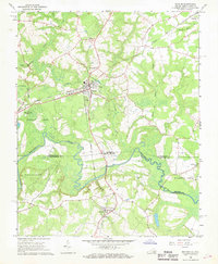 1966 Boykins1968 Print · USGSThe Virginia and North Carolina borderlands come to life in the 1960s, centered on the railroad crossing at Boykins. Researchers can trace the legacy of rural communities through markers like Beechwood Cem, Meherrin Sch, and the winding Meherrin River.2 unique versions available
 - 1967 Map of Riverdale, 1970 Print
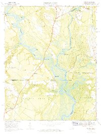 1967 Riverdale1970 Print · USGSThe convergence of the Blackwater and Nottoway Rivers at the Virginia-North Carolina border defines this late-1960s landscape. Researchers can trace the legacy of river commerce and local genealogy through numerous sites like Cobbs Wharf, Riddicksville, and Diamond Grove Ch.3 unique versions available
 - 1972 Map of Aulander, 1977 Print
 1972 Aulander1977 Print · USGSNortheastern North Carolina farming communities and swamp landscapes are captured here in the early 1970s. Genealogists can locate family-named landmarks and centers of local life like South Aulander Sch, Francis Mill, and Connáritsa Ch.
 - 1973 Map of Murfreesboro, 1977 Print
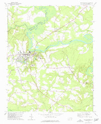 1973 Murfreesboro1977 Print · USGSMurfreesboro and the surrounding tobacco and timber country are captured here in the early 1970s. Trace local family history through numerous rural landmarks like Barretts Crossroads, Chowan College, and Worrell Millpond.
 - 1973 Map of Conway, 1977 Print
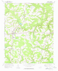 1973 Conway1977 Print · USGSNorthampton County during the 1970s is characterized by quiet rail-side hamlets and extensive swamp drainages. Genealogists and local historians can trace legacy landmarks like Roberts Chapel, Hare Sch, and the old rail path of the Seaboard Coast Line.
 - 1973 Map of Kelford, 1977 Print
 1973 Kelford1977 Print · USGSBertie County in the early 1970s is a landscape of established rail towns and productive peanut farms. Genealogists can trace family names through numerous rural cemeteries and local landmarks like Beautiful Zion Ch, West Bertie Sch, and the Peanut Belt Research Station.
 - 1977 Map of Union
 1977 Union1977 Print · USGSHertford County in the late 1970s is a landscape of rural crossroads and stream-fed lowlands. Genealogists and historians can trace family locations through numerous rural cemeteries and sites like St Johns Ch, Poor Town, and Fraziers Crossroads.
 - 1977 Map of Woodland, 1978 Print
 1977 Woodland1978 Print · USGSNorthampton County during the 1970s remained a landscape of rural crossroads and rail-connected towns. Genealogists can trace family footprints through numerous church sites like Pleasant Grove Ch and the many unnamed Cem scattered near Eagletown and George.
 - 1981 Map of Gatesville
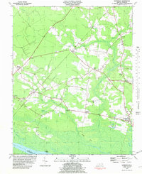 1981 Gatesville1981 Print · USGSGates County was a landscape of intricate swamplands and rural crossroads in the late seventies. Researchers can trace ancestral roots through community landmarks like Kittrells Ch, Eleanors Crossroads, and the riverfront at Rays Beach.2 unique versions available
 - 1982 Map of Powellsville
 1982 Powellsville1982 Print · USGSBertie and Hertford counties appear in the early eighties as a rural landscape of vast wetlands and small farming crossroads. Genealogists can trace family roots at Highland Mem Cem or locate historic congregation sites like Holly Grove Ch and Piney Wood Chapel.
 - 1982 Map of Winton
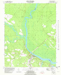 1982 Winton1982 Print · USGSHertford and Gates Counties are mapped here in the early eighties as the riverfront communities along the Chowan River evolved. Genealogists and local historians can trace family-named sites like Askew Cem, Mt Moriah Ch, and the Brown Sch.
Showing maps 1-25 of 129
Top cities of Hertford County
- Ahoskie historical maps
- Murfreesboro historical maps
- Winton historical maps
- Cofield historical maps
- Harrellsville historical maps
- Como historical maps
Frequently asked questions
- What are the different types of historical maps available for Hertford County?
- What is the oldest map of Hertford County?
- Where can I purchase historical maps of Hertford County for my home or office?
- Where can I download high-res historical maps of Hertford County?
- Are there historical topographic maps available for Hertford County?
- Is there historical aerial imagery available for Hertford County?
- Where are historical maps of Hertford County sourced from?