1900s (20th Century) Maps of Johnston County, North Carolina
Explore 53 historic maps of Johnston County from the 1900s (20th Century). These maps offer a rare glimpse into what life looked like during the 1900s — showing old roads, neighborhoods, homes, and landmarks that have changed or disappeared over time.
Whether you're researching your family's past, planning a metal detecting trip, or studying how Johnston County's landscape evolved across the 1900s, these high-resolution maps are a powerful tool for exploring the history of this region.
- Focus on a specific era: All maps on this page are from the 1900s, giving you a focused view of this time period.
- See what’s changed: Compare century-old streets, trails, and buildings to today's modern landscape using overlays and satellite layers.
- Research with precision: Use these maps for genealogy, historical research, land use analysis, or educational projects.
- View, download, or print: Maps are fully viewable online in high resolution, and can be downloaded or printed for your own records.
Start exploring Johnston County's history through authentic maps from the 1900s. This is your window into the past.
Johnston County, NC maps
(53)- 1902 Map of Kenly
 1902 Kenly1902 Print · USGSCoastal plain settlements in Johnston and Wilson Counties flourished along the rail lines during the early nineteen-hundreds. Genealogists can locate family landmarks like Moores Crossroads and Hares Crossroads or trace the Atlantic Coast Line through Kenly and Micro.2 unique versions available
 - 1902 Map of Spring Hope, 1965 Print
 1902 Spring Hope1965 Print · USGSNash and Franklin Counties are seen here at the turn of the century as a landscape of river-bend settlements and railroad progress. Researchers can trace ancestral roots through family-named landmarks like Lamm Crossroads, Lee Chapel, and Pine Ridge Schoolhouse.
 - 1903 Map of Kenly
 1903 Kenly1903 Print · USGSCoastal plain settlements and crossroads thrive along the rail corridors of Johnston and Wilson counties at the dawn of the twentieth century. Genealogists can locate family-named sites like Hornes Mill and Barnes Store or trace the early paths through Beulahtown and Kenly.2 unique versions available
 - 1904 Map of Springhope, 1942 Print
 1904 Springhope1942 Print · USGSNash County at the turn of the century shows a rural landscape connected by the Atlantic Coast Line R. R. and the winding Tar River. Researchers can trace ancestral locations at Lamm Crossroads, Whiteoak Church, and the Pine Ridge Schoolhouse.
 - 1906 Map of Four Oaks
 1906 Four Oaks1906 Print · USGSCoastal plain farming and river commerce define Johnston County at the turn of the century. Genealogists can locate family landmarks like Tarts Store and Bentonville (Beasley PO), alongside historic river crossings at Pierce's Ferry.
 - 1908 Map of Four Oaks
 1908 Four Oaks1908 Print · USGSJohnston County’s agrarian landscape is captured here in the years following the turn of the century, centered on the rail commerce of Four Oaks. Researchers can trace the heritage of local families through landmarks like Peacocks Crossroads, Lees Mill, and Wentworth School.3 unique versions available
 - 1953 Map of Raleigh, 1965 Print
 1953 Raleigh1965 Print · USGSCentral North Carolina in the early sixties shows a landscape of growing towns and military hubs before the full expansion of the interstate system. Genealogists can trace family footprints across the Piedmont through Wake Forest, Siler City, and the large Fort Bragg Military Reservation.4 unique versions available
 - 1954 Map of Raleigh
 1954 Raleigh1954 Print · USGSThe North Carolina Piedmont and Sandhills are captured in the mid-fifties during a period of steady regional growth. Genealogists and historians can trace the development of towns like Siler City or locate landmarks such as Falls of Neuse and Camp Mackall.
 - 1964 Map of Garner, 1965 Print
 1964 Garner1965 Print · USGSGarner and the surrounding townships of Wake County are shown in the mid-sixties as the rail-side communities began to expand. Researchers can locate family landmarks and rural hubs like Hayes Chapel, Rand Cem, and the State Agriculture Experiment Station near Clayton.4 unique versions available
 - 1964 Map of Flowers, 1965 Print
 1964 Flowers1965 Print · USGSCentral Johnston County during the mid-sixties remains a landscape of traditional crossroads and family farmsteads. Trace local roots at Hocutts Crossroads, Corinth Holder High Sch, or the Watkins Chapel Cem.3 unique versions available
 - 1964 Map of Selma, 1965 Print
 1964 Selma1965 Print · USGSEastern Johnston County flourished as a rail and river hub in the mid-sixties, dominated by the crossing of the Neuse River. Researchers can trace old family sites and crossroads from Archers Lodge to Pine Level, including the Harrison High Sch and Branch Chapel.
 - 1964 Map of Angier, 1965 Print
 1964 Angier1965 Print · USGSAngier and the surrounding tobacco-farming country appear here in the mid-1960s at the junction of three counties. Genealogists and researchers can trace local family roots through numerous cemeteries and country churches like St Ann Ch, Fellowship Ch, and Ogburn Crossroads.3 unique versions available
 - 1964 Map of Clayton, 1965 Print
 1964 Clayton1965 Print · USGSThe Neuse River valley in Johnston and Wake Counties is captured here in the mid-1960s, showing the early expansion of the Clayton area. Researchers can locate numerous family burial sites like Stephenson Cem and rural centers such as Archers Lodge and Shotwell.3 unique versions available
 - 1964 Map of Edmondson, 1965 Print
 1964 Edmondson1965 Print · USGSJohnston County in the early sixties was a landscape of crossroads communities and family-run mills. Genealogists can locate specific family landmarks such as Penny Cem, trace the waters near McGee Mill, and find vanished gathering spots like Drug Store.3 unique versions available
 - 1964 Map of Garner, 1965 Print
 1964 Garner1965 Print · USGSThe rural landscapes south of Raleigh were transitioning from farm to suburb in the mid-sixties. Researchers can trace family roots at numerous country churches like Wooten Chapel Ch or locate sites such as McCullers, Willow Springs, and the historic McGee Mill.
 - 1964 Map of Powhatan, 1965 Print
 1964 Powhatan1965 Print · USGSJohnston County's rural landscape is captured here in the mid-sixties, showing a community organized around country churches and winding creek bottoms. Researchers can trace family sites near Elizabeth Ch, Short Journey Sch, and the Southern railroad line.3 unique versions available
 - 1964 Map of Selma, 1965 Print
 1964 Selma1965 Print · USGSJohnston County in the mid-sixties reveals a landscape shaped by the Neuse River and a dense network of railroads. Researchers can trace family history through dozens of rural sites like Richardson Cem, New Hill Ch, and the County Training Sch.3 unique versions available
 - 1967 Map of Knightdale, 1972 Print
 1967 Knightdale1972 Print · USGSEastern Wake County comes into focus in the mid-1960s, showing the rural character and emerging infrastructure between the capital and the coastal plain. Genealogists and local historians can trace family locations near Lizard Lick, Eagle Rock, and Hephzibah Ch.4 unique versions available
 - 1968 Map of Zebulon, 1972 Print
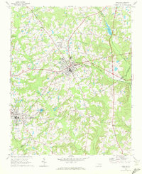 1968 Zebulon1972 Print · USGSThe eastern edges of Wake County meet Franklin and Nash in the late sixties, where small-town industry revolves around the rail lines. Local historians can trace family ties at St. Mathews Church or explore the origins of Lizard Lick and Wakefield.3 unique versions available
 - 1973 Map of Benson, 1975 Print
 1973 Benson1975 Print · USGSBenson and the surrounding Johnston County countryside are captured here in the early seventies during a period of steady rural development. Genealogists can trace family landmarks like Hardee Cross Roads, Stevens Chapel, and the Drive-in Theater.2 unique versions available
 - 1973 Map of Dunn, 1975 Print
 1973 Dunn1975 Print · USGSDunn and Benson were thriving railroad and agricultural hubs in the early 1970s. Genealogists and local historians can trace family church roots at Jonesboro Ch and Mingo Hill Ch or locate landmarks like the Young Lookout Tower.2 unique versions available
 - 1973 Map of Coats, 1975 Print
 1973 Coats1975 Print · USGSHarnett County in the early seventies shows a landscape of small farming communities and academic growth centered around Campbell College. Genealogists and historians can trace the paths of the Durham and Southern line or locate rural landmarks like Barclaysville and Bethel Ch.3 unique versions available
 - 1974 Map of Grantham, 1976 Print
 1974 Grantham1976 Print · USGSWestern Wayne County in the mid-seventies is a landscape of winding creeks and rural crossroads. Local historians can trace established community centers like Grantham, Stevens Mill, and numerous country churches including Selah Ch and Bethany Ch.
 - 1974 Map of Northwest Goldsboro, 1976 Print
 1974 Northwest Goldsboro1976 Print · USGSWayne County just west of Goldsboro in the mid-1970s reveals a landscape of expanding institutional campuses and rural crossroads. Local historians can trace the grounds of CHERRY HOSPITAL, the community at Rosewood, and family landmarks like Spring Hill Ch.2 unique versions available
 - 1974 Map of Princeton, 1976 Print
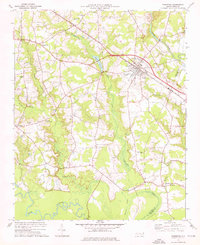 1974 Princeton1976 Print · USGSNear the Johnston and Wayne county line in the mid-1970s, this area centers on the railroad town of Princeton and its surrounding wetlands. Local historians can locate numerous rural landmarks like Bakers Chapel, Raynor Town, and Bizzell Grove Memorial Gardens.
Showing maps 1-25 of 53
Top cities of Johnston County
- Clayton historical maps
- Smithfield historical maps
- Selma historical maps
- Benson historical maps
- Four Oaks historical maps
- Pine Level historical maps
See more
Frequently asked questions
- What are the different types of historical maps available for Johnston County?
- What is the oldest map of Johnston County?
- Where can I purchase historical maps of Johnston County for my home or office?
- Where can I download high-res historical maps of Johnston County?
- Are there historical topographic maps available for Johnston County?
- Is there historical aerial imagery available for Johnston County?
- Where are historical maps of Johnston County sourced from?