1960s Maps of Johnston County, North Carolina
Explore 11 historic maps of Johnston County from the 1960s. These maps offer a rare glimpse into what life looked like during the 1960s — showing old roads, neighborhoods, homes, and landmarks that have changed or disappeared over time.
Whether you're researching your family's past, planning a metal detecting trip, or studying how Johnston County's landscape evolved across the 1960s, these high-resolution maps are a powerful tool for exploring the history of this region.
- Focus on a specific era: All maps on this page are from the 1960s, giving you a focused view of this time period.
- See what’s changed: Compare century-old streets, trails, and buildings to today's modern landscape using overlays and satellite layers.
- Research with precision: Use these maps for genealogy, historical research, land use analysis, or educational projects.
- View, download, or print: Maps are fully viewable online in high resolution, and can be downloaded or printed for your own records.
Start exploring Johnston County's history through authentic maps from the 1960s. This is your window into the past.
Johnston County, NC maps
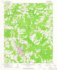
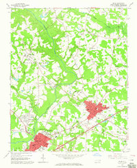
(11)- 1964 Map of Garner, 1965 Print
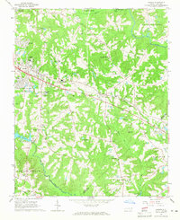 1964 Garner1965 Print · USGSGarner and the surrounding townships of Wake County are shown in the mid-sixties as the rail-side communities began to expand. Researchers can locate family landmarks and rural hubs like Hayes Chapel, Rand Cem, and the State Agriculture Experiment Station near Clayton.4 unique versions available
 - 1964 Map of Flowers, 1965 Print
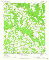
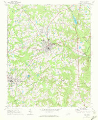
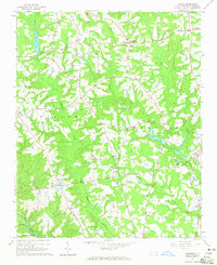 1964 Flowers1965 Print · USGSCentral Johnston County during the mid-sixties remains a landscape of traditional crossroads and family farmsteads. Trace local roots at Hocutts Crossroads, Corinth Holder High Sch, or the Watkins Chapel Cem.3 unique versions available
 - 1964 Map of Selma, 1965 Print
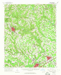 1964 Selma1965 Print · USGSEastern Johnston County flourished as a rail and river hub in the mid-sixties, dominated by the crossing of the Neuse River. Researchers can trace old family sites and crossroads from Archers Lodge to Pine Level, including the Harrison High Sch and Branch Chapel.
 - 1964 Map of Angier, 1965 Print
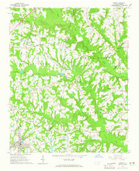 1964 Angier1965 Print · USGSAngier and the surrounding tobacco-farming country appear here in the mid-1960s at the junction of three counties. Genealogists and researchers can trace local family roots through numerous cemeteries and country churches like St Ann Ch, Fellowship Ch, and Ogburn Crossroads.3 unique versions available
 - 1964 Map of Clayton, 1965 Print
 1964 Clayton1965 Print · USGSThe Neuse River valley in Johnston and Wake Counties is captured here in the mid-1960s, showing the early expansion of the Clayton area. Researchers can locate numerous family burial sites like Stephenson Cem and rural centers such as Archers Lodge and Shotwell.3 unique versions available
 - 1964 Map of Edmondson, 1965 Print
 1964 Edmondson1965 Print · USGSJohnston County in the early sixties was a landscape of crossroads communities and family-run mills. Genealogists can locate specific family landmarks such as Penny Cem, trace the waters near McGee Mill, and find vanished gathering spots like Drug Store.3 unique versions available
 - 1964 Map of Garner, 1965 Print
 1964 Garner1965 Print · USGSThe rural landscapes south of Raleigh were transitioning from farm to suburb in the mid-sixties. Researchers can trace family roots at numerous country churches like Wooten Chapel Ch or locate sites such as McCullers, Willow Springs, and the historic McGee Mill.
 - 1964 Map of Powhatan, 1965 Print
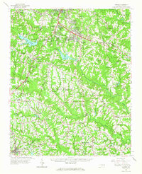
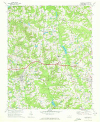
 1964 Powhatan1965 Print · USGSJohnston County's rural landscape is captured here in the mid-sixties, showing a community organized around country churches and winding creek bottoms. Researchers can trace family sites near Elizabeth Ch, Short Journey Sch, and the Southern railroad line.3 unique versions available
 - 1964 Map of Selma, 1965 Print
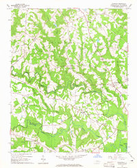
 1964 Selma1965 Print · USGSJohnston County in the mid-sixties reveals a landscape shaped by the Neuse River and a dense network of railroads. Researchers can trace family history through dozens of rural sites like Richardson Cem, New Hill Ch, and the County Training Sch.3 unique versions available
 - 1967 Map of Knightdale, 1972 Print
 1967 Knightdale1972 Print · USGSEastern Wake County comes into focus in the mid-1960s, showing the rural character and emerging infrastructure between the capital and the coastal plain. Genealogists and local historians can trace family locations near Lizard Lick, Eagle Rock, and Hephzibah Ch.4 unique versions available
 - 1968 Map of Zebulon, 1972 Print
 1968 Zebulon1972 Print · USGSThe eastern edges of Wake County meet Franklin and Nash in the late sixties, where small-town industry revolves around the rail lines. Local historians can trace family ties at St. Mathews Church or explore the origins of Lizard Lick and Wakefield.3 unique versions available
End of results
Showing maps 1-11 of 11
Top cities of Johnston County
- Clayton historical maps
- Smithfield historical maps
- Selma historical maps
- Benson historical maps
- Four Oaks historical maps
- Pine Level historical maps
See more
Frequently asked questions
- What are the different types of historical maps available for Johnston County?
- What is the oldest map of Johnston County?
- Where can I purchase historical maps of Johnston County for my home or office?
- Where can I download high-res historical maps of Johnston County?
- Are there historical topographic maps available for Johnston County?
- Is there historical aerial imagery available for Johnston County?
- Where are historical maps of Johnston County sourced from?