1990s Maps of Johnston County, North Carolina
Explore 18 historic maps of Johnston County from the 1990s. These maps offer a rare glimpse into what life looked like during the 1990s — showing old roads, neighborhoods, homes, and landmarks that have changed or disappeared over time.
Whether you're researching your family's past, planning a metal detecting trip, or studying how Johnston County's landscape evolved across the 1990s, these high-resolution maps are a powerful tool for exploring the history of this region.
- Focus on a specific era: All maps on this page are from the 1990s, giving you a focused view of this time period.
- See what’s changed: Compare century-old streets, trails, and buildings to today's modern landscape using overlays and satellite layers.
- Research with precision: Use these maps for genealogy, historical research, land use analysis, or educational projects.
- View, download, or print: Maps are fully viewable online in high resolution, and can be downloaded or printed for your own records.
Start exploring Johnston County's history through authentic maps from the 1990s. This is your window into the past.
Johnston County, NC maps
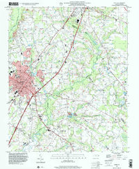
(18)- 1990 Map of Raleigh, 1991 Print
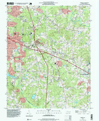
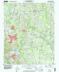
 1990 Raleigh1991 Print · USGSGreater Raleigh and the Research Triangle entered a period of significant suburban growth during the 1990s. Researchers can trace the development of towns like Fuquay-Varina and Wake Forest or locate landmarks such as the State Prison and Harris Reservoir.2 unique versions available
 - 1993 Map of Angier, 1998 Print
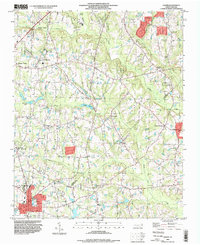 1993 Angier1998 Print · USGSThe borderlands of Wake, Johnston, and Harnett counties are shown here in the 1990s as the area transition toward modern growth. Genealogists can locate family landmarks like Wooten Chapel Cem, Sandy Grove Ch, and the Triple W Air Park.
 - 1993 Map of Edmondson, 1999 Print
 1993 Edmondson1999 Print · USGSJohnston County in the early nineties shows a landscape of traditional crossroads and family farms adapting to modern highway growth. Genealogists can locate numerous family burial sites like Penny Cem and Honeycutt Cem, or trace the rural economy at McGee Mill and Edmondson.
 - 1993 Map of Knightdale, 1999 Print
 1993 Knightdale1999 Print · USGSWake County's rural and suburban interface comes into focus in the 1990s, highlighting the established town centers and surrounding crossroads. Local historians can trace the foundations of the community through Lizard Lick, Lake Myra, and the Wendell-Knightdale Airport.
 - 1993 Map of Powhatan, 1999 Print
 1993 Powhatan1999 Print · USGSCoastal plain communities south of Powhatan are shown here in the 1990s as the area transitioned between rural farmland and suburban growth. Genealogists and historians can trace local landmarks like Short Journey Sch, Powhatan Ch, and Whitley Heights.
 - 1993 Map of Clayton, 1999 Print
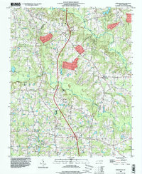
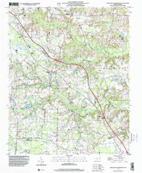
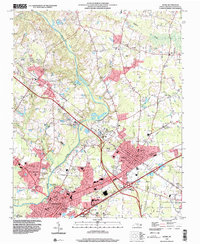
 1993 Clayton1999 Print · USGSMid-century Johnston and Wake counties come alive here, showing the river-and-rail economy as it stood before modern suburban expansion. Genealogists can trace family roots through numerous local landmarks, from Cooper High Sch to the quiet Stephenson Cem and Clydes Chapel.
 - 1993 Map of Garner, 1999 Print
 1993 Garner1999 Print · USGSWake County undergoes a period of rapid suburban expansion in the 1990s as the suburbs of the state capital extend southward. Genealogists and historians can trace numerous family landmarks like Mitchiner Cem and Sauls Cem or the local roots of Auburn and Emerald Village.
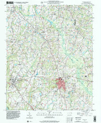
 - 1997 Map of Benson, 2000 Print
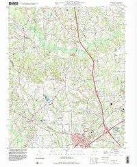 1997 Benson2000 Print · USGSBenson and its rural surroundings in Johnston County were undergoing modern development during the late nineties. Researchers can find numerous family-named sites and country churches, including Hardee Cross Roads, Stevens Chapel, and Hannah Creek Ch.
 - 1997 Map of Newton Grove North, 2000 Print
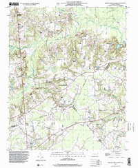 1997 Newton Grove North2000 Print · USGSThe rural borderlands of Johnston, Sampson, and Wayne counties are captured here in the late nineties, centered on the significant Bentonville Battleground. Researchers can trace the layout of Newton Grove or locate family-named landmarks and rural congregations like Ebenezer Ch and St John Ch.
 - 1997 Map of Four Oaks NE, 2000 Print
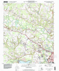
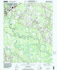 1997 Four Oaks NE2000 Print · USGSThe riverfront and rural outskirts of Johnston County come alive in the late nineties, where the winding Neuse River meets the growing edge of Smithfield. Researchers can trace the location of numerous country churches and landmarks like Sanders Chapel, The Cowbone, and Polecat Landing.
 - 1997 Map of Dunn, 2000 Print
 1997 Dunn2000 Print · USGSThe area surrounding Dunn and Benson is captured in the late nineties, documenting a landscape of rural crossroads and established schools. Researchers can trace family sites at Mary Stewart Sch, Savannah Hill Ch, or the Mingo Primitive Ch.
 - 1997 Map of Coats, 2000 Print
 1997 Coats2000 Print · USGSCoastal plain settlements in Harnett and Johnston counties show a mix of rural tradition and late-twentieth-century growth. Researchers can trace family history through numerous rural cemeteries and local congregations like Plainview Ch, or locate old landmarks such as Popes Lake and Barclaysville.
 - 1997 Map of Four Oaks, 2000 Print
 1997 Four Oaks2000 Print · USGSFour Oaks and its surrounding Johnston County farmland are captured here in the late nineties as the region balanced its rural roots with growing highway infrastructure. Genealogists can trace family footprints at Barbour Chapel, Keen Cem Park, and the crossroads at Allens Crossroads.
 - 1997 Map of Peacocks Crossroads, 2000 Print
 1997 Peacocks Crossroads2000 Print · USGSCoastal plain crossroads and agricultural lands in the late nineties show a community woven through wetlands and family farms. Researchers can trace rural genealogy and landmarks through Peacocks Crossroads, the Meadow School, and Massengill Airport.
 - 1998 Map of Flowers, 2000 Print
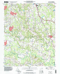
 1998 Flowers2000 Print · USGSJohnston County's rural landscape is captured here in the late nineties, showing a network of historic crossroads and family farmsteads. Genealogists can locate numerous family burial grounds like Woodard Cem and Price Cem, or trace community roots at Archers Lodge and Thanksgiving Ch.
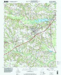
 - 1998 Map of Selma, 2000 Print
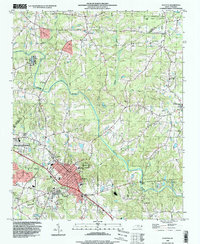
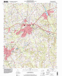
 1998 Selma2000 Print · USGSThe Johnston County corridor at the close of the century shows a landscape where historic rural settlements meet modern regional infrastructure. Genealogists can trace family landmarks like Lassiter Cem and Yelverton Grove Ch alongside civic hubs like the Johnston County Hospital.
 - 1998 Map of Northwest Goldsboro, 2001 Print
 1998 Northwest Goldsboro2001 Print · USGSWayne County at the close of the century shows a landscape where the Little River meets the Neuse River west of Goldsboro. Researchers can trace historic local institutions and rural community centers like Cherry Hospital, Rosewood, and Spring Hill Ch.
 - 1999 Map of Zebulon, 2000 Print
 1999 Zebulon2000 Print · USGSZebulon and Wendell were thriving hubs in eastern Wake County at the turn of the millennium. Researchers can trace the layout of regional schools like Wakelon High School and locate rural landmarks such as Lizard Lick and Earpsboro.
End of results
Showing maps 1-18 of 18
Top cities of Johnston County
- Clayton historical maps
- Smithfield historical maps
- Selma historical maps
- Benson historical maps
- Four Oaks historical maps
- Pine Level historical maps
See more
Frequently asked questions
- What are the different types of historical maps available for Johnston County?
- What is the oldest map of Johnston County?
- Where can I purchase historical maps of Johnston County for my home or office?
- Where can I download high-res historical maps of Johnston County?
- Are there historical topographic maps available for Johnston County?
- Is there historical aerial imagery available for Johnston County?
- Where are historical maps of Johnston County sourced from?