1970s Maps of Robeson County, North Carolina
Explore 30 historic maps of Robeson County from the 1970s. These maps offer a rare glimpse into what life looked like during the 1970s — showing old roads, neighborhoods, homes, and landmarks that have changed or disappeared over time.
Whether you're researching your family's past, planning a metal detecting trip, or studying how Robeson County's landscape evolved across the 1970s, these high-resolution maps are a powerful tool for exploring the history of this region.
- Focus on a specific era: All maps on this page are from the 1970s, giving you a focused view of this time period.
- See what’s changed: Compare century-old streets, trails, and buildings to today's modern landscape using overlays and satellite layers.
- Research with precision: Use these maps for genealogy, historical research, land use analysis, or educational projects.
- View, download, or print: Maps are fully viewable online in high resolution, and can be downloaded or printed for your own records.
Start exploring Robeson County's history through authentic maps from the 1970s. This is your window into the past.
Robeson County, NC maps
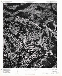
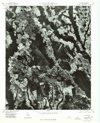
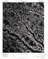
(30)- 1971 Map of Minturn, 1975 Print
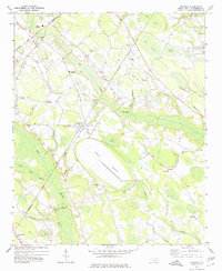
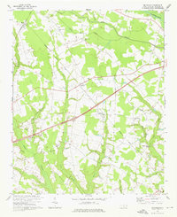
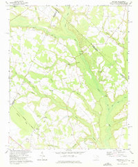 1971 Minturn1975 Print · USGSThe Carolina borderlands near the start of the 1970s show a landscape shaped by river crossings and rural parish life. Genealogists and historians can trace family locations through landmarks like Minturn, Sinclair Crossroads, and the Seaboard Coast Line railroad.
 - 1971 Map of Johns, 1975 Print
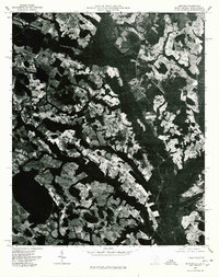
 1971 Johns1975 Print · USGSThe borderlands of North and South Carolina in the early seventies are captured here during a period of steady rural development. Genealogists and local historians can trace the foundations of St Andrews College or locate family sites near Stewartsville Cem and Zion Hill Ch.2 unique versions available
 - 1972 Map of Northwest Lumberton, 1975 Print
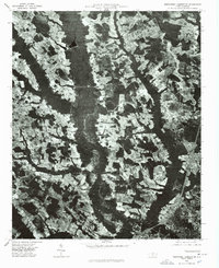
 1972 Northwest Lumberton1975 Print · USGSThe northern edge of Lumberton in the early 1970s reveals a rural landscape deeply tied to the wetlands of the Lumber River. Genealogists can locate family-named sites like Mc Niell Cem and community landmarks such as Bethel Hill Ch and Saddletree.2 unique versions available
 - 1972 Map of Southwest Lumberton, 1975 Print
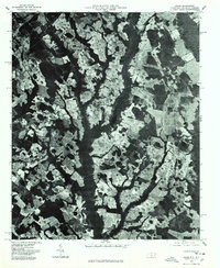
 1972 Southwest Lumberton1975 Print · USGSRobeson County in the early seventies is a landscape of expansive blackwater wetlands and rural crossroads south of the county seat. Researchers can trace the heritage of local communities through landmarks like the Rosenwald Sch, Prevatte Cem, and Thompson Chapel.2 unique versions available
 - 1972 Map of Rennert, 1975 Print
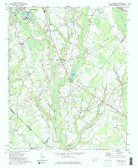
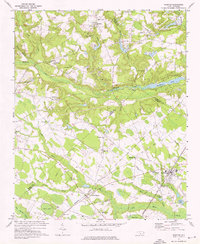
 1972 Rennert1975 Print · USGSCentral Robeson County in the early seventies is a landscape of expansive wetlands and rail-linked settlements. Genealogists can trace family names at McKinsey Cem, New Bethel Ch, and the rural community of Rennert.
 - 1972 Map of Raeford, 1976 Print
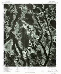
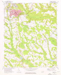 1972 Raeford1976 Print · USGSHoke County in the early seventies centers on the rail-driven growth of Raeford and its surrounding rural townships. Genealogists and local historians can trace the foundations of these communities through landmarks like Antioch Ch, Dundarrach, and Scurlock Sch.3 unique versions available
 - 1972 Map of Pembroke, 1976 Print
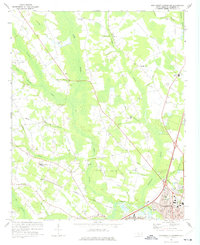
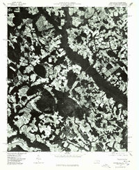
 1972 Pembroke1976 Print · USGSPembroke and the surrounding Robeson County wetlands are shown here in the early 1970s, as the university and rail lines shaped local life. Researchers can trace family-named landmarks and old congregations such as Harpers Ferry Ch and Union Chapel near the Lumber River.2 unique versions available
 - 1972 Map of Rowland, 1976 Print
 1972 Rowland1976 Print · USGSThe North Carolina and South Carolina borderlands were a patchwork of tobacco fields and swampy timberlands in the early seventies. Genealogists can trace family footprints through numerous rural landmarks like Alfordsville, Salem Ch, and the Baker Cem.2 unique versions available
 - 1972 Map of Mc Donald, 1976 Print
 1972 Mc Donald1976 Print · USGSRobeson County is shown here in the early 1970s, a landscape shaped by the Lumber River and its vast swamp systems. Researchers can locate many community landmarks, from Green Grove Sch to historic pulpits like Asbury Ch and Aaron Ch.
 - 1972 Map of Parkton, 1976 Print
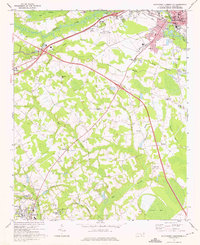
 1972 Parkton1976 Print · USGSParkton and the surrounding North Carolina swamps are captured in the early 1970s as the regional rail network still tied together rural communities. Researchers can trace family history through sites like Pittman Grove Ch, McNatts Sta, and the SEABOARD COAST LINE rail corridor.2 unique versions available
 - 1974 Map of Red Springs, 1975 Print
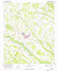
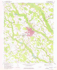 1974 Red Springs1975 Print · USGSRobeson County in the mid-seventies shows a landscape of clustered rail towns and rural congregations intertwined with the local swamplands. Researchers can trace family history through sites like Antioch Chapel, Vardell Hall, and the Seaboard Coast Line corridor.2 unique versions available
 - 1974 Map of Maxton, 1975 Print
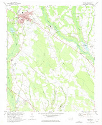 1974 Maxton1975 Print · USGSMaxton and its surrounding rural communities are captured here in the mid-1970s, as the railroad and river define the local geography. Researchers can trace family history at sites like the Carolina Military Academy, McLeod Memorial Cem, and the Antioch Mission.2 unique versions available
 - 1976 Map of Dillon East
 1976 Dillon East1976 Print · USGSDillon and the surrounding Carolina borderlands are captured from the air during the mid-seventies, showing the region's agricultural and industrial patterns. Local historians can trace the development of Dillon or locate smaller settlements like Hamer and Stewarts Crossroads.2 unique versions available
 - 1976 Map of Southwest Lumberton
 1976 Southwest Lumberton1976 Print · USGSRobeson County in the mid-seventies is captured from the air, showing the precise layout of fields and forest before modern expansion. Researchers can trace the established streets of Lumberton or find the early boundaries of East Side Park and Fairmont.
 - 1976 Map of Wakulla, 1978 Print
 1976 Wakulla1978 Print · USGSRobeson County in the mid-1970s is captured here in sharp aerial detail, showing the rural landscape just before significant modern development. Genealogists and local historians can trace the foundations of Floral College or locate homesites near Wakulla and the Lumber River.
 - 1976 Map of Rennert, 1978 Print
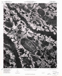 1976 Rennert1978 Print · USGSRennert and the surrounding Robeson County farmlands are captured in the mid-seventies in this detailed aerial survey. Genealogists and local historians can trace the rural road networks and land divisions near Rennert and the curious grid-like patterns within the Great Desert.
 - 1976 Map of Gaddysville, 1978 Print
 1976 Gaddysville1978 Print · USGSRobeson County near the South Carolina line is seen here in the mid-seventies through detailed aerial orthophotography. Researchers can trace rural settlement patterns and field boundaries around Gaddysville, Five Forks, and White Pond.
 - 1976 Map of Maxton, 1978 Print
 1976 Maxton1978 Print · USGSRobeson County is captured in the mid-seventies through detailed aerial imagery showing the rural landscape around the Lumber River. Genealogists and local historians can trace the footprint of Maxton and outlying communities like Raemon.
 - 1976 Map of Minturn, 1978 Print
 1976 Minturn1978 Print · USGSThe Carolina borderlands come into focus in the mid-seventies through this detailed aerial orthophoto. Local historians and genealogists can trace property lines and land use patterns around Minturn, Crossroads, and the Little Pee Dee River.
 - 1976 Map of Northwest Lumberton, 1978 Print
 1976 Northwest Lumberton1978 Print · USGSThe northern reaches of Lumberton meet the rural Robeson County landscape in the mid-1970s. Researchers can trace the era's land use through the detailed aerial views of Saddletree Swamp and the secluded Circle T Lake.
 - 1976 Map of Johns, 1978 Print
 1976 Johns1978 Print · USGSScotland County's agrarian landscape is captured in the mid-seventies, showing the intersection of rural life and regional transport. Genealogists and historians can trace old property lines and farmsteads near Laurinburg, Johns, and Mc Arthur Crossroads.
 - 1976 Map of Mc Donald, 1978 Print
 1976 Mc Donald1978 Print · USGSRobeson County is shown during the mid-seventies in this detailed aerial study of its rural landscape. Genealogists and local historians can trace the clear boundaries of family farms and the early footprints of Mc Donald, Raynham, and Elrod.
 - 1976 Map of Pembroke, 1978 Print
 1976 Pembroke1978 Print · USGSRobeson County is captured in detail during the mid-seventies, showing the agricultural rhythm and small-town structure of the North Carolina coastal plain. Genealogists and local researchers can trace the footprint of Pembroke or find historic crossroads like Buie and Moss Neck.
 - 1976 Map of Fair Bluff, 1978 Print
 1976 Fair Bluff1978 Print · USGSThe Lumber River basin comes into sharp focus during the mid-seventies, showing the intersection of North and South Carolina. Researchers can trace the river's path past Fair Bluff or locate smaller outposts like Marietta and Causey.
 - 1976 Map of Raeford, 1978 Print
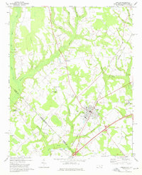
 1976 Raeford1978 Print · USGSRaeford and the surrounding Hoke County countryside are captured in this mid-1970s aerial survey. Researchers can trace the development of Raeford and the rural layout around Dundarrach through high-resolution photographic imagery.
Showing maps 1-25 of 30
Top cities of Robeson County
- Lumberton historical maps
- Fairmont historical maps
- Pembroke historical maps
- Maxton historical maps
- Rowland historical maps
- Parkton historical maps
See more
Frequently asked questions
- What are the different types of historical maps available for Robeson County?
- What is the oldest map of Robeson County?
- Where can I purchase historical maps of Robeson County for my home or office?
- Where can I download high-res historical maps of Robeson County?
- Are there historical topographic maps available for Robeson County?
- Is there historical aerial imagery available for Robeson County?
- Where are historical maps of Robeson County sourced from?