Old Maps of Elkin, North Carolina for Academic Research
Study the evolution of Elkin with 35 high-resolution historic maps. Whether you're teaching, researching, or modeling changes in land use, these maps provide essential visual documentation of urban, environmental, and geographic change.
- Analyze long-term change: Track patterns in development, transportation, and natural features.
- Ideal for environmental or urban studies: Support academic projects with primary historical map data.
- Use in the classroom or lab: Educators and researchers rely on these maps to bring historical context to life.
These maps are a powerful tool for teaching, research, and visualizing how Elkin has changed over the decades.
Elkin, NC maps
(35)- 1891 Map of Yadkinville, 1964 Print
 1891 Yadkinville1964 Print · USGSSurry and Yadkin counties are shown here in the late nineteenth century as the river-and-rail economy began to reshape the Piedmont. Genealogists can trace family landmarks and early crossings like Kapps Mill, Poindexter Ferry, and Cross Roads Church.
 - 1893 Map of Yadkinville, 1944 Print
 1893 Yadkinville1944 Print · USGSNorthwest North Carolina at the close of the nineteenth century was a landscape of river-dependent commerce and mountain ridges. Researchers can trace the early industrial footprint of Kapps Mill, locate remote river crossings like Douglass Ford, and follow the progress of the Cape Fear and Yadkin Valley Railroad.
 - 1953 Map of Winston-Salem, 1974 Print
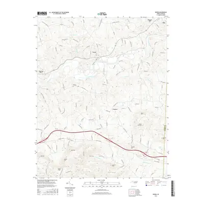
 1953 Winston-Salem1974 Print · USGSThe North Carolina Piedmont and Virginia highlands meet in the mid-1950s, a landscape defined by the tobacco and textile hubs of the Blue Ridge foothills. Researchers can trace the rail-and-river geography connecting Winston-Salem to mountain towns like Mount Airy and Galax.2 unique versions available
 - 1955 Map of Winston-Salem
 1955 Winston-Salem1955 Print · USGSThe Central Blue Ridge and Piedmont transition are captured here in the mid-fifties, from the industrial hub of Winston-Salem to the high peaks of Southwest Virginia. Genealogists can trace family landmarks like Richmond Hill Ch, Siloam Ch, and the old rail stops along the Southern Railway.
 - 1962 Map of Winston-Salem
 1962 Winston-Salem1962 Print · USGSThe North Carolina Piedmont meets the Virginia highlands in the early sixties, showing the rail corridors and mountain gaps of the southern Appalachians. Researchers can trace the Blue Ridge Parkway or locate family sites near Winston-Salem, Mount Airy, and Hanging Rock Mountain.
 - 1971 Map of Thurmond, 1973 Print
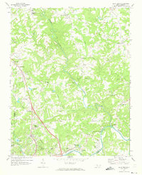
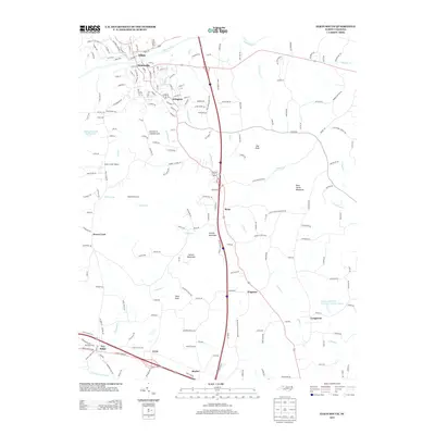
 1971 Thurmond1973 Print · USGSWilkes and Surry counties meet along these wooded ridges during the early seventies, showing a landscape of tightly-knit rural communities. Genealogists and historians can trace family locations near Mining Ridge, Carter Falls, and numerous country churches like Roaring Gap Ch.
 - 1971 Map of Elkin South, 1973 Print
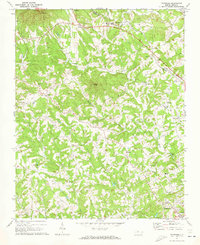
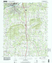
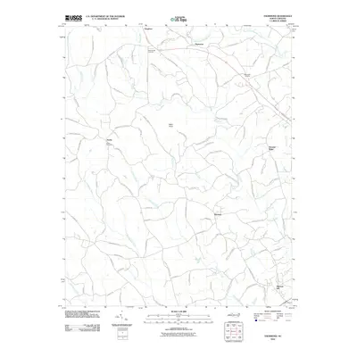
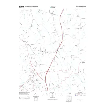
 1971 Elkin South1973 Print · USGSCrossing the Yadkin River in the early 1970s, this area captures the industrial activity of Jonesville and the rural reaches of the Brushy Mountains. Genealogists and local historians can trace rural communities around Longtown, Fall Creek Ch, and Starmount High Sch.
 - 1971 Map of Elkin North, 1973 Print
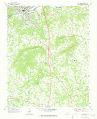
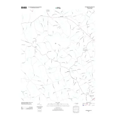
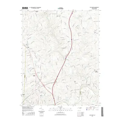
 1971 Elkin North1973 Print · USGSSurry County communities north of the Yadkin River are captured here in the early 1970s as rural crossroads began to integrate with modern infrastructure. Researchers can trace historic local congregations at Union Cross Ch and Bessies Chapel, or locate family sites near Little Richmond and Zephyr.2 unique versions available
 - 1971 Map of Ronda, 1973 Print
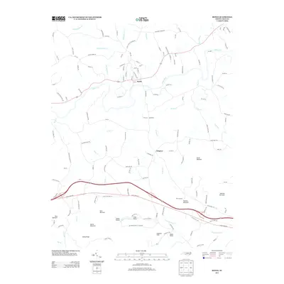
 1971 Ronda1973 Print · USGSWilkes County life in the early seventies centered on the Yadkin River and the Southern railroad corridor. Genealogists and local historians can trace the foundations of rural communities through sites like Macedonia Ch, Dennyville, and Cranberry Ch.
 - 1976 Map of Elkin South, 1979 Print
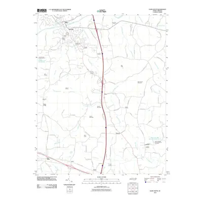
 1976 Elkin South1979 Print · USGSYadkin County and the river valley are captured in the mid-1970s, showing the precise layout of farms and settlements. Genealogists can trace the rural landscape surrounding Elkin, Wagoner, and the family-named landmarks of Arnold Mountain.
 - 1976 Map of Elkin North, 1979 Print
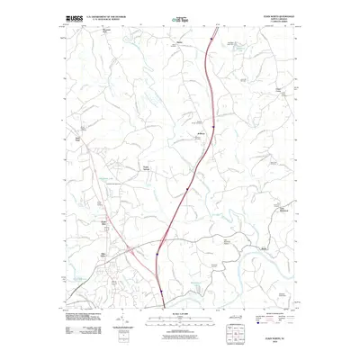
 1976 Elkin North1979 Print · USGSThe foothills of Surry County are captured in the mid-seventies, showing a patchwork of small farms and developing interstate corridors. Genealogists and local historians can trace the rural layouts of Zephyr, State Road, and the northern reaches of Elkin.
 - 1984 Map of Winston-Salem, 1985 Print
 1984 Winston-Salem1985 Print · USGSThe North Carolina Piedmont in the mid-1980s shows the growth of Winston-Salem and the busy rail corridors of the Southern Railway. Genealogists and local historians can trace family-named lands and rural communities from Yadkinville to Mount Airy.2 unique versions available
 - 1996 Map of Elkin South, 2000 Print
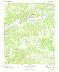
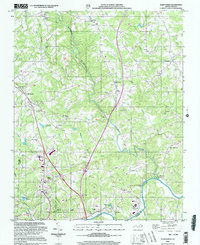
 1996 Elkin South2000 Print · USGSThe riverfront towns of Jonesville and Elkin meet at the Yadkin River in the mid-1990s, where the rising peaks of the Brushy Mountains define the rural landscape. Genealogists can locate family landmarks like Mountain Grove Ch Cem, Starmount High Sch, and the small airfield at Swan Creek Airport.
 - 1997 Map of Ronda, 2000 Print
 1997 Ronda2000 Print · USGSThe Yadkin River valley in the late 1990s is captured here, showing the communities of Ronda and Roaring River amidst the southern ridges. Researchers can trace local roots through numerous landmarks like Brier Creek Cem, Poplar Springs Ch, and East Wilkes High Sch.
 - 2000 Map of Elkin North, 2003 Print
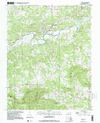
 2000 Elkin North2003 Print · USGSSurry County at the turn of the millennium shows a landscape where mountain rivers meet the growing outskirts of Elkin. Researchers can trace rural lineages through numerous country landmarks like Snow Hill Ch, the community at Zephyr, and Crestwood Memorial Park.
 - 2010 Map of Thurmond, 2010 Print
 2010 Thurmond2010 Print · USGSCovers Elkin, including Austin, Benham, and other nearby areas
 - 2010 Map of Elkin South, 2010 Print
 2010 Elkin South2010 Print · USGSCovers Elkin, including Jonesville, Cycle, and other nearby areas
 - 2010 Map of Elkin North, 2010 Print
 2010 Elkin North2010 Print · USGSCovers Elkin, including Jonesville, Little Richmond, and other nearby areas
 - 2010 Map of Ronda, 2010 Print
 2010 Ronda2010 Print · USGSCovers Elkin, including Ronda, Clingman, and other nearby areas
 - 2013 Map of Elkin North, 2013 Print
 2013 Elkin North2013 Print · USGSCovers Elkin, including Jonesville, Little Richmond, and other nearby areas
 - 2013 Map of Thurmond, 2013 Print
 2013 Thurmond2013 Print · USGSCovers Elkin, including Austin, Benham, and other nearby areas
 - 2013 Map of Elkin South, 2013 Print
 2013 Elkin South2013 Print · USGSCovers Elkin, including Jonesville, Cycle, and other nearby areas
 - 2013 Map of Ronda, 2013 Print
 2013 Ronda2013 Print · USGSCovers Elkin, including Ronda, Clingman, and other nearby areas
 - 2016 Map of Elkin North, 2016 Print
 2016 Elkin North2016 Print · USGSCovers Elkin, including Jonesville, Little Richmond, and other nearby areas
 - 2016 Map of Ronda, 2016 Print
 2016 Ronda2016 Print · USGSCovers Elkin, including Ronda, Clingman, and other nearby areas
Showing maps 1-25 of 35
Top cities near Elkin
- Mount Airy historical maps
- Yadkinville historical maps
- Jonesville historical maps
- Dobson historical maps
- Boonville historical maps
- Ronda historical maps
Top neighborhoods of Elkin
Frequently asked questions
- What are the different types of historical maps available for Elkin?
- What is the oldest map of Elkin?
- Where can I purchase historical maps of Elkin for my home or office?
- Where can I download high-res historical maps of Elkin?
- Are there historical topographic maps available for Elkin?
- Is there historical aerial imagery available for Elkin?
- Where are historical maps of Elkin sourced from?