1960s Maps of Bottineau County, North Dakota
Explore 2 historic maps of Bottineau County from the 1960s. These maps offer a rare glimpse into what life looked like during the 1960s — showing old roads, neighborhoods, homes, and landmarks that have changed or disappeared over time.
Whether you're researching your family's past, planning a metal detecting trip, or studying how Bottineau County's landscape evolved across the 1960s, these high-resolution maps are a powerful tool for exploring the history of this region.
- Focus on a specific era: All maps on this page are from the 1960s, giving you a focused view of this time period.
- See what’s changed: Compare century-old streets, trails, and buildings to today's modern landscape using overlays and satellite layers.
- Research with precision: Use these maps for genealogy, historical research, land use analysis, or educational projects.
- View, download, or print: Maps are fully viewable online in high resolution, and can be downloaded or printed for your own records.
Start exploring Bottineau County's history through authentic maps from the 1960s. This is your window into the past.
Bottineau County, ND maps
(2)- 1963 Map of Gardena, 1964 Print
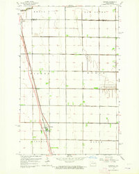 1963 Gardena1964 Print · USGSNorth Dakota's fertile Red River Valley is captured in the early sixties as a major highway was Under Construction next to the rail lines. Trace family roots and agricultural history through the townships of Kinyon and Noble or the grain-handling centers of Gardner and Grandin.
 - 1968 Map of Boundary Lake, 1971 Print
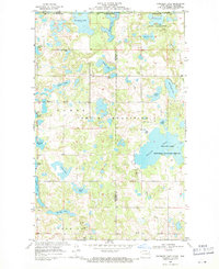 1968 Boundary Lake1971 Print · USGSThe international border near the Manitoba line was a landscape of protected wetlands and family-named water bodies in the late sixties. Researchers can find old community landmarks like Ackworth Cem and Rendahl Ch set among Boundary Lake and the Turtle Mountains.
End of results
Showing maps 1-2 of 2
Top cities of Bottineau County
- Bottineau historical maps
- Westhope historical maps
- Lansford historical maps
- Willow City historical maps
- Maxbass historical maps
- Newburg historical maps
See more
Frequently asked questions
- What are the different types of historical maps available for Bottineau County?
- What is the oldest map of Bottineau County?
- Where can I purchase historical maps of Bottineau County for my home or office?
- Where can I download high-res historical maps of Bottineau County?
- Are there historical topographic maps available for Bottineau County?
- Is there historical aerial imagery available for Bottineau County?
- Where are historical maps of Bottineau County sourced from?