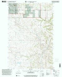
Old Maps of Mandaree, North Dakota for Genealogy
Trace your family roots with 106 historic maps of Mandaree. These high-res maps reveal old neighborhoods, homesites, landmarks, and streets — helping you uncover where your ancestors lived and how the area evolved over time.
- Explore historic neighborhoods: Identify where your relatives may have lived in the 1800s or 1900s.
- Compare maps over time: Trace the changes in streets, buildings, and landmarks for multi-generational research.
- Perfect for genealogy & ancestry research: Used by family historians and researchers to map out lineage and migration.
These maps are an incredible resource for exploring your personal connection to Mandaree's past.
Mandaree, ND maps
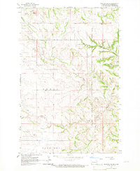
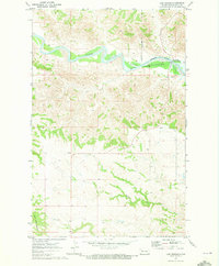
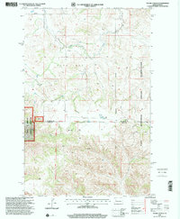
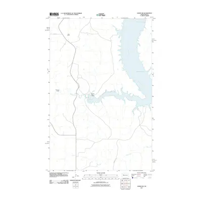
(106)- 1953 Map of Watford City, 1968 Print
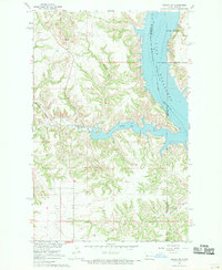
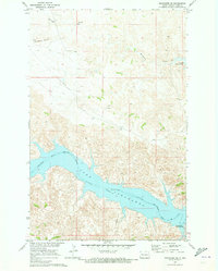
 1953 Watford City1968 Print · USGSNorth Dakota's badlands and the Missouri River basin are captured here during the 1950s and 60s as the Garrison Dam changed the landscape. Researchers can trace old rail lines like the Great Northern or find rural outposts such as Grassy Butte and Halliday.3 unique versions available
 - 1957 Map of Watford City
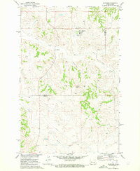
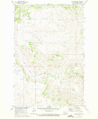
 1957 Watford City1957 Print · USGSWestern North Dakota's landscape is captured here during the mid-fifties as the Missouri River valley undergoes massive change following the creation of Garrison Reservoir. Genealogists and historians can trace dozens of rural schools like Divide School and early settlements such as Arnegard and Grassy Butte.
 - 1965 Map of Blue Buttes SE, 1967 Print
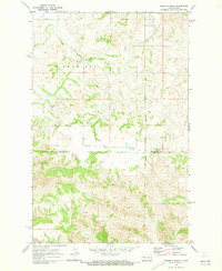
 1965 Blue Buttes SE1967 Print · USGSMcKenzie County was a landscape of remote ranching and reservation lands in the mid-1960s. Genealogists and researchers can trace the Fort Berthold Indian Reservation Boundary and find local landmarks like the Scoria Pit and Aura Butte.
 - 1967 Map of Watford City
 1967 Watford City1967 Print · USGSWestern North Dakota is captured during a period of landscape transformation as the Missouri River valley was reshaped by the new Garrison Reservoir. Genealogists and local historians can trace the foundations of Watford City, find the Elkhorn Ranch Site, or locate rural landmarks like Ziner Butte and Grassy Butte.
 - 1967 Map of Sanish SE, 1969 Print
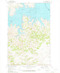
 1967 Sanish SE1969 Print · USGSThe Missouri River breaks in Mountrail County are shown during a transformative era in the late sixties as the reservoir fills the valley. Researchers can trace the Fort Berthold Indian Reservation Boundary and locate Shell Creek Ch and the Little Shell Creek Public Use Area.
 - 1967 Map of Twin Buttes, 1969 Print
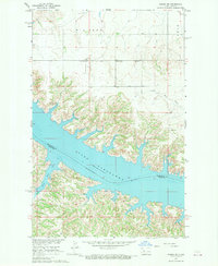
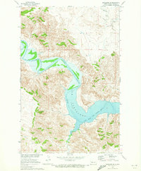
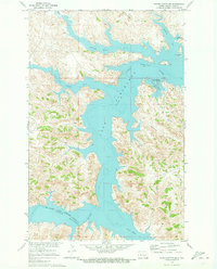
 1967 Twin Buttes1969 Print · USGSThe rising waters of Lake Sakakawea define this part of Mercer and Dunn County during the late 1960s. Researchers can locate numerous local landmarks including St Joseph Ch, Twin Buttes, and several rural cemeteries like Chase Cem.
 - 1967 Map of New Town SW, 1970 Print
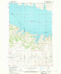
 1967 New Town SW1970 Print · USGSMountrail County's shoreline was dramatically reshaped by the mid-1960s as the Missouri River valley transitioned into a vast reservoir. Researchers can trace the Fort Berthold Indian Reservation Boundary and locate local landmarks like Little Shell Ch and the Van Hook State Game Management Area.
 - 1967 Map of Sanish SW, 1970 Print
 1967 Sanish SW1970 Print · USGSMcKenzie County's badlands terrain meets the rising waters of the Missouri River in the late sixties. Trace the inundated shoreline of Lake Sakakawea and find landmarks like Blue Butte or the Bear Den Creek Public Use Area.
 - 1967 Map of New Town SE, 1970 Print
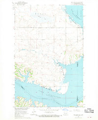
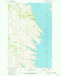
 1967 New Town SE1970 Print · USGSLake Sakakawea and the Missouri River Basin were undergoing significant transformation in the late sixties as reservoir waters reshaped the landscape. Researchers can trace submerged river channels and shoreline features like Independence Point and Lucky Mound Creek Bay.
 - 1970 Map of Mandaree, 1973 Print
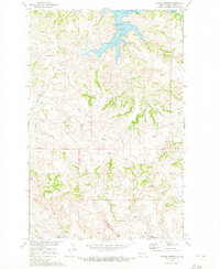
 1970 Mandaree1973 Print · USGSMcKenzie and Dunn counties are captured here in the 1970s within the Fort Berthold Indian Reservation. Researchers can trace the development of Mandaree and locate distinctive landforms like Eagle Nest Butte and Phaelens Butte.
 - 1970 Map of Hay Flat, 1973 Print
 1970 Hay Flat1973 Print · USGSDunn County's high plains meet the intricate new shoreline of the Missouri River Basin during the early seventies. Genealogists and local historians can locate Lincoln Memorial Cem and trace the rugged coulees surrounding Old Man Dancing Butte.
 - 1970 Map of String Buttes, 1973 Print
 1970 String Buttes1973 Print · USGSDunn County at the start of the 1970s shows a landscape transformed by the waters of the Missouri River Basin project. Genealogists and local historians can locate Independence Ch and trace the original shorelines of Skunk Creek Bay and Heart Butte.
 - 1970 Map of Lost Bridge, 1973 Print
 1970 Lost Bridge1973 Print · USGSDunn County at the start of the 1970s shows the Missouri River's transformation into a massive reservoir. Trace the rising shoreline of Lake Sakakawea and the wild terrain around North Killdeer Mountain and Corral Creek.2 unique versions available
 - 1970 Map of Figure 4 Ranch, 1973 Print
 1970 Figure 4 Ranch1973 Print · USGSMcKenzie and Dunn counties are captured here in the early 1970s, showing a landscape defined by ranching and the eastern reservation line. Researchers can trace land use through the Figure 4 Ranch, find the rural Faith Ch, and follow the breaks of Bear Den Creek.
 - 1970 Map of Mandaree SW, 1973 Print
 1970 Mandaree SW1973 Print · USGSDunn County at the start of the 1970s shows a landscape transformed by the waters of Lake Sakakawea. Genealogists and historians can trace the Fort Berthold Indian Reservation Boundary as it meets the Little Missouri River and Moccasin Creek.2 unique versions available
 - 1970 Map of Saddle Butte, 1973 Print
 1970 Saddle Butte1973 Print · USGSThe Missouri River breaks in western North Dakota are shown just as the reservoir reached its mature levels in the early seventies. Genealogists and researchers can trace the submerged county lines and find landmarks like Saddle Butte and Saddle Butte Bay.
 - 1970 Map of Mandaree SE, 1973 Print
 1970 Mandaree SE1973 Print · USGSThe Missouri River Basin development transformed this Dunn County landscape in the early seventies. Trace the rising waters of Lake Sakakawea against high points like McGregory Buttes and find early energy infrastructure such as a pipeline.
 - 1970 Map of Mandaree NE, 1973 Print
 1970 Mandaree NE1973 Print · USGSIn the early 1970s, the Missouri River Basin landscape was recorded during a period of regional development. Genealogists and historians can trace local landmarks like St Anthonys Ch and follow the natural drainages of Skunk Creek and Squaw Creek across the Fort Berthold Indian Reservation.
 - 1970 Map of Saddle Butte SW, 1973 Print
 1970 Saddle Butte SW1973 Print · USGSDunn County’s badlands meet the sprawling reservoir of Lake Sakakawea in the early seventies, marking a landscape transformed by the Missouri River Basin project. Trace the intricate shoreline from Hidatsa Bay to the mouth of the Little Missouri River.
 - 1982 Map of Parshall, 1983 Print
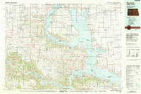 1982 Parshall1983 Print · USGSNorth Dakota's badlands and reservoir shorelines meet during the early eighties, showcasing a landscape shaped by both water and oil. Researchers can trace the development of New Town, locate the Riverview Cem, and explore the extent of the Antelope Oil Field.
 - 1997 Map of Figure 4 Ranch, 2001 Print
 1997 Figure 4 Ranch2001 Print · USGSThe McKenzie and Dunn County line area in the late nineties is captured here during a period of modern ranching and land management. Researchers can trace the sprawling bounds of the Figure 4 Ranch and the eastern edge of the Little Missouri National Grassland.
 - 1997 Map of Blue Buttes SE, 2001 Print
 1997 Blue Buttes SE2001 Print · USGSMcKenzie County was a landscape of high buttes and isolated ranching outposts during the late twentieth century. Genealogists and researchers can locate specific homesteads like D Sivertson and the C Mercer Ranch near the Fort Berthold Indian Reservation boundary.
 - 2011 Map of Saddle Butte SW, 2011 Print
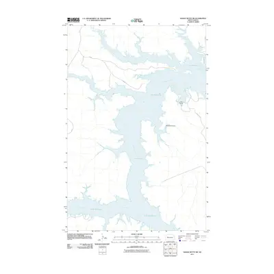 2011 Saddle Butte SW2011 Print · USGSCovers Mandaree, including Charging Eagle Bay, Twin Buttes, and other nearby areas
 - 2011 Map of Mandaree NE, 2011 Print
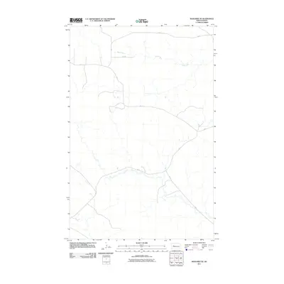 2011 Mandaree NE2011 Print · USGSCovers Mandaree, including Dunn County, United States, and other nearby areas
 - 2011 Map of Sanish SW, 2011 Print
 2011 Sanish SW2011 Print · USGSCovers Mandaree, including New Town, Four Bears Segment, and other nearby areas
Showing maps 1-25 of 106
Top cities near Mandaree
Top neighborhoods of Mandaree
Frequently asked questions
- What are the different types of historical maps available for Mandaree?
- What is the oldest map of Mandaree?
- Where can I purchase historical maps of Mandaree for my home or office?
- Where can I download high-res historical maps of Mandaree?
- Are there historical topographic maps available for Mandaree?
- Is there historical aerial imagery available for Mandaree?
- Where are historical maps of Mandaree sourced from?