
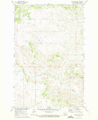
1970 Map of Mandaree SE
USGS Topo · Published 1973About this map
Lake Sakakawea and the flooded confluence of the Missouri and Little Missouri River dominate this early 1970s landscape within the Fort Berthold Indian Reservation. The map details the complex shoreline and inundation areas following the development of the Missouri River Basin, contrasting the massive reservoir waters with the high, arid terrain of the McGregory Buttes. Evidence of industrial development is visible through a noted pipeline and scattered drill holes, while the Little Missouri Public Use Area provides a point of recreational access to the expanding waters. The survey captures a moment when the managed levels of the lake were reshaping the geography of Dunn County, as indicated by the Fort Berthold Indian Reservation Boundary crossing both land and water.
Find a feature on this map
9 named features on this map. Tap any name to fly to it.
Don’t see what you’re looking for? This feature index may not catch every label — zoom into the map to look around manually.
Map Details
Editions of this 1970 Mandaree SE Map
This is the sole edition of this map. No revisions or reprints were ever made.
Other maps of this area

1953 · Watford City
USGS Topo · 1:250,000

1957 · Watford City
USGS Topo · 1:250,000

1967 · Watford City
USGS Topo · 1:250,000

1970 · Mandaree
USGS Topo · 1:24,000

1970 · String Buttes
USGS Topo · 1:24,000

1970 · Dunn Center NW
USGS Topo · 1:24,000

1970 · Mandaree SW
USGS Topo · 1:24,000

1970 · Halliday NW
USGS Topo · 1:24,000

1970 · Dunn Center NE
USGS Topo · 1:24,000
1970 · Mandaree NE
USGS Topo · 1:24,000