2020s Maps of Riverdale, North Dakota
Explore 8 historic maps of Riverdale from the 2020s. These maps offer a rare glimpse into what life looked like during the 2020s — showing old roads, neighborhoods, homes, and landmarks that have changed or disappeared over time.
Whether you're researching your family's past, planning a metal detecting trip, or studying how Riverdale's landscape evolved across the 2020s, these high-resolution maps are a powerful tool for exploring the history of this region.
- Focus on a specific era: All maps on this page are from the 2020s, giving you a focused view of this time period.
- See what’s changed: Compare century-old streets, trails, and buildings to today's modern landscape using overlays and satellite layers.
- Research with precision: Use these maps for genealogy, historical research, land use analysis, or educational projects.
- View, download, or print: Maps are fully viewable online in high resolution, and can be downloaded or printed for your own records.
Start exploring Riverdale's history through authentic maps from the 2020s. This is your window into the past.
Riverdale, ND maps
(8)- 2020 Map of Garrison Dam North, 2020 Print
 2020 Garrison Dam North2020 Print · USGSCovers Riverdale, including Pick City, McLean County, and other nearby areas
 - 2020 Map of Riverdale North, 2020 Print
 2020 Riverdale North2020 Print · USGSCovers Riverdale, including McLean County, Mercer County, and other nearby areas
 - 2020 Map of Riverdale South, 2020 Print
 2020 Riverdale South2020 Print · USGSCovers Riverdale, including McLean County, United States, and other nearby areas
 - 2020 Map of Garrison Dam South, 2020 Print
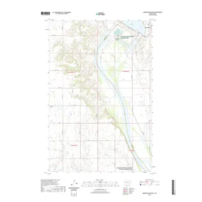 2020 Garrison Dam South2020 Print · USGSCovers Riverdale, including McLean County, Mercer County, and other nearby areas
 - 2024 Map of Riverdale South, 2024 Print
 2024 Riverdale South2024 Print · USGSThe community of Riverdale and its surrounding plains are documented in this contemporary survey of McLean County. Researchers can trace the local road network and section boundaries from Main St to rural routes like Co Hwy 16 and 37th Ave NW.
 - 2024 Map of Garrison Dam North, 2024 Print
 2024 Garrison Dam North2024 Print · USGSThe Missouri River and the deep inlets of Lake Sakakawea define this central North Dakota landscape in the early twenty-first century. Researchers can trace the modern shoreline of Garrison Bay and the street plan of Pick City near the Mercer Co border.
 - 2024 Map of Garrison Dam South, 2024 Print
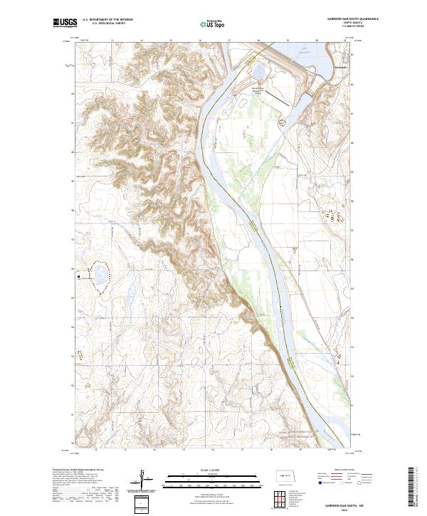 2024 Garrison Dam South2024 Print · USGSThe Missouri River valley in the twenty-first century is a landscape of massive engineering and deep indigenous history near the edge of Riverdale. Researchers can trace the grounds of the Knife River Indian Villages National Historic Site or find family names at Saint Pauls Cemetery.
 - 2024 Map of Riverdale North, 2024 Print
 2024 Riverdale North2024 Print · USGSMcLean County is captured here in the 2020s, showing the intersection of the Missouri River with the vast reservoirs created by the Garrison Dam. Trace the intricate shorelines of Mallard Island and explore the protected habitat within the Audubon National Wildlife Refuge.
End of results
Showing maps 1-8 of 8
Top cities near Riverdale
- Garrison historical maps
- Underwood historical maps
- Stanton historical maps
- Pick City historical maps
- Coleharbor historical maps
Frequently asked questions
- What are the different types of historical maps available for Riverdale?
- What is the oldest map of Riverdale?
- Where can I purchase historical maps of Riverdale for my home or office?
- Where can I download high-res historical maps of Riverdale?
- Are there historical topographic maps available for Riverdale?
- Is there historical aerial imagery available for Riverdale?
- Where are historical maps of Riverdale sourced from?