1980s Maps of Mountrail County, North Dakota
Explore 36 historic maps of Mountrail County from the 1980s. These maps offer a rare glimpse into what life looked like during the 1980s — showing old roads, neighborhoods, homes, and landmarks that have changed or disappeared over time.
Whether you're researching your family's past, planning a metal detecting trip, or studying how Mountrail County's landscape evolved across the 1980s, these high-resolution maps are a powerful tool for exploring the history of this region.
- Focus on a specific era: All maps on this page are from the 1980s, giving you a focused view of this time period.
- See what’s changed: Compare century-old streets, trails, and buildings to today's modern landscape using overlays and satellite layers.
- Research with precision: Use these maps for genealogy, historical research, land use analysis, or educational projects.
- View, download, or print: Maps are fully viewable online in high resolution, and can be downloaded or printed for your own records.
Start exploring Mountrail County's history through authentic maps from the 1980s. This is your window into the past.
Mountrail County, ND maps
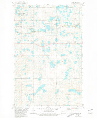
(36)- 1980 Map of Minot
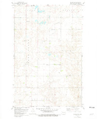
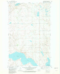
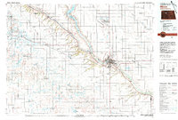 1980 Minot1980 Print · USGSNorth Dakota's northern plains are shown at the start of the 1980s, centered on the strategic rail and river hub of Minot. Genealogists and local historians can trace the transition from rural grain stops like Berthold to the significant military presence at Minot Air Force Base.
 - 1980 Map of Plaza SE, 1981 Print
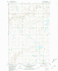
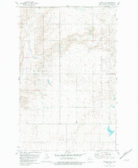
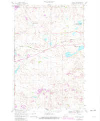
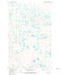
 1980 Plaza SE1981 Print · USGSThe prairie wetlands of the Missouri Plateau are captured here in the early 1980s at the Mountrail and Ward County line. Local historians and land researchers can trace civil townships like Linton and Orlien or locate the rural Townhall.
 - 1980 Map of Makoti, 1981 Print
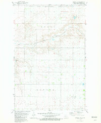
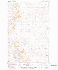
 1980 Makoti1981 Print · USGSMakoti and the surrounding townships of Ward and Mountrail Counties are captured here in the late 1970s as agricultural and rail life thrived. Genealogists and local historians can trace the Soo Line railroad, family plots at Hope Cem, and the Fort Berthold Indian Reservation Boundary.
 - 1980 Map of Plaza, 1981 Print
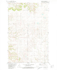
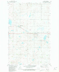
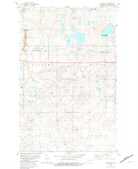
 1980 Plaza1981 Print · USGSThe North Dakota prairie near the Mountrail and Ward county line comes into focus in the early 1980s. Genealogists can trace family roots at First Lutheran Cem and Sacred Heart Cem, or locate the town site of Plaza along the Soo Line.
 - 1980 Map of Aurelia, 1981 Print
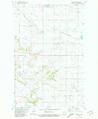
 1980 Aurelia1981 Print · USGSThe rural landscape of Ward and Mountrail counties is shown here as it appeared in the late 1970s, focused on the railroad hamlet of Aurelia. Local historians can trace early community sites like Moravian Cem, the local Townhall, and the winding path of Shipton Coulee.
 - 1980 Map of Tagus, 1981 Print
 1980 Tagus1981 Print · USGSThe prairie wetlands of Ward and Mountrail counties are captured here in the early 1980s. Genealogists and researchers can locate the settlement of Tagus, trace the Burlington Northern rail line, and find local landmarks like St Olaf Cem.
 - 1980 Map of Wabek, 1981 Print
 1980 Wabek1981 Print · USGSMountrail County at the start of the 1980s reveals a rural landscape defined by the Soo Line and the Fort Berthold Indian Reservation Boundary. Genealogists and local historians can trace the Lutheran Cem, Townhall, and the small settlement of Wabek.
 - 1981 Map of Parshall NE
 1981 Parshall NE1981 Print · USGSMountrail County is captured in the early eighties as a landscape of rural townships and reservation lands. Researchers can trace the path of the Soo Line railroad and locate local gathering points like the Townhall and the Banner township line.
 - 1981 Map of Belden SW
 1981 Belden SW1981 Print · USGSMountrail County in the early eighties shows a high-plains landscape defined by the drainage of the Little Knife River and Crane Creek. Genealogists and local historians can locate the Bolen Cem and trace early industrial sites like the local Quarry and various Gravel Pits.
 - 1981 Map of Epworth SE
 1981 Epworth SE1981 Print · USGSThe North Dakota prairie of Mountrail County is captured here in the early eighties, organized by the traditional township system. Researchers can locate the central Townhall and trace the drainage patterns of Shell Creek and Spring Coulee.
 - 1981 Map of Robinson Lake
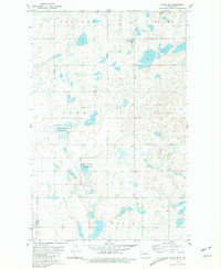
 1981 Robinson Lake1981 Print · USGSMountrail County's prairie wetlands and agricultural townships are captured here in the early eighties. Researchers can trace the protected boundaries of the National Waterfowl Production Area and locate local landmarks like Robinson Lake or the Debing and Alger districts.
 - 1981 Map of New Town
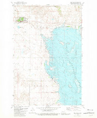 1981 New Town1981 Print · USGSThe Missouri River landscape was being redefined in the early eighties as New Town sat at the edge of a massive reservoir. Genealogists and researchers can trace the town's development near the Van Hook Arm and locate landmarks like the High Sch and Cem.
 - 1981 Map of Rat Lake SE
 1981 Rat Lake SE1981 Print · USGSMountrail and McKenzie counties meet along the vast reach of the Missouri River in the early eighties. Genealogists and outdoorsmen can trace the rugged shoreline of Knife River Bay or locate landmarks like Stony Hill and the Rat Lake uplands.
 - 1981 Map of Belden SE
 1981 Belden SE1981 Print · USGSMountrail County prairie land is documented here in the early 1980s, showing the intersection of rural township life and natural drainages. Genealogists can locate family burial sites such as the Belden Finnish Cem and Bethlehem Ch Cem near the local Townhall.
 - 1981 Map of Ross
 1981 Ross1981 Print · USGSThe prairie landscape of Mountrail County comes into focus in the early 1980s, centered on the railroad hub of Ross. Genealogists and local researchers can locate specific burial grounds like Manitou Cem and Moslem Cem or trace the Burlington Northern rail line.
 - 1981 Map of Stanley SE
 1981 Stanley SE1981 Print · USGSMountrail County's prairie landscape is captured here in the early eighties, where the Little Knife River meets a network of conservation areas. Trace the Burlington Northern rail line as it passes Gravel Pits and the Idaho and Palermo townships.
 - 1981 Map of Manitou
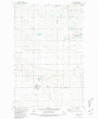
 1981 Manitou1981 Print · USGSMountrail County in the early eighties is a landscape of prairie drainage and railroad utility. Genealogists and researchers can locate the Bohemian Cem and trace the winding course of the White Earth River near Manitou.
 - 1981 Map of Lostwood
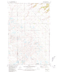
 1981 Lostwood1981 Print · USGSMountrail County's prairie wetland landscape was undergoing specialized conservation efforts during the early eighties. Researchers can trace the Burlington Northern rail corridor and locate local landmarks like the Mennonite Cem and the Alkali Salt Pit.
 - 1981 Map of Palermo NE
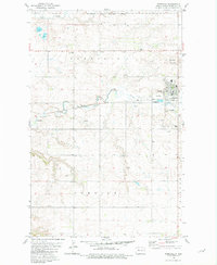
 1981 Palermo NE1981 Print · USGSMountrail County's pothole-dotted landscape is documented here in the early eighties, revealing a region defined by wetland conservation and rural prairie life. Researchers can locate family landmarks like St Luke Ch, the nearby Cem, and small settlements such as Grandrue and Smith.
 - 1981 Map of Rat Lake
 1981 Rat Lake1981 Print · USGSMountrail County in the early eighties shows a landscape shaped by the Missouri River and the expansive Lake Sakakawea. Researchers can trace the winding White Earth River and locate conservation landmarks like the NATIONAL WATERFOWL PRODUCTION AREA.
 - 1981 Map of Palermo
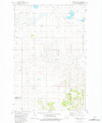
 1981 Palermo1981 Print · USGSThe town of Palermo stands as a rail-side prairie hub in the early eighties, surrounded by a complex network of wetlands. Genealogists and local historians can trace landmarks like Rest Haven Cem, Faith Ch, and the sprawling National Waterfowl Production Area.
 - 1981 Map of Shell Lake
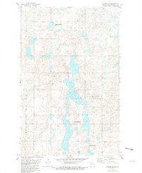
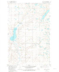 1981 Shell Lake1981 Print · USGSMountrail County's prairie pothole region is captured here in the early 1980s, centered on the conservation lands of the Shell Lake National Wildlife Refuge. Family historians can locate specific sites like Trinity Cem or the Shell Lake Ch among the townships of Kickapoo and Osloe.
 - 1981 Map of Rat Lake SW
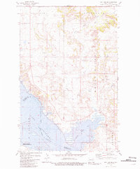
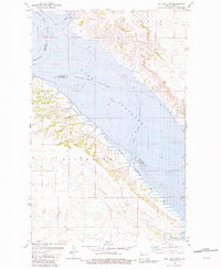 1981 Rat Lake SW1981 Print · USGSThe western reaches of North Dakota's great reservoir are captured here in the early eighties, showing where the prairie meets the Missouri. Researchers can trace the submerged valley floor of Lake Sakakawea and find landmarks like Elkhorn and Crow Flies High.
 - 1981 Map of Palermo NW
 1981 Palermo NW1981 Print · USGSMountrail County's pothole prairie is documented here in the early eighties, showing a landscape of scattered wetlands and section roads. Researchers can locate Zion Cem and trace the boundaries of Sidonia and Redmond townships.
 - 1981 Map of Parshall
 1981 Parshall1981 Print · USGSParshall and the surrounding prairie of Mountrail County are captured here in the early 1980s within the Fort Berthold Indian Reservation Boundary. Genealogists and local historians can locate Parshall Cem, trace the course of Shell Creek, and identify landmarks like Hankins Field.
Showing maps 1-25 of 36
Top cities of Mountrail County
- New Town historical maps
- Stanley historical maps
- Plaza historical maps
- Palermo historical maps
- White Earth historical maps
- Manitou historical maps
See more
Frequently asked questions
- What are the different types of historical maps available for Mountrail County?
- What is the oldest map of Mountrail County?
- Where can I purchase historical maps of Mountrail County for my home or office?
- Where can I download high-res historical maps of Mountrail County?
- Are there historical topographic maps available for Mountrail County?
- Is there historical aerial imagery available for Mountrail County?
- Where are historical maps of Mountrail County sourced from?