1950s Maps of Ramsey County, North Dakota
Explore 24 historic maps of Ramsey County from the 1950s. These maps offer a rare glimpse into what life looked like during the 1950s — showing old roads, neighborhoods, homes, and landmarks that have changed or disappeared over time.
Whether you're researching your family's past, planning a metal detecting trip, or studying how Ramsey County's landscape evolved across the 1950s, these high-resolution maps are a powerful tool for exploring the history of this region.
- Focus on a specific era: All maps on this page are from the 1950s, giving you a focused view of this time period.
- See what’s changed: Compare century-old streets, trails, and buildings to today's modern landscape using overlays and satellite layers.
- Research with precision: Use these maps for genealogy, historical research, land use analysis, or educational projects.
- View, download, or print: Maps are fully viewable online in high resolution, and can be downloaded or printed for your own records.
Start exploring Ramsey County's history through authentic maps from the 1950s. This is your window into the past.
Ramsey County, ND maps
(24)- 1950 Map of Tokio, 1952 Print
 1950 Tokio1952 Print · USGSBenson County at the start of the 1950s was a landscape defined by the shifting waters of the Devils Lake basin and the lifeline of the railroad. Researchers can trace the mid-century footprints of Saint Michael and Tokio, or find local landmarks like Wood Lake Ch and Devils Heart Butte.
 - 1950 Map of Grahams Island, 1959 Print
 1950 Grahams Island1959 Print · USGSDevils Lake and its rugged shoreline dominate this mid-century survey of Benson and Ramsey counties. Local historians can trace the legacy of rural education and faith at School No 5, St Paul Cem, and the Old Military Reservation.2 unique versions available
 - 1950 Map of Devils Lake, 1959 Print
 1950 Devils Lake1959 Print · USGSDevils Lake and the surrounding North Dakota prairies are captured mid-century, showing a landscape shaped by rail lines and regional institutions. Genealogists can locate several schools and cemeteries, including the Grand Harbor Cem, Grove Sch, and the military grounds at Camp Grafton.2 unique versions available
 - 1950 Map of Devils Lake Mountain, 1978 Print
 1950 Devils Lake Mountain1978 Print · USGSRamsey County and the surrounding prairies are captured here at mid-century as rural life centered around small township hubs. Genealogists can locate the Odessa Cem and early landmarks like School No 2 near the shores of East Devils Lake.
 - 1951 Map of Crary
 1951 Crary1951 Print · USGSRamsey County's prairie landscape was still a patchwork of small school districts and family farms in the mid-twentieth century. Trace local genealogy and rail history through the Great Northern tracks, Crary Cem, and rural landmarks like School No 1.
 - 1951 Map of Devils Lake Mountain
 1951 Devils Lake Mountain1951 Print · USGSThe rural landscapes of Ramsey and Nelson counties are captured here in the early fifties, showing the sparse prairie settlements of Odessa and Minco. Genealogists can trace family footprints near School No 2 and the Odessa Cem, while the Old Indian Reservation Boundary marks a significant historical line.
 - 1951 Map of Devils Lake
 1951 Devils Lake1951 Print · USGSDevils Lake in the early fifties shows a thriving regional center defined by its institutions and the rail lines of the Great Northern. Researchers can trace the footprints of the Odd Fellows Home, St Marys Academy, and several rural sites like School No 1.2 unique versions available
 - 1951 Map of Grahams Island
 1951 Grahams Island1951 Print · USGSGrahams Island and the intricate bays of Devils Lake are captured here in the early fifties, showing the region's rural character. Trace the Old Military Reservation Boundary or locate local landmarks like School No 1 and School No 2.2 unique versions available
 - 1951 Map of Tilden
 1951 Tilden1951 Print · USGSThe Benson and Ramsey county borderlands come alive in this mid-century survey of the North Dakota prairie. Genealogists and historians can trace the foundations of rural life through the locations of Antiochia Ch, Presbyterian Cem, and the village of Tilden.
 - 1951 Map of Grand Harbor
 1951 Grand Harbor1951 Print · USGSRamsey County's prairie and wetland landscape is captured here in the early fifties as the rail-driven economy of Grand Harbor remained central. Genealogists and historians can locate Grand Harbor Cem, School No 1, and the rail junction near Darby.2 unique versions available
 - 1951 Map of Camp Grafton
 1951 Camp Grafton1951 Print · USGSDevils Lake at the mid-century reveals a landscape of military training and conservation efforts on the shores of Ramsey and Benson counties. Researchers can trace the Great Northern rail line past Fort Totten Station and find local landmarks like Grove Sch and Camp Grafton.2 unique versions available
 - 1951 Map of Free Peoples Lake
 1951 Free Peoples Lake1951 Print · USGSBenson and Ramsey Counties show their mid-century rural character before shifting water levels altered the landscape. Genealogists and local historians can trace specific district boundaries and find the locations of early rural landmarks like Free Peoples School, School No 8, and Free Peoples Lake.2 unique versions available
 - 1951 Map of Penn
 1951 Penn1951 Print · USGSRamsey County was a landscape of rail-dependent prairie towns and scattered schoolhouses in the early fifties. Genealogists and local historians can trace the foundations of the Penn community, find St Paul Cem, and locate rural landmarks like Bay School.
 - 1951 Map of Sweetwater
 1951 Sweetwater1951 Print · USGSRamsey County's prairie potholes and rail-line settlements are documented here in the early fifties during a period of Missouri River Basin development. Researchers can trace the path of the Great Northern railroad and find the locations of School No 21 and the lakeside Pumping Station.2 unique versions available
 - 1951 Map of Fort Totten, 1953 Print
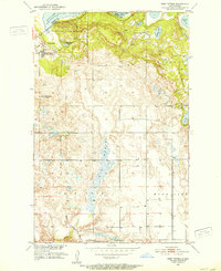 1951 Fort Totten1953 Print · USGSBenson and Ramsey Counties were undergoing significant transitions in the early fifties along the shores of Devils Lake. Genealogists and local historians can locate the Fort Totten Indian Agency, the Great Northern rail line, and rural landmarks like Lone Tree Sch No 1.2 unique versions available
 - 1951 Map of Tokio, 1959 Print
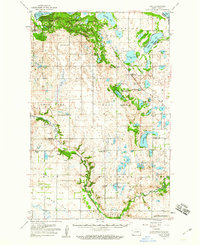 1951 Tokio1959 Print · USGSBenson County in the early 1950s is a landscape defined by the intersection of military history, tribal lands, and glacial lakes. Genealogists and historians can trace old routes like the Old Indian Military Road or locate family sites near Tokio, Saint Michael, and Wood Lake Ch.
 - 1952 Map of New Rockford, 1968 Print
 1952 New Rockford1968 Print · USGSThe North Dakota prairie during the mid-1950s was a landscape of rail-dependent farm towns and vast wildlife refuges. Genealogists and historians can trace the foundations of local communities at Fort Totten Indian Agenc, Concordia Lutheran Church, and the Bowdon Country Church and Cemetery.3 unique versions available
 - 1953 Map of Devils Lake, 1968 Print
 1953 Devils Lake1968 Print · USGSNorth Dakota's northern plains are captured here in the mid-fifties, showing a landscape of rail-fed grain elevators and prairie wetlands. Genealogists can locate family landmarks like Rose Hill School, Hurricane Lake Church, and the Turtle Mountain Indian Reservation.3 unique versions available
 - 1956 Map of New Rockford
 1956 New Rockford1956 Print · USGSMid-century central North Dakota is captured here as a landscape of prairie rail towns and vast wildlife refuges. Trace family roots at the Bowdon Country Church and Cemetery or locate the old St Michael Mission School and Fort Totten.
 - 1956 Map of Devils Lake
 1956 Devils Lake1956 Print · USGSNorthern North Dakota is shown at a mid-century peak of rail-driven agriculture, where the Soo Line and Great Northern railroads cross the prairie. Trace the borders of the Turtle Mountain Indian Reservation and locate local landmarks like Rose Hill School or Camp Grafton.
 - 1957 Map of Cando SE, 1958 Print
 1957 Cando SE1958 Print · USGSThe lakeside prairie of Ramsey and Towner counties is captured here in the late fifties, showing a landscape defined by seasonal waters and rural shifts. Researchers can locate specific heritage sites like the Almira Cem, Chain Lakes Ch, and former schoolhouses like School No 9 (Abandoned).2 unique versions available
 - 1957 Map of Starkweather SE, 1958 Print
 1957 Starkweather SE1958 Print · USGSRamsey County's prairie landscape is documented here in the late 1950s, showing a transition in rural education and community life. Researchers can locate the settlement of Garske, several rural schoolhouses, and the SS Peter and Paul Ch near Morrison Lake.
 - 1957 Map of Churchs Ferry, 1958 Print
 1957 Churchs Ferry1958 Print · USGSChurchs Ferry and Maza are centers of North Dakota rail and lake life in the late fifties. Genealogists and local historians can trace the Great Northern rail lines and find specific family landmarks like Zion Cem or the edges of Lake Irvine.
 - 1957 Map of Webster, 1958 Print
 1957 Webster1958 Print · USGSRamsey County's prairie landscape is captured here in the late fifties, as the grain-dependent rail economy shaped the local plains. Genealogists and historians can trace the tracks of the Great Northern through Webster and Garske or locate the Webster Cem.
End of results
Showing maps 1-24 of 24
Top cities of Ramsey County
- Devils Lake historical maps
- Edmore historical maps
- Grand Harbor historical maps
- Starkweather historical maps
- Crary historical maps
- Webster historical maps
See more
Frequently asked questions
- What are the different types of historical maps available for Ramsey County?
- What is the oldest map of Ramsey County?
- Where can I purchase historical maps of Ramsey County for my home or office?
- Where can I download high-res historical maps of Ramsey County?
- Are there historical topographic maps available for Ramsey County?
- Is there historical aerial imagery available for Ramsey County?
- Where are historical maps of Ramsey County sourced from?