1990s Maps of Richland County, North Dakota
Explore 8 historic maps of Richland County from the 1990s. These maps offer a rare glimpse into what life looked like during the 1990s — showing old roads, neighborhoods, homes, and landmarks that have changed or disappeared over time.
Whether you're researching your family's past, planning a metal detecting trip, or studying how Richland County's landscape evolved across the 1990s, these high-resolution maps are a powerful tool for exploring the history of this region.
- Focus on a specific era: All maps on this page are from the 1990s, giving you a focused view of this time period.
- See what’s changed: Compare century-old streets, trails, and buildings to today's modern landscape using overlays and satellite layers.
- Research with precision: Use these maps for genealogy, historical research, land use analysis, or educational projects.
- View, download, or print: Maps are fully viewable online in high resolution, and can be downloaded or printed for your own records.
Start exploring Richland County's history through authentic maps from the 1990s. This is your window into the past.
Richland County, ND maps
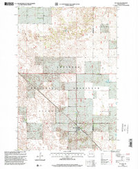
(8)- 1998 Map of Hankinson, 2000 Print
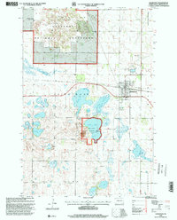 1998 Hankinson2000 Print · USGSHankinson was a vital prairie rail hub and wetland refuge in the late nineties. Local researchers can trace the Soo Line tracks, locate Calvary Cem, and explore the shoreline of Lake Elsie near the national wildlife refuge.
 - 1998 Map of Wyndmere, 2000 Print
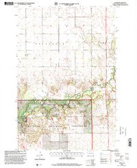
 1998 Wyndmere2000 Print · USGSRichland County at the close of the twentieth century shows a landscape split between the Sheyenne National Grassland and the agricultural hub of Wyndmere. Local researchers can locate the Drive-in Theater, Ponderosa Ranch, and several flowing wells.
 - 1998 Map of Mantador, 2000 Print
 1998 Mantador2000 Print · USGSRichland County, North Dakota, is documented here in the late 1990s as a landscape of structured townships and winding prairie waterways. Genealogists and local historians can locate the community of Mantador, St Johns Ch, and the winding Wild Rice River.
 - 1998 Map of De Lamere, 2000 Print
 1998 De Lamere2000 Print · USGSNorth Dakota's southeastern prairie reveals its late-twentieth-century agricultural character and survey grid. Genealogists and local historians can locate De Lamere, trace family roots at Anderson Cem, and identify rural landmarks like School No 1 and the Town Hall.
 - 1998 Map of Coburn, 2000 Print
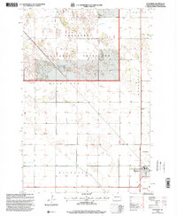
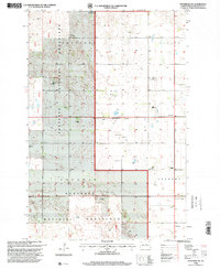
 1998 Coburn2000 Print · USGSRansom and Richland counties appear here in the late nineties, where the prairie gives way to the deep bends of the river. Genealogists and local historians can trace the rural landscape near Coburn and find the Owego Ch within the Sheyenne National Grassland.
 - 1998 Map of McLeod, 2000 Print
 1998 McLeod2000 Print · USGSSoutheast North Dakota's prairie and ranching lands are captured here during the late twentieth century. Genealogists and local historians can trace the Soo Line rail corridor through McLeod and locate the historic Free Lutheran Cem.
 - 1998 Map of Wyndmere NW, 2000 Print
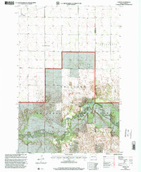
 1998 Wyndmere NW2000 Print · USGSRichland County at the close of the twentieth century shows a landscape defined by the Sheyenne National Grassland and the legacy of its early settlers. Researchers can locate local landmarks like Nordmanna Cem, School No 34, and the United Lutheran Ch.
 - 1998 Map of Power, 2000 Print
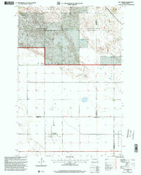
 1998 Power2000 Print · USGSRichland County's prairie and river lowlands are captured here in the late twentieth century, showing the intersection of agricultural townships and protected lands. Genealogists can locate family landmarks like Helendale Ch, Barrie Ch, and the small community of Power.
End of results
Showing maps 1-8 of 8
Top cities of Richland County
- Wahpeton historical maps
- Hankinson historical maps
- Lidgerwood historical maps
- Wyndmere historical maps
- Fairmount historical maps
- Abercrombie historical maps
See more
Frequently asked questions
- What are the different types of historical maps available for Richland County?
- What is the oldest map of Richland County?
- Where can I purchase historical maps of Richland County for my home or office?
- Where can I download high-res historical maps of Richland County?
- Are there historical topographic maps available for Richland County?
- Is there historical aerial imagery available for Richland County?
- Where are historical maps of Richland County sourced from?