1970s Maps of Rolette County, North Dakota
Explore 9 historic maps of Rolette County from the 1970s. These maps offer a rare glimpse into what life looked like during the 1970s — showing old roads, neighborhoods, homes, and landmarks that have changed or disappeared over time.
Whether you're researching your family's past, planning a metal detecting trip, or studying how Rolette County's landscape evolved across the 1970s, these high-resolution maps are a powerful tool for exploring the history of this region.
- Focus on a specific era: All maps on this page are from the 1970s, giving you a focused view of this time period.
- See what’s changed: Compare century-old streets, trails, and buildings to today's modern landscape using overlays and satellite layers.
- Research with precision: Use these maps for genealogy, historical research, land use analysis, or educational projects.
- View, download, or print: Maps are fully viewable online in high resolution, and can be downloaded or printed for your own records.
Start exploring Rolette County's history through authentic maps from the 1970s. This is your window into the past.
Rolette County, ND maps
(9)- 1970 Map of Rolla, 1973 Print
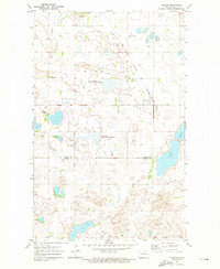
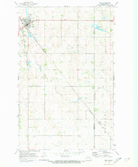 1970 Rolla1973 Print · USGSThe northern plains around Rolla are captured here in the early seventies, detailing a landscape defined by the intersection of rail and road. Researchers can trace the Burlington Northern tracks and locate St Michael Cem or Emanuel Cem.
 - 1971 Map of Bisbee South, 1973 Print
 1971 Bisbee South1973 Print · USGSTowner County and Rolette County are captured in the early 1970s, showcasing a rural prairie landscape defined by the Soo Line and family-named cemeteries. Researchers can trace local heritage at Teubner Cem, Halling Cem, and the old Townhall.
 - 1971 Map of Island Lake, 1973 Print
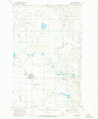
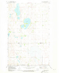 1971 Island Lake1973 Print · USGSNorth Dakota's northern prairie is captured here in the early 1970s, showing a landscape of seasonal wetlands and rural townships. Genealogists and historians can locate community centers like Island Lake Ch and trace the path of the Burlington Northern rail line.
 - 1971 Map of Mylo, 1973 Print
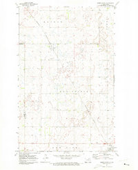
 1971 Mylo1973 Print · USGSThe North Dakota prairie near Mylo appears as a complex landscape of wetlands and cultivated fields in the early seventies. Genealogists and historians can trace the local rail economy along the Soo Line and locate property lines across the Rolette Co border.
 - 1971 Map of Bisbee North, 1973 Print
 1971 Bisbee North1973 Print · USGSNorth Dakota's northern plains are captured here in the early seventies, showing a landscape defined by the grain economy and the rail line. Researchers can trace the local infrastructure of Perth and Bisbee, from the Townhall and Lyster Field to the Perth Cem.
 - 1971 Map of Mylo NW, 1973 Print
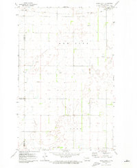
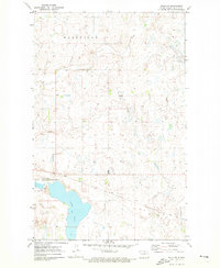 1971 Mylo NW1973 Print · USGSRolette County's prairie and wetland landscape is captured here in the early seventies, just as the local rail and wildlife systems were well-established. Trace the path of the Soo Line railroad past Long Lake or locate the boundaries of Maryville.
 - 1971 Map of Rolette, 1973 Print
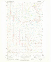
 1971 Rolette1973 Print · USGSNorth Dakota's prairie landscape is centered on the railroad crossing at Rolette during the early 1970s. Trace the intersection of the Soo Line and Burlington Northern alongside landmarks like Rolette Cemetery and Wolf Creek.
 - 1971 Map of Mylo SE, 1973 Print
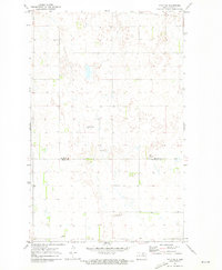 1971 Mylo SE1973 Print · USGSRolette and Pierce counties in the early seventies reveal a landscape of prairie potholes and remote townships. Genealogists and local historians can locate Mylo Cem, Pleasant Valley Cem, and scattered Gravel Pits across the plains.
 - 1971 Map of Nanson, 1973 Print
 1971 Nanson1973 Print · USGSThe Rolette and Pierce County line near Nanson is shown here in the early 1970s, at a time when prairie wetlands and wildlife refuges shaped the local landscape. Researchers can trace rural roots at Ox Creek Ch and North Ox Creek Cem or follow the path of the Burlington Northern tracks.
End of results
Showing maps 1-9 of 9
Top cities of Rolette County
- Belcourt historical maps
- Rolla historical maps
- Dunseith historical maps
- Rolette historical maps
- Mylo historical maps
Frequently asked questions
- What are the different types of historical maps available for Rolette County?
- What is the oldest map of Rolette County?
- Where can I purchase historical maps of Rolette County for my home or office?
- Where can I download high-res historical maps of Rolette County?
- Are there historical topographic maps available for Rolette County?
- Is there historical aerial imagery available for Rolette County?
- Where are historical maps of Rolette County sourced from?