Old Maps of Rolette County, North Dakota for Metal Detecting
Plan your next treasure hunt with 167 historic maps of Rolette County. Find old homesites, ghost towns, trails, and gathering spots that may be lost to time — perfect for identifying promising metal detecting locations.
- Locate forgotten sites: Uncover places like long-lost settlements, abandoned rail lines, or gathering spots.
- Plan better hunts: Use map overlays combined with LiDAR or satellite views to narrow in on historically rich areas.
- Made for detectorists: Thousands of hobbyists use these maps to discover relics, coins, and hidden history.
Use these historic maps to boost your research and find new opportunities beneath the surface of Rolette County.
Rolette County, ND maps
(167)- 1935 Map of Dunseith
 1935 Dunseith1935 Print · USGSNorth Dakota's borderlands near the Turtle Mountains are captured here in the mid-1930s, showing the early layout of the International Peace Garden. Genealogists and historians can trace the rural school districts and parish sites of Rolette County, including St Johns Ch, Kelvin PO, and the Great Northern rail line into Dunseith.
 - 1936 Map of Lake Upsilon
 1936 Lake Upsilon1936 Print · USGSThe Turtle Mountain region near the Canadian border is captured here in the mid-1930s, showing a landscape of scattered rural schools and deep glacial lakes. Researchers can locate early family-named landmarks like Shell Valley Sch, St Johns Ch, and the Belcourt Indian Agency.
 - 1939 Map of Dunseith
 1939 Dunseith1939 Print · USGSThe Turtle Mountains of Rolette County are shown here in the late 1930s, documenting a landscape of glacial lakes and prairie borderlands. Genealogists and local historians can locate early landmarks like the International Peace Garden, San Haven, and several rural sites like Beaverdam Sch.2 unique versions available
 - 1942 Map of Lake Upsilon
 1942 Lake Upsilon1942 Print · USGSThe North Dakota borderlands and the Turtle Mountain Indian Reservation are captured here in the late 1930s. Genealogists and local historians can locate early landmarks like Belcourt Indian Agency, Lakeview Cem, and several parish churches.
 - 1953 Map of Devils Lake, 1968 Print
 1953 Devils Lake1968 Print · USGSNorth Dakota's northern plains are captured here in the mid-fifties, showing a landscape of rail-fed grain elevators and prairie wetlands. Genealogists can locate family landmarks like Rose Hill School, Hurricane Lake Church, and the Turtle Mountain Indian Reservation.3 unique versions available
 - 1954 Map of Overly SE, 1956 Print
 1954 Overly SE1956 Print · USGSThe Rolette and Pierce County borderlands in the mid-fifties reveal a classic North Dakota prairie landscape of section-line roads and rural schoolhouses. Researchers can trace the locations of the Zion Cem, Banner School No 14, and the winding course of Wolf Creek.
 - 1954 Map of Barton, 1956 Print
 1954 Barton1956 Print · USGSThe northern Great Plains landscape around Barton is captured here during the mid-fifties, showing the intersection of three counties. Researchers can trace the path of the Great Northern railroad and locate rural landmarks like Pleasant Valley Sch.2 unique versions available
 - 1954 Map of Minot, 1964 Print
 1954 Minot1964 Print · USGSNorth Dakota's northern borderlands are captured here in the mid-fifties, showing a landscape defined by the winding Souris River and the rise of the Turtle Mountains. Genealogists can locate family-named sidings like Hurd Siding and Truro Siding alongside the vital Great Northern rail lines.3 unique versions available
 - 1955 Map of Fonda, 1956 Print
 1955 Fonda1956 Print · USGSNorth Dakota's prairie townships in the mid-fifties reveal a landscape of rural schools and rail-dependent settlements. Trace the old Soo Line tracks through Fonda or locate the site of Cleveland Sch.
 - 1955 Map of Thorne, 1956 Print
 1955 Thorne1956 Print · USGSMid-century Rolette County comes into focus through this survey of the northern prairie and its vital rail corridors. Researchers can trace the dual rail lines serving Thorne or locate local landmarks like St Edward Cem and the waters of Girl Lake.
 - 1955 Map of Rolette SW, 1956 Print
 1955 Rolette SW1956 Print · USGSThe North Dakota prairie along the Rolette and Pierce county line is captured here in the mid-fifties during the development of the Missouri River Basin. Genealogists and local historians can locate rural landmarks like Dewey Sch No 2 and Gilmore Lake among the many glacial potholes.
 - 1955 Map of Lords Lake, 1956 Print
 1955 Lords Lake1956 Print · USGSThe Turtle Mountains and the prairie levels of Bottineau County meet here in the mid-1950s. Genealogists and local historians can locate early landmarks like Butte St Paul, Deerheart Lodge, and the Lords Lake National Wildlife Refuge.
 - 1955 Map of Dunseith, 1956 Print
 1955 Dunseith1956 Print · USGSMid-century Rolette County comes into focus as the wooded Turtle Mountains meet the prairie at the Great Northern rail line. Researchers can locate the Dunseith Indian Sch, multiple missions, and several cemeteries including Riverside Cem and St Louis Cem.
 - 1955 Map of Overly, 1956 Print
 1955 Overly1956 Print · USGSThe rail-and-creek landscape of Bottineau and Rolette counties is captured here in the mid-fifties. Genealogists and historians can locate rural landmarks like Little Fargo Cem, Cote Sch No 2, and the namesake town of Overly.
 - 1955 Map of Lake Upsilon SW, 1957 Print
 1955 Lake Upsilon SW1957 Print · USGSThe Turtle Mountain plateau meets the North Dakota prairie in the mid-1950s, documenting the cultural landscape of the Rolette County borderlands. Genealogists and local historians can locate early landmarks like St Michael Ch, Lakeview Cem, and schoolhouses including Pigeon Sch.
 - 1956 Map of Devils Lake
 1956 Devils Lake1956 Print · USGSNorthern North Dakota is shown at a mid-century peak of rail-driven agriculture, where the Soo Line and Great Northern railroads cross the prairie. Trace the borders of the Turtle Mountain Indian Reservation and locate local landmarks like Rose Hill School or Camp Grafton.
 - 1956 Map of Lords Lake, 1959 Print
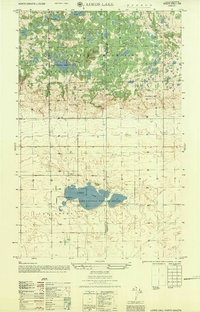 1956 Lords Lake1959 Print · USGSThe Turtle Mountains and the prairie lowlands meet at the Bottineau and Rolette county line during the mid-fifties. Genealogists and local historians can locate early rural landmarks like School No 1, Deerheart Lodge, and the Butte St Paul Historic Site.
 - 1958 Map of Minot
 1958 Minot1958 Print · USGSNorthern North Dakota is shown here during the mid-fifties, dominated by the rail-driven growth of Minot and the surrounding grain-farming prairie. Genealogists can trace family connections to border towns like Westhope or explore the vast reaches of the Turtle Mountains.
 - 1968 Map of Lake Upsilon SE
 1968 Lake Upsilon SE1968 Print · USGSThe Turtle Mountain region of North Dakota is captured here in the late sixties, showcasing the intersection of tribal lands and local prairie life. Researchers can locate St Anns Indian Mission and Maryville, or trace water patterns from Belcourt Lake through Shell Valley.
 - 1968 Map of International Peace Garden, 1971 Print
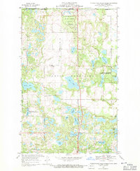 1968 International Peace Garden1971 Print · USGSThe high lakelands of the Rolette County border come to life in this late-sixties survey of the Turtle Mountains. Researchers can trace rural landmarks and protected lands like Little Prairie Ch, the International Peace Garden, and Kelvin.
 - 1968 Map of Carpenter Lake, 1971 Print
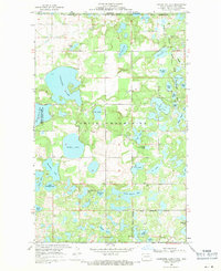 1968 Carpenter Lake1971 Print · USGSThe Turtle Mountains straddle the international border in the late sixties, revealing a complex landscape of lakes and conservation lands. Genealogists and historians can trace the Turtle Mountain Indian Reservation Boundary and find local landmarks like Carpenter Lake and Wakopa Creek.
 - 1968 Map of Lake Upsilon, 1971 Print
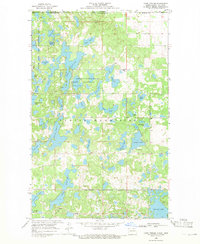 1968 Lake Upsilon1971 Print · USGSThe North Dakota-Manitoba borderlands are shown here in the late sixties, where the Turtle Mountains create a unique lake-filled landscape. Genealogists and historians can trace the St Benedicts Ch and Mill Lake Cem, or explore the early layout of the St John Game Farm.
 - 1968 Map of Boundary Lake, 1971 Print
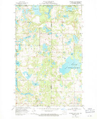 1968 Boundary Lake1971 Print · USGSThe international border near the Manitoba line was a landscape of protected wetlands and family-named water bodies in the late sixties. Researchers can find old community landmarks like Ackworth Cem and Rendahl Ch set among Boundary Lake and the Turtle Mountains.
 - 1968 Map of Belcourt, 1973 Print
 1968 Belcourt1973 Print · USGSThe Turtle Mountain region of North Dakota is captured here in the late sixties, showing the vital connection between the reservation and its neighboring prairie towns. Genealogists can locate family sites near St Paul Cem, the An-qui-ni-gay Indian Burial Ground, and the small community of Belcourt.
 - 1969 Map of Saint John, 1972 Print
 1969 Saint John1972 Print · USGSThe borderlands of Rolette County come alive in this late-sixties survey of the area surrounding Saint John. Trace family history and land use near the Turtle Mountain Indian Reservation, the Saint John Cem, and the Burlington Northern rail line.
Showing maps 1-25 of 167
Top cities of Rolette County
- Belcourt historical maps
- Rolla historical maps
- Dunseith historical maps
- Rolette historical maps
- Mylo historical maps
Frequently asked questions
- What are the different types of historical maps available for Rolette County?
- What is the oldest map of Rolette County?
- Where can I purchase historical maps of Rolette County for my home or office?
- Where can I download high-res historical maps of Rolette County?
- Are there historical topographic maps available for Rolette County?
- Is there historical aerial imagery available for Rolette County?
- Where are historical maps of Rolette County sourced from?