Old Maps of Jamestown, North Dakota for Hiking & Exploration
Hike through history with 25 historic maps of Jamestown. Explore old trails, ghost towns, and forgotten backroads — perfect for outdoor adventurers and local explorers.
- Rediscover forgotten places: Map out old mining camps, roads, and footpaths that no longer exist on modern maps.
- Layer with modern tools: Combine with LiDAR or satellite views to plan hikes through historical terrain.
- Made for exploration: Popular among hikers, overlanders, and local history lovers.
Use these maps to find adventure and explore the hidden past of Jamestown.
Jamestown, ND maps
(25)- 1896 Map of Jamestown
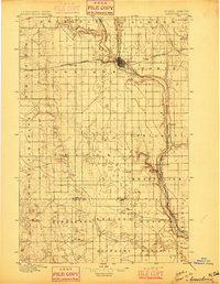 1896 Jamestown1896 Print · USGSJamestown and the surrounding prairie were rapidly developing at the close of the nineteenth century as the railroad transformed the territory. Genealogists and historians can trace the early rail stops and river settlements like Eldridge, Ypsilanti, and Adrian.3 unique versions available
 - 1951 Map of Jamestown
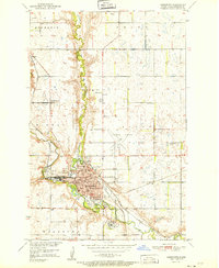 1951 Jamestown1951 Print · USGSJamestown serves as a busy rail and educational hub in the early 1950s, centered on the winding James River valley. Researchers can trace local genealogy and land use through features like Jamestown College, McGinnis Cem, and rural outposts such as Parkhurst.
 - 1952 Map of Eldridge
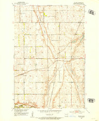
 1952 Eldridge1952 Print · USGSStutsman County is captured here during a period of transition as the Missouri River Basin project reshaped local waterways. Genealogists and historians can trace the foundations of the Eldridge community, from the Eldridge Cem to old rural landmarks like Woodbury School No 5.2 unique versions available
 - 1952 Map of Bloom, 1954 Print
 1952 Bloom1954 Print · USGSStutsman County's prairie townships are captured here in the early fifties, showing a rural landscape organized by the rail-and-river economy. Researchers can trace the path of the Midland Continental railroad and find local sites like Bloom, Spiritwood Cem, and several country schoolhouses.2 unique versions available
 - 1953 Map of Jamestown
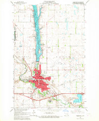
 1953 Jamestown1953 Print · USGSSoutheastern North Dakota was a thriving rail and agricultural corridor in the early fifties, anchored by the James River. Researchers can trace the footprints of institutional landmarks like the North Dakota State Hospital and historic sites such as Whitestone Hill Battlefield Park.3 unique versions available
 - 1956 Map of Jamestown
 1956 Jamestown1956 Print · USGSThe James River valley and the vast alkali lake country of south-central North Dakota are captured here in the mid-fifties. Genealogists can trace family farms across several counties, locating small rail stops like Medberry and monuments like Whitestone Hill Battlefield Park.
 - 1966 Map of Jamestown, 1967 Print
 1966 Jamestown1967 Print · USGSIn the mid-1960s, Jamestown served as a bustling rail and educational hub at the confluence of the James River. Genealogists and historians can trace institutional roots at Jamestown College, locate family plots in Highland Home Cem, and see the early footprint of the Jamestown Municipal Airport.2 unique versions available
 - 1986 Map of Jamestown
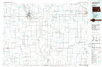 1986 Jamestown1986 Print · USGSThe eastern North Dakota prairie comes into focus in the mid-eighties, centered on the rail and river hubs of Jamestown and Valley City. You can trace the Burlington Northern line through historic stops like Eckelson, Sanborn, and Spiritwood while exploring vast wildlife refuges and local landmarks.2 unique versions available
 - 1990 Map of Jamestown, 1995 Print
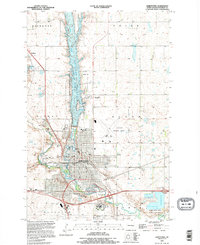 1990 Jamestown1995 Print · USGSJamestown and its surrounding prairie townships are captured here during the mid-nineties as the city expanded along the river forks. Genealogists and researchers can trace family plots in Jamestown Cem, explore the Jamestown College campus, or locate the historic Ft Seward Historic Site.
 - 1990 Map of Eldridge, 1995 Print
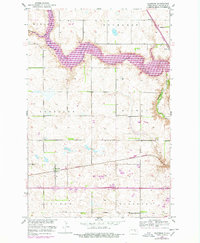
 1990 Eldridge1995 Print · USGSStutsman County's prairie landscape comes into focus during the 1990s as modern interstate travel meets historic rail routes. Researchers can trace the rail line of the Minneapolis St Paul and Sault Ste Marie RR and locate the Eldridge Cem near the town of Eldridge.
 - 2011 Map of Eldridge, 2011 Print
 2011 Eldridge2011 Print · USGSCovers Jamestown, including Eldridge, Parkhurst, and other nearby areas
 - 2011 Map of Bloom, 2011 Print
 2011 Bloom2011 Print · USGSCovers Jamestown, including Bloom, Johnson, and other nearby areas
 - 2011 Map of Jamestown, 2011 Print
 2011 Jamestown2011 Print · USGSCovers Jamestown, including Stutsman County, United States, and other nearby areas
 - 2014 Map of Jamestown, 2014 Print
 2014 Jamestown2014 Print · USGSCovers Jamestown, including Stutsman County, United States, and other nearby areas
 - 2014 Map of Eldridge, 2014 Print
 2014 Eldridge2014 Print · USGSCovers Jamestown, including Eldridge, Parkhurst, and other nearby areas
 - 2014 Map of Bloom, 2014 Print
 2014 Bloom2014 Print · USGSCovers Jamestown, including Bloom, Johnson, and other nearby areas
 - 2018 Map of Eldridge, 2018 Print
 2018 Eldridge2018 Print · USGSCovers Jamestown, including Eldridge, Parkhurst, and other nearby areas
 - 2018 Map of Jamestown, 2018 Print
 2018 Jamestown2018 Print · USGSCovers Jamestown, including Stutsman County, United States, and other nearby areas
 - 2018 Map of Bloom, 2018 Print
 2018 Bloom2018 Print · USGSCovers Jamestown, including Bloom, Johnson, and other nearby areas
 - 2020 Map of Eldridge, 2020 Print
 2020 Eldridge2020 Print · USGSCovers Jamestown, including Eldridge, Parkhurst, and other nearby areas
 - 2020 Map of Jamestown, 2020 Print
 2020 Jamestown2020 Print · USGSCovers Jamestown, including Stutsman County, United States, and other nearby areas
 - 2020 Map of Bloom, 2020 Print
 2020 Bloom2020 Print · USGSCovers Jamestown, including Bloom, Johnson, and other nearby areas
 - 2024 Map of Eldridge, 2024 Print
 2024 Eldridge2024 Print · USGSStutsman County's prairie landscape is captured in the mid-2020s, showing the intersection of rural agriculture and vital water resources. Local historians can trace the area around Eldridge, the Eldridge Cem, and the expansive Pipestem Lake.
 - 2024 Map of Bloom, 2024 Print
 2024 Bloom2024 Print · USGSThe eastern edges of the prairie hub of Jamestown are captured here as they transition into the agricultural reaches of central North Dakota. Genealogists and local historians can trace family locations near Bloom, the Spiritwood Cem, and the small settlement of Spiritwood.
 - 2024 Map of Jamestown, 2024 Print
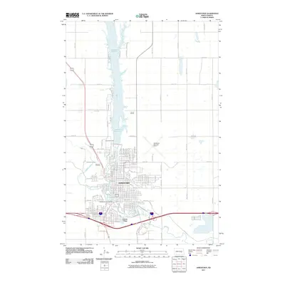
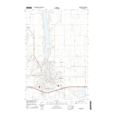
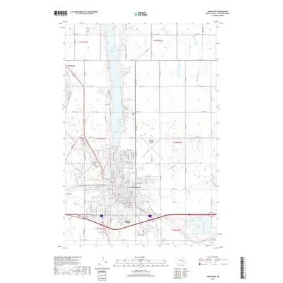
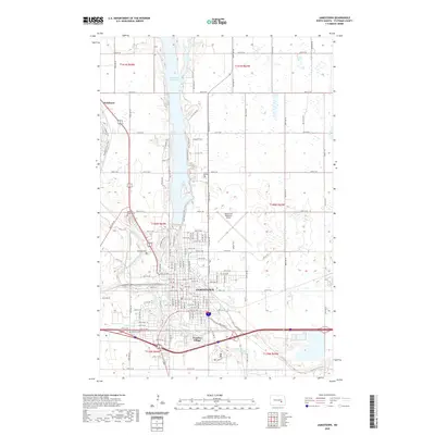
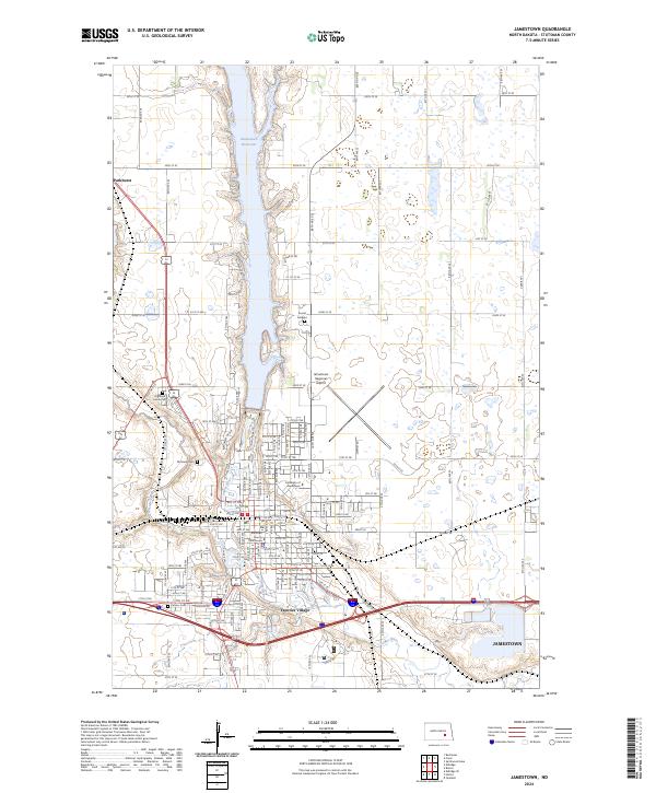 2024 Jamestown2024 Print · USGSJamestown and its surrounding prairie landscapes are captured here in the early 2020s, centered on the confluence of the James River and Pipestem Creek. Local historians can trace the development of the University of Jamestown and locate family sites at Highland Home Cem or Frontier Village.
End of results
Showing maps 1-25 of 25
Top cities near Jamestown
- Bloom historical maps
- Homer historical maps
- Fried historical maps
- Ypsilanti historical maps
- Eldridge historical maps
- Montpelier historical maps
See more
Frequently asked questions
- What are the different types of historical maps available for Jamestown?
- What is the oldest map of Jamestown?
- Where can I purchase historical maps of Jamestown for my home or office?
- Where can I download high-res historical maps of Jamestown?
- Are there historical topographic maps available for Jamestown?
- Is there historical aerial imagery available for Jamestown?
- Where are historical maps of Jamestown sourced from?