
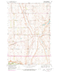
1952 Map of Bloom
USGS Topo · Published 1954About this map
Sevenmile Coulee carves through the central portion of this prairie landscape, where the agricultural grid of Stutsman County is defined by the intersections of several townships including Bloom, Spiritwood, and Fried. The 1952 geography reflects a transition in rural education, showing School No 1 and School No 4 still standing while School No 1 (Abandoned) marks a former site near the James River. This survey was conducted as part of the Department of the Interior's Missouri River Basin development program, illustrating the era's focus on water management and land use.
Find a feature on this map
19 named features on this map. Tap any name to fly to it.
Don’t see what you’re looking for? This feature index may not catch every label — zoom into the map to look around manually.
Map Details
Editions of this 1952 Bloom Map
2 editions found
Other maps of this area

1896 · Jamestown
USGS Topo · 1:125,000

1897 · Eckelson
USGS Topo · 1:125,000

1900 · Pingree
USGS Topo · 1:125,000

1950 · Fried
USGS Topo · 1:24,000

1951 · Jamestown
USGS Topo · 1:24,000

1951 · Fried
USGS Topo · 1:24,000

1951 · Spiritwood Lake
USGS Topo · 1:24,000

1952 · Homer
USGS Topo · 1:24,000

1952 · Ypsilanti
USGS Topo · 1:24,000

1952 · New Rockford
USGS Topo · 1:250,000