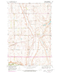
1952 Map of Bloom
USGS Topo · Published 1978About this map
The Burlington Northern railroad cuts through the center of this prairie landscape, defining the development of small settlements like Bloom during the mid-20th century. This survey, conducted as part of the Missouri River Basin development program, shows a transition from traditional rural schooling to a more consolidated era, noted by the presence of School No 4, School No 1, and the specifically marked School No 1 (Abandoned) near the James River.
Find a feature on this map
18 named features on this map. Tap any name to fly to it.
Don’t see what you’re looking for? This feature index may not catch every label — zoom into the map to look around manually.
Map Details
Editions of this 1952 Bloom Map
2 editions found
Other maps of this area

1896 · Jamestown
USGS Topo · 1:125,000

1897 · Eckelson
USGS Topo · 1:125,000

1900 · Pingree
USGS Topo · 1:125,000

1950 · Fried
USGS Topo · 1:24,000

1951 · Jamestown
USGS Topo · 1:24,000

1951 · Fried
USGS Topo · 1:24,000

1951 · Spiritwood Lake
USGS Topo · 1:24,000

1952 · Homer
USGS Topo · 1:24,000

1952 · Ypsilanti
USGS Topo · 1:24,000

1952 · Bloom
USGS Topo · 1:24,000