1950s Maps of Towner County, North Dakota
Explore 7 historic maps of Towner County from the 1950s. These maps offer a rare glimpse into what life looked like during the 1950s — showing old roads, neighborhoods, homes, and landmarks that have changed or disappeared over time.
Whether you're researching your family's past, planning a metal detecting trip, or studying how Towner County's landscape evolved across the 1950s, these high-resolution maps are a powerful tool for exploring the history of this region.
- Focus on a specific era: All maps on this page are from the 1950s, giving you a focused view of this time period.
- See what’s changed: Compare century-old streets, trails, and buildings to today's modern landscape using overlays and satellite layers.
- Research with precision: Use these maps for genealogy, historical research, land use analysis, or educational projects.
- View, download, or print: Maps are fully viewable online in high resolution, and can be downloaded or printed for your own records.
Start exploring Towner County's history through authentic maps from the 1950s. This is your window into the past.
Towner County, ND maps
(7)- 1953 Map of Devils Lake, 1968 Print
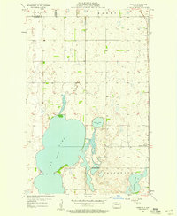
 1953 Devils Lake1968 Print · USGSNorth Dakota's northern plains are captured here in the mid-fifties, showing a landscape of rail-fed grain elevators and prairie wetlands. Genealogists can locate family landmarks like Rose Hill School, Hurricane Lake Church, and the Turtle Mountain Indian Reservation.3 unique versions available
 - 1956 Map of Devils Lake
 1956 Devils Lake1956 Print · USGSNorthern North Dakota is shown at a mid-century peak of rail-driven agriculture, where the Soo Line and Great Northern railroads cross the prairie. Trace the borders of the Turtle Mountain Indian Reservation and locate local landmarks like Rose Hill School or Camp Grafton.
 - 1957 Map of Cando SE, 1958 Print
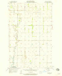
 1957 Cando SE1958 Print · USGSThe lakeside prairie of Ramsey and Towner counties is captured here in the late fifties, showing a landscape defined by seasonal waters and rural shifts. Researchers can locate specific heritage sites like the Almira Cem, Chain Lakes Ch, and former schoolhouses like School No 9 (Abandoned).2 unique versions available
 - 1957 Map of Cando, 1958 Print
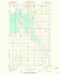
 1957 Cando1958 Print · USGSCando and the surrounding Towner County prairie are captured in the late fifties, dominated by the vital rail corridor of the GREAT NORTHERN. Genealogists can locate family sites at Olson Cem and Cando Cem, or trace the rural school district at Gopher Sch No 4.
 - 1957 Map of Cando NE, 1958 Print
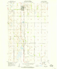
 1957 Cando NE1958 Print · USGSTowner County's prairie wetlands and township divisions are meticulously captured in the late fifties. Genealogists and historians can trace the local landscape through features like School No 1, the Gaging Station, and the edges of the Lac Aux Mortes National Wildlife Refuge.
 - 1957 Map of Churchs Ferry, 1958 Print
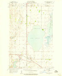 1957 Churchs Ferry1958 Print · USGSChurchs Ferry and Maza are centers of North Dakota rail and lake life in the late fifties. Genealogists and local historians can trace the Great Northern rail lines and find specific family landmarks like Zion Cem or the edges of Lake Irvine.
 - 1957 Map of Webster, 1958 Print
 1957 Webster1958 Print · USGSRamsey County's prairie landscape is captured here in the late fifties, as the grain-dependent rail economy shaped the local plains. Genealogists and historians can trace the tracks of the Great Northern through Webster and Garske or locate the Webster Cem.
End of results
Showing maps 1-7 of 7
Top cities of Towner County
- Cando historical maps
- Bisbee historical maps
- Crocus historical maps
- Egeland historical maps
- Maza historical maps
- Perth historical maps
See more
Frequently asked questions
- What are the different types of historical maps available for Towner County?
- What is the oldest map of Towner County?
- Where can I purchase historical maps of Towner County for my home or office?
- Where can I download high-res historical maps of Towner County?
- Are there historical topographic maps available for Towner County?
- Is there historical aerial imagery available for Towner County?
- Where are historical maps of Towner County sourced from?