1990s Maps of Towner County, North Dakota
Explore 6 historic maps of Towner County from the 1990s. These maps offer a rare glimpse into what life looked like during the 1990s — showing old roads, neighborhoods, homes, and landmarks that have changed or disappeared over time.
Whether you're researching your family's past, planning a metal detecting trip, or studying how Towner County's landscape evolved across the 1990s, these high-resolution maps are a powerful tool for exploring the history of this region.
- Focus on a specific era: All maps on this page are from the 1990s, giving you a focused view of this time period.
- See what’s changed: Compare century-old streets, trails, and buildings to today's modern landscape using overlays and satellite layers.
- Research with precision: Use these maps for genealogy, historical research, land use analysis, or educational projects.
- View, download, or print: Maps are fully viewable online in high resolution, and can be downloaded or printed for your own records.
Start exploring Towner County's history through authentic maps from the 1990s. This is your window into the past.
Towner County, ND maps
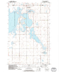
(6)- 1993 Map of Devils Lake, 1994 Print
 1993 Devils Lake1994 Print · USGSThe Ramsey County prairie and the shores of Devils Lake are captured here during the 1990s as the region's agricultural and conservation landscapes were maturing. Genealogists and researchers can trace the rail-side growth of Lakota and Michigan or locate family lands near Camp Grafton and the Sullys Hills N W R.
 - 1994 Map of Webster
 1994 Webster1994 Print · USGSRamsey County in the mid-nineties reveals a landscape of prairie potholes and small agricultural hubs. Researchers can trace the boundaries of the National Waterfowl Production Area and locate the Webster Cem near the town of Webster.
 - 1994 Map of Churchs Ferry
 1994 Churchs Ferry1994 Print · USGSThe northern prairie plains of the 1990s are defined here by the waters of the Chain Lakes and the town of Churchs Ferry. Researchers can trace the Burlington Northern rail lines and locate landmarks like the Churchs Ferry Cem and Maza.
 - 1994 Map of Cando
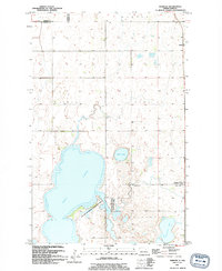
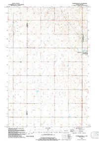
 1994 Cando1994 Print · USGSThe prairie hub of Cando is captured in the mid-1990s, showcasing its role as a regional center for Towner County. Genealogists and historians can locate the Cando Cem, the County Fairground, and the southern settlement of Maza.
 - 1994 Map of Cando SE
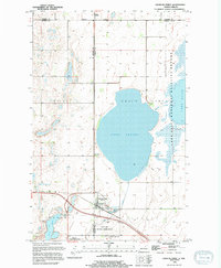
 1994 Cando SE1994 Print · USGSThe prairie wetlands of Ramsey County are captured here in the mid-1990s, dominated by the intricate hydrology of the Chain Lakes. Researchers can locate rural landmarks like the Chain Lake Ch, the Almira Cem, and the small settlement of Townhall.
 - 1994 Map of Starkweather
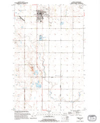
 1994 Starkweather1994 Print · USGSThe town of Starkweather and the surrounding prairie potholes of the Devils Lake basin are captured in this mid-nineties survey. Genealogists and local historians can trace family roots through the Bergen Cem and explore the geography of Hammer and Klingstrup townships.
End of results
Showing maps 1-6 of 6
Top cities of Towner County
- Cando historical maps
- Bisbee historical maps
- Crocus historical maps
- Egeland historical maps
- Maza historical maps
- Perth historical maps
See more
Frequently asked questions
- What are the different types of historical maps available for Towner County?
- What is the oldest map of Towner County?
- Where can I purchase historical maps of Towner County for my home or office?
- Where can I download high-res historical maps of Towner County?
- Are there historical topographic maps available for Towner County?
- Is there historical aerial imagery available for Towner County?
- Where are historical maps of Towner County sourced from?