1950s Maps of Wells County, North Dakota
Explore 21 historic maps of Wells County from the 1950s. These maps offer a rare glimpse into what life looked like during the 1950s — showing old roads, neighborhoods, homes, and landmarks that have changed or disappeared over time.
Whether you're researching your family's past, planning a metal detecting trip, or studying how Wells County's landscape evolved across the 1950s, these high-resolution maps are a powerful tool for exploring the history of this region.
- Focus on a specific era: All maps on this page are from the 1950s, giving you a focused view of this time period.
- See what’s changed: Compare century-old streets, trails, and buildings to today's modern landscape using overlays and satellite layers.
- Research with precision: Use these maps for genealogy, historical research, land use analysis, or educational projects.
- View, download, or print: Maps are fully viewable online in high resolution, and can be downloaded or printed for your own records.
Start exploring Wells County's history through authentic maps from the 1950s. This is your window into the past.
Wells County, ND maps
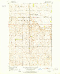
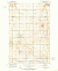
(21)- 1950 Map of Manfred SE
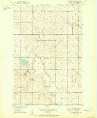 1950 Manfred SE1950 Print · USGSMid-century Wells County is captured here during a period of established prairie farming and rural school districts. Genealogists can locate the Menonite Cem and Menonite Ch or trace the locations of Eddy School No 1 and Eddy School No 4.
 - 1950 Map of Wellsburg
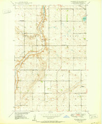
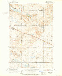
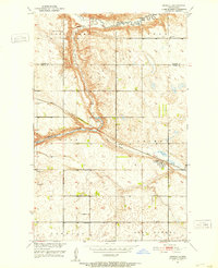
 1950 Wellsburg1950 Print · USGSThe mid-century plains of Wells County are defined here by the winding Sheyenne River and the critical Great Northern rail corridor. Genealogists can locate several rural landmarks including Wellsburg, Odessa Sch No 1, and Butte De Morale.
 - 1950 Map of Manfred NW
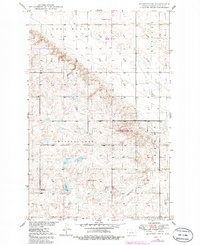
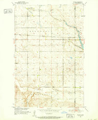
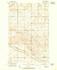
 1950 Manfred NW1950 Print · USGSWells County at mid-century reveals a prairie landscape defined by the winding Sheyenne River and a network of rural school districts. Genealogists and local historians can locate St Peters Ch and early schoolhouses like Eigenheim School No 2 and Pioneer Sch No 2.2 unique versions available
 - 1950 Map of Sheyenne Lake NE
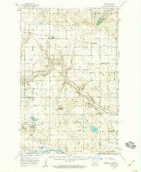
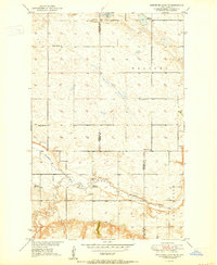 1950 Sheyenne Lake NE1950 Print · USGSSheridan and Wells Counties appear here as a landscape of rural schoolhouses and prairie homesteads at the mid-century. Researchers can locate family roots near Zion Cem, the Mennonite Ch, and local landmarks like Fairview Sch No 1 or Pony Gulch.2 unique versions available
 - 1950 Map of Manfred
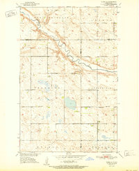
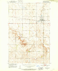
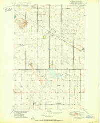 1950 Manfred1950 Print · USGSWells County's agricultural heartland is documented here just after the war, showing the dispersed settlement pattern of the central North Dakota plains. Researchers can locate numerous rural schoolhouses like Whitby School No 1 and Eigenheim School No 5, or trace the Soo Line tracks through Manfred.2 unique versions available
 - 1950 Map of Manfred SW, 1986 Print
 1950 Manfred SW1986 Print · USGSNorth Dakota's central prairie remains largely undisturbed in this mid-century survey of Wells County. Genealogists and local historians can trace the locations of rural schoolhouses like Hillside Sch No 4 and the settlement at Chaseley.
 - 1951 Map of Flora SE
 1951 Flora SE1951 Print · USGSThe Sheyenne River valley and the surrounding townships of Wells and Benson counties are recorded here in the early fifties. Genealogists and historians can locate rural landmarks such as Eden Ch, Augustana Ch, and multiple schoolhouses like School No 1.2 unique versions available
 - 1951 Map of Harvey
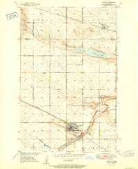 1951 Harvey1951 Print · USGSMid-century Wells County is captured here during a time of bustling rail commerce and established township life. Genealogists and local historians can trace family roots through several dedicated sites, including St Anthony Cem, Sunnyside Cem, and the Sheyenne River Academy.2 unique versions available
 - 1951 Map of Bowdon, 1952 Print
 1951 Bowdon1952 Print · USGSThe town of Bowdon and its surrounding grain-farming townships are captured at mid-century as the Missouri River Basin project was underway. Genealogists can locate family sites near Wayside Cem, Mielke Cem, and the rural Lincoln Sch.2 unique versions available
 - 1951 Map of Heaton, 1952 Print
 1951 Heaton1952 Print · USGSWells County in the early fifties shows a rural landscape defined by the prairie-rail economy and the winding course of Pipestem Creek. Genealogists and local historians can locate early townships like Speedwell and Berlin, alongside Heaton Cem and several numbered schoolhouses.2 unique versions available
 - 1951 Map of Martin, 1952 Print
 1951 Martin1952 Print · USGSThe rural prairie landscape surrounding Martin is shown in detail during the early fifties as the railroad connected these remote townships. Genealogists can trace family roots through sites like Reform Cem, Hillsdale Ch, and several local schoolhouses.2 unique versions available
 - 1951 Map of Dover, 1952 Print
 1951 Dover1952 Print · USGSWells County ranching and rail life are preserved here in the early fifties as the Missouri River Basin program took shape. Researchers can trace the Northern Pacific line through Dover, identifying the Bilodeau Sch and Brethren Cem.2 unique versions available
 - 1951 Map of Sykeston, 1952 Print
 1951 Sykeston1952 Print · USGSSykeston and the surrounding prairie townships are captured here in the early fifties, showing a landscape shaped by rail and water. Local researchers can locate School No 1, Lake Hiawatha, and the St Elizabeth Cem along the Northern Pacific line.
 - 1951 Map of Black Hammer Hill, 1953 Print
 1951 Black Hammer Hill1953 Print · USGSBenson and Wells Counties appear here in the early fifties, showing a prairie landscape of isolated farmsteads and township schools. Genealogists and local historians can trace the foundations of Bremen and find rural landmarks like Viking Ch and Trinity Cem.2 unique versions available
 - 1951 Map of Heimdal, 1953 Print
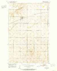
 1951 Heimdal1953 Print · USGSHeimdal was a thriving rail stop on the Great Northern line during the early fifties, surrounded by a network of Scandinavian-named townships. Researchers can trace the locations of the Klara Ch, Bethania Cem, and rural sites like North Fork Sch No 2.2 unique versions available
 - 1951 Map of Hamberg, 1953 Print
 1951 Hamberg1953 Print · USGSHamberg and the surrounding Wells County prairie are documented here in the early fifties, centered on the railroad economy of the North Dakota plains. Researchers can trace the path of the Great Northern rail line and locate rural landmarks like Corby Sch, Lynne Sch, and the winding Big Slough.2 unique versions available
 - 1951 Map of Flora, 1959 Print
 1951 Flora1959 Print · USGSBenson County in the early fifties shows a landscape shaped by the Northern Pacific railroad and the winding Sheyenne River. Genealogists can trace rural roots through the many country churches and schools, including Viking Ch, School No 1, and Flora Cem.
 - 1952 Map of New Rockford, 1968 Print
 1952 New Rockford1968 Print · USGSThe North Dakota prairie during the mid-1950s was a landscape of rail-dependent farm towns and vast wildlife refuges. Genealogists and historians can trace the foundations of local communities at Fort Totten Indian Agenc, Concordia Lutheran Church, and the Bowdon Country Church and Cemetery.3 unique versions available
 - 1954 Map of McClusky, 1968 Print
 1954 McClusky1968 Print · USGSCentral North Dakota was undergoing a profound transformation in the fifties as the newly formed Lake Sakakawea reshaped the Missouri River valley. Genealogists and historians can trace rail-town development along the Soo Line and locate historic markers like Garrison Dam or the Lewis and Clark Trail.3 unique versions available
 - 1956 Map of New Rockford
 1956 New Rockford1956 Print · USGSMid-century central North Dakota is captured here as a landscape of prairie rail towns and vast wildlife refuges. Trace family roots at the Bowdon Country Church and Cemetery or locate the old St Michael Mission School and Fort Totten.
 - 1958 Map of McClusky
 1958 McClusky1958 Print · USGSCentral North Dakota was undergoing a profound change in the late fifties as the Garrison Reservoir filled behind its massive new dam. Trace the early layout of Riverdale, the Lewis and Clark Trail, and the vanishing rail stops of the Northern Pacific.
End of results
Showing maps 1-21 of 21
Top cities of Wells County
- Harvey historical maps
- Fessenden historical maps
- Sykeston historical maps
- Bowdon historical maps
- Hurdsfield historical maps
- Bremen historical maps
See more
Frequently asked questions
- What are the different types of historical maps available for Wells County?
- What is the oldest map of Wells County?
- Where can I purchase historical maps of Wells County for my home or office?
- Where can I download high-res historical maps of Wells County?
- Are there historical topographic maps available for Wells County?
- Is there historical aerial imagery available for Wells County?
- Where are historical maps of Wells County sourced from?