
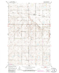
1951 Map of Heaton
USGS Topo · Published 1952About this map
Heaton stands as a rail-side settlement along the Northern Pacific line in this early 1950s survey of Wells County. The landscape is defined by the winding course of Pipestem Creek, which cuts through the townships of Speedwell and Sykeston. This period of documentation captures the rural infrastructure of the Missouri River Basin development era, evidenced by localized centers of community life like Heaton Cem and scattered one-room schoolhouses including School No 1 and School No 4. The map reveals a transition in land use, where section-line roads and traditional townships like Berlin and Johnson coexist with industrial markers such as a Gravel Pit. The detailed topography illustrates the pothole-dotted prairie terrain characteristic of central North Dakota before more modern drainage and consolidation altered these small rural districts.
Find a feature on this map
11 named features on this map. Tap any name to fly to it.
Don’t see what you’re looking for? This feature index may not catch every label — zoom into the map to look around manually.
Map Details
Editions of this 1951 Heaton Map
2 editions found
Other maps of this area

1948 · Cathay
USGS Topo · 1:62,500

1948 · Fessenden
USGS Topo · 1:62,500

1949 · Cathay
USGS Topo · 1:24,000

1949 · Fessenden SW
USGS Topo · 1:24,000

1949 · Emrick
USGS Topo · 1:24,000

1951 · Bowdon
USGS Topo · 1:24,000

1951 · Sykeston
USGS Topo · 1:24,000

1952 · New Rockford
USGS Topo · 1:250,000

1956 · New Rockford
USGS Topo · 1:250,000

1971 · New Rockford
USGS Topo · 1:250,000