Old Maps of Wells County, North Dakota for Metal Detecting
Plan your next treasure hunt with 235 historic maps of Wells County. Find old homesites, ghost towns, trails, and gathering spots that may be lost to time — perfect for identifying promising metal detecting locations.
- Locate forgotten sites: Uncover places like long-lost settlements, abandoned rail lines, or gathering spots.
- Plan better hunts: Use map overlays combined with LiDAR or satellite views to narrow in on historically rich areas.
- Made for detectorists: Thousands of hobbyists use these maps to discover relics, coins, and hidden history.
Use these historic maps to boost your research and find new opportunities beneath the surface of Wells County.
Wells County, ND maps
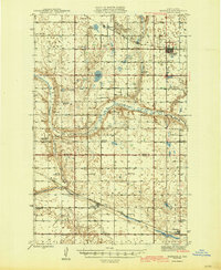
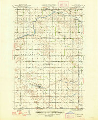
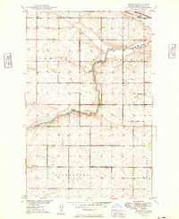
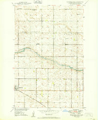
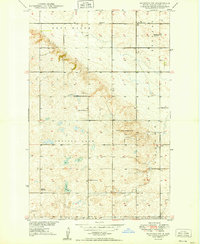
(235)- 1932 Map of Flora
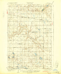 1932 Flora1932 Print · USGSBenson and Wells Counties are captured here between the wars, when the prairie was a network of small school districts and railroad sidings. Trace the early township life of the region through landmarks like Monterey Town Hall, Stony Lake, and the Maddock Cem.2 unique versions available
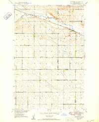
 - 1940 Map of Aylmer
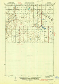
 1940 Aylmer1940 Print · USGSPierce and Sheridan Counties come into focus just before the war, showing the peak of the North Dakota rail-and-prairie economy. Genealogists can pinpoint exact locations for family landmarks like Hillsdale Ch, White Sch, and Martin Cem.3 unique versions available
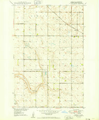
 - 1941 Map of Selz
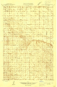
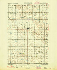
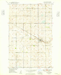
 1941 Selz1941 Print · USGSPierce and Wells Counties are shown in the late thirties as a landscape of rural school districts and bustling rail towns. Genealogists can locate family landmarks such as the Sheyenne River Academy, St Anthony Cem, and dozens of numbered country schools.2 unique versions available
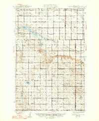
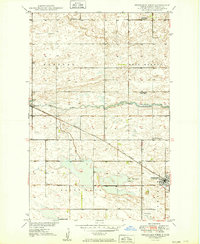
 - 1943 Map of Maddock, 1963 Print
 1943 Maddock1963 Print · USGSBenson and Wells counties are shown in detail during the 1940s, when the prairie was dotted with localized school districts and rural parishes. Genealogists can trace family footprints at North Viking Cem or find the sites of East Fram Sch No 4 and Heimdal.
 - 1945 Map of Maddock
 1945 Maddock1945 Print · USGSBenson and Wells counties in the mid-1940s are defined by a robust network of prairie towns and competing rail lines. Researchers can trace rural life through numerous landmark schools and churches, from Maddock and Heimdal to Klara Church and East Fram School No 4.
 - 1945 Map of Manfred
 1945 Manfred1945 Print · USGSWells County prairie life is captured here at the end of the Second World War, showing a landscape of section-line roads and rural school districts. Genealogists can locate family landmarks like St Peters Ch, Manfred Sch No 3, and the village of Manfred.
 - 1946 Map of Sheyenne Lake
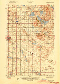
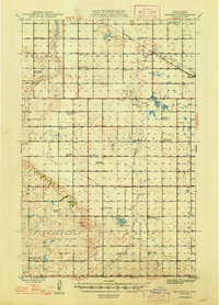
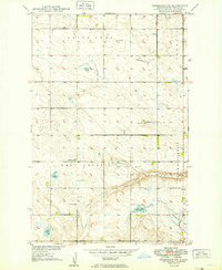
 1946 Sheyenne Lake1946 Print · USGSSheridan and Wells counties are captured here in the mid-1940s, revealing a dense rural network of prairie schoolhouses and churches. Family historians can trace landmarks like St Emanuel Gemeinde Cem, Sheyenne Lake, and numerous local schools including Pioneer Sch No 1.
 - 1947 Map of Sheyenne Lake
 1947 Sheyenne Lake1947 Print · USGSThe Sheridan and Wells county borderlands are captured here in the late 1940s, showing a landscape defined by an extensive network of rural school districts and prairie lakes. Genealogists can locate family-named landmarks like Mertz Sch No 1, St Emanuel Gemeinde Cem, and the Coal Mine at Coal Lake.2 unique versions available
 - 1948 Map of Cathay
 1948 Cathay1948 Print · USGSWells County was a network of rail-towns and prairie parishes in the years following the war. Researchers can trace the family legacies of Cathay and Bremen, identifying rural landmarks like St Josephs Ch, Lake View Cem, and numerous one-room schoolhouses.2 unique versions available
 - 1948 Map of Fessenden
 1948 Fessenden1948 Print · USGSWells County was a landscape of township schools and prairie settlements during the 1940s. Genealogists can trace family landmarks like Brynjulson Cem and Concordia Ch, or locate vanished schoolhouses such as Oshkosh Sch.2 unique versions available
 - 1948 Map of Manfred
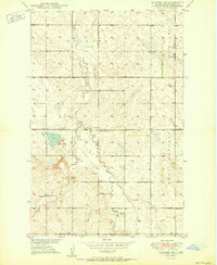
 1948 Manfred1948 Print · USGSWells County in the late 1940s is depicted as a thriving agricultural region centered on the town of Manfred. Genealogists can trace a remarkable number of rural school districts and community churches, such as Eddy Sch No 1, Hillside Sch No 2, and Seventh Day Adventist Ch.
 - 1948 Map of Bremen, 1976 Print
 1948 Bremen1976 Print · USGSWells County prairie life is documented here in the late 1940s, centered on the railroad siding and the river valley. Researchers can trace the layout of early rural school districts and find local landmarks like St Josephs Ch and the German Baptist Cem.2 unique versions available
 - 1949 Map of Bremen
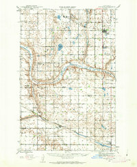
 1949 Bremen1949 Print · USGSWells County farming townships and the meandering James River are captured here in the late 1940s. Genealogists and local historians can trace the rural school system and find family landmarks like St Josephs Ch and the German Baptist Cem.
 - 1949 Map of Cathay
 1949 Cathay1949 Print · USGSWells County's prairie landscape is captured here in the late 1940s, centered on the rail-aligned town of Cathay. Researchers can trace the mid-century rural school system at School No 3 or locate family plots at Lake View Cem near the banks of Rocky Run.2 unique versions available
 - 1949 Map of Fessenden SW
 1949 Fessenden SW1949 Print · USGSWells County farm country is captured here just after the war, showing the organized section lines and rural townships of central North Dakota. Researchers can locate family landmarks like Byrnjuison Cem, Bowman Sch, and the waters of Lake Ontario.2 unique versions available
 - 1949 Map of Cathay SE
 1949 Cathay SE1949 Print · USGSWells County and Foster County farmland is captured here in the late 1940s, centered on the rail-driven hamlet of Lemert. Genealogists can locate family landmarks like Stavanger Ch, the Norwegian Lutheran Cem, and numerous rural schools.2 unique versions available
 - 1949 Map of Fessenden East
 1949 Fessenden East1949 Print · USGSWells County, North Dakota, is documented here in the late 1940s as a region of dispersed prairie farmsteads and rural townships. Genealogists can locate family landmarks like Bloomington School No 3, Concordia Cem, and the tracks of the Minneapolis St Paul and Sault Ste Marie.2 unique versions available
 - 1949 Map of Munster
 1949 Munster1949 Print · USGSWells and Eddy Counties come to life in the late 1940s, showing the agricultural landscape before modern consolidation. Genealogists and local historians can locate early farmstead sites, the village of Munster, and rural landmarks like School No 1 and the James River.2 unique versions available
 - 1949 Map of Emrick
 1949 Emrick1949 Print · USGSWells County prairie life is centered on the rail sidings and rural townships during the late 1940s. Genealogists can locate Tolbert Cem, the vanished Oshkosh Sch, and the rail-side settlement of Emrick.2 unique versions available
 - 1949 Map of Fessenden West
 1949 Fessenden West1949 Print · USGSWells County at mid-century reveals a rural landscape defined by the iron rails and prairie townships of central North Dakota. Researchers can locate family landmarks like the German Baptist Cem, Mohr Landing field, and early local schools like Bloomington School No 4.2 unique versions available
 - 1949 Map of Manfred SW
 1949 Manfred SW1949 Print · USGSWells County farming townships come into focus during the late 1940s, showing a landscape shaped by rural education and prairie wetlands. Trace family history at Eigenheim Ch or locate defunct schoolhouses like Hillside Sch No 4 and Eddy Sch No 2.
 - 1950 Map of Manfred SE
 1950 Manfred SE1950 Print · USGSMid-century Wells County is captured here during a period of established prairie farming and rural school districts. Genealogists can locate the Menonite Cem and Menonite Ch or trace the locations of Eddy School No 1 and Eddy School No 4.
 - 1950 Map of Wellsburg
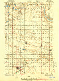
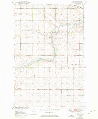
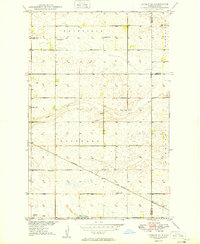
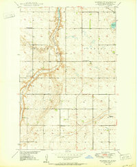
 1950 Wellsburg1950 Print · USGSThe mid-century plains of Wells County are defined here by the winding Sheyenne River and the critical Great Northern rail corridor. Genealogists can locate several rural landmarks including Wellsburg, Odessa Sch No 1, and Butte De Morale.
 - 1950 Map of Manfred NW
 1950 Manfred NW1950 Print · USGSWells County at mid-century reveals a prairie landscape defined by the winding Sheyenne River and a network of rural school districts. Genealogists and local historians can locate St Peters Ch and early schoolhouses like Eigenheim School No 2 and Pioneer Sch No 2.2 unique versions available
 - 1950 Map of Sheyenne Lake NE
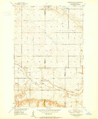 1950 Sheyenne Lake NE1950 Print · USGSSheridan and Wells Counties appear here as a landscape of rural schoolhouses and prairie homesteads at the mid-century. Researchers can locate family roots near Zion Cem, the Mennonite Ch, and local landmarks like Fairview Sch No 1 or Pony Gulch.2 unique versions available
Showing maps 1-25 of 235
Top cities of Wells County
- Harvey historical maps
- Fessenden historical maps
- Sykeston historical maps
- Bowdon historical maps
- Hurdsfield historical maps
- Bremen historical maps
See more
Frequently asked questions
- What are the different types of historical maps available for Wells County?
- What is the oldest map of Wells County?
- Where can I purchase historical maps of Wells County for my home or office?
- Where can I download high-res historical maps of Wells County?
- Are there historical topographic maps available for Wells County?
- Is there historical aerial imagery available for Wells County?
- Where are historical maps of Wells County sourced from?