
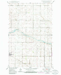
1949 Map of Fessenden East
USGS Topo · Published 1949About this map
Fessenden sits at the southwestern edge of this landscape, where the Minneapolis St Paul and Sault Ste Marie railroad cuts across the prairie. The survey captures a late 1940s agricultural environment organized into distinct townships like West Norway, Hamburg, Osh Kosh, and Germantown. The James River meanders across the central portion of the map, providing a natural break in the gridded sections of the Great Plains.
Find a feature on this map
16 named features on this map. Tap any name to fly to it.
Don’t see what you’re looking for? This feature index may not catch every label — zoom into the map to look around manually.
Map Details
Editions of this 1949 Fessenden East Map
2 editions found
Other maps of this area

1932 · Flora
USGS Topo · 1:62,500

1943 · Maddock
USGS Topo · 1:62,500

1945 · Maddock
USGS Topo · 1:62,500

1948 · Cathay
USGS Topo · 1:62,500

1948 · Fessenden
USGS Topo · 1:62,500

1948 · Bremen
USGS Topo · 1:24,000

1949 · Bremen
USGS Topo · 1:24,000

1949 · Cathay
USGS Topo · 1:24,000

1949 · Fessenden SW
USGS Topo · 1:24,000

1949 · Emrick
USGS Topo · 1:24,000