2020s Maps of Belmont County, Ohio
Explore 19 historic maps of Belmont County from the 2020s. These maps offer a rare glimpse into what life looked like during the 2020s — showing old roads, neighborhoods, homes, and landmarks that have changed or disappeared over time.
Whether you're researching your family's past, planning a metal detecting trip, or studying how Belmont County's landscape evolved across the 2020s, these high-resolution maps are a powerful tool for exploring the history of this region.
- Focus on a specific era: All maps on this page are from the 2020s, giving you a focused view of this time period.
- See what’s changed: Compare century-old streets, trails, and buildings to today's modern landscape using overlays and satellite layers.
- Research with precision: Use these maps for genealogy, historical research, land use analysis, or educational projects.
- View, download, or print: Maps are fully viewable online in high resolution, and can be downloaded or printed for your own records.
Start exploring Belmont County's history through authentic maps from the 2020s. This is your window into the past.
Belmont County, OH maps
(19)- 2023 Map of Hunter, 2023 Print
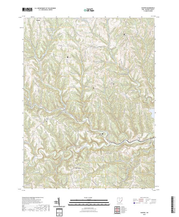 2023 Hunter2023 Print · USGSBelmont County’s ridges and hollows are documented here in the early twenty-first century, showcasing a rural landscape defined by the Captina Creek drainage. Genealogists can trace family footprints through numerous upland burial sites like Chestnut Level Cem and Pleasant Ridge Cem.
 - 2023 Map of Woodsfield, 2023 Print
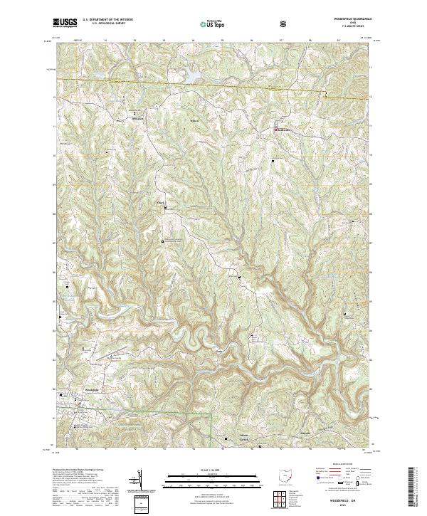 2023 Woodsfield2023 Print · USGSSoutheastern Ohio’s ridgeline settlements and deep creek valleys are captured here in the early twenty-first century. Researchers can locate family sites at Jerusalem Cem or Asbury Chapel Cem and trace the terrain from Mount Carrick to the Wayne National Forest.
 - 2023 Map of Dillonvale, 2023 Print
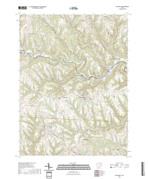 2023 Dillonvale2023 Print · USGSJefferson and Belmont Counties appear in detail in this recent survey of eastern Ohio's ridge-and-valley landscape. Researchers can trace local history through a high density of rural burial grounds like Rehoboth Cem and industrial landmarks such as the Dunglen Mine Impoundment.
 - 2023 Map of Harrisville, 2023 Print
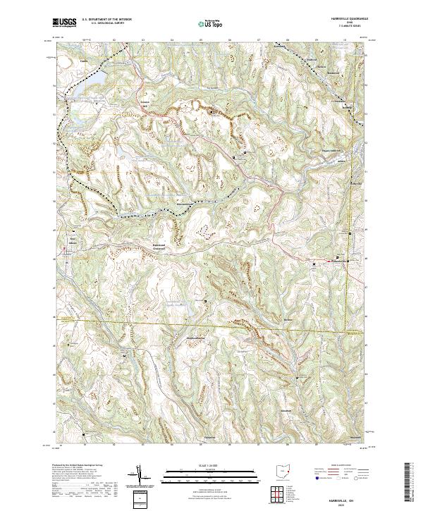 2023 Harrisville2023 Print · USGSEastern Ohio’s coal and Quaker heritage remains visible in the landscape of the early twenty-first century. Genealogists can trace family lines across dozens of rural burial sites like the Friends Meeting House Cem, Stiers Cem, and Olive Branch Cem.
 - 2023 Map of Wheeling, 2023 Print
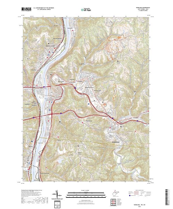 2023 Wheeling2023 Print · USGSThe industrial corridor of the Ohio River is captured here in a contemporary context, showcasing the dense riverfront development of WHEELING and MARTINS FERRY. Genealogists and historians can trace numerous family burial grounds like Mount Olivet Cem and Greenwood Cem, or explore the repurposed industrial paths along the Wheeling Creek Rail-Trl.
 - 2023 Map of Flushing, 2023 Print
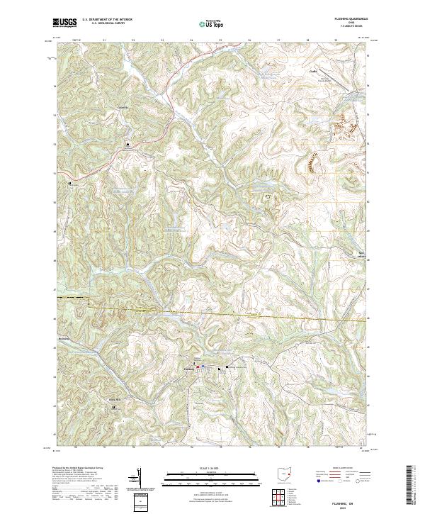 2023 Flushing2023 Print · USGSThe borderlands of Harrison and Belmont counties appear in high detail during the early 2020s, centered on the village of Flushing. Genealogists and local historians can locate several family burial sites like Rockhill Cem or trace the drainage of Jockey Hollow Run.
 - 2023 Map of Fairview, 2023 Print
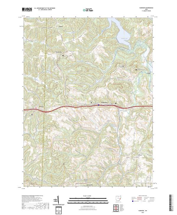 2023 Fairview2023 Print · USGSEastern Ohio hill country at the start of the 2020s shows a landscape of scattered rural hamlets and upland cemeteries. Researchers can trace family history at sites like Gibson Cem and Fairview Cem or locate the village of Hendrysburg near the Belmont County line.
 - 2023 Map of Businessburg, 2023 Print
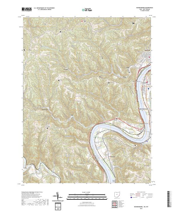 2023 Businessburg2023 Print · USGSThe Ohio River valley near the Belmont and Marshall county lines is shown here in the contemporary era. Researchers can locate family burial grounds like Upper Wegee Cem and trace the paths of old routes like Warren Hill Rd or Dilles Bottom Rd.
 - 2023 Map of Armstrongs Mills, 2023 Print
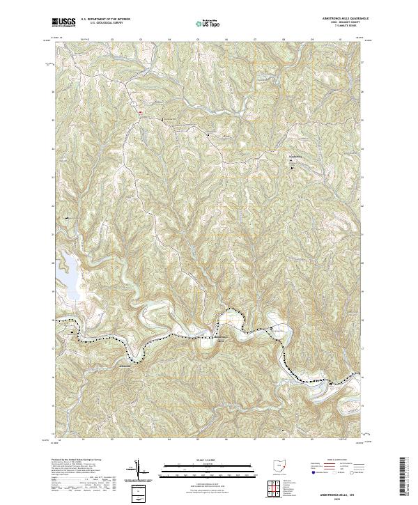 2023 Armstrongs Mills2023 Print · USGSBelmont County is shown in this recent survey, centered on the historic winding valleys of the Ohio hill country. Genealogists can trace family burial sites at Armstrongs Cem and Jacobsburg Cem or locate the quiet settlements of Alledonia and Cool Hill.
 - 2023 Map of Cameron, 2023 Print
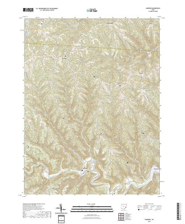 2023 Cameron2023 Print · USGSSoutheast Ohio's ridge-and-hollow country is documented here in the early twenty-first century, showing the enduring rural layout of Monroe County. Genealogists can trace ancestral sites at Zion Methodist Cem, Grandview Cem, and the village of Cameron.
 - 2023 Map of Lewisville, 2023 Print
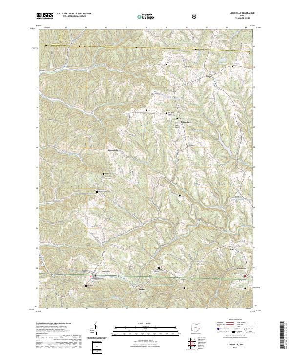 2023 Lewisville2023 Print · USGSMonroe County, Ohio, maintains its rural character in this 2023 survey of the ridge-and-valley landscape near Lewisville. Genealogists and local historians can trace early settlement patterns through numerous sites like Miltonsburg, the Eggar Cem, and Decker.
 - 2023 Map of Barnesville, 2023 Print
 2023 Barnesville2023 Print · USGSBelmont County at the start of the 2020s shows a landscape of established villages and significant cemeteries. Researchers can trace family lines through the Old Quaker Cem and Harmony Cem or explore early settlements like Baileys Mills and Somerton.
 - 2023 Map of Powhatan Point, 2023 Print
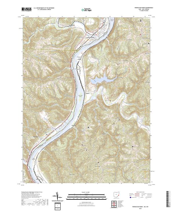 2023 Powhatan Point2023 Print · USGSThe Ohio River borderlands at the turn of the decade reveal a complex landscape of industrial mining and deep-rooted river towns. Researchers can trace historic family burial sites like Saint Johns Cem and Grace Chapel Cem alongside modern operations at Quarto Mine Number Four Dam Number Two.
 - 2023 Map of Moundsville, 2023 Print
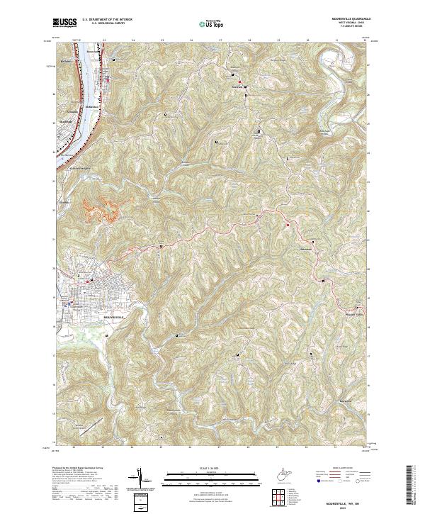 2023 Moundsville2023 Print · USGSMoundsville and the Ohio River valley are shown here in recent detail, where ancient landmarks meet modern riverside industry. Genealogists can trace family names across a high density of ridge-top burial grounds including Waymans Ridge Cem, Blairs Ridge Cem, and McMecken Cem.
 - 2023 Map of Saint Clairsville, 2023 Print
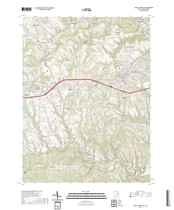 2023 Saint Clairsville2023 Print · USGSBelmont County is captured here in the early twenty-first century, centered on the bustling county seat and the historic National Road corridor. Researchers can locate numerous ancestral burial grounds like Friends Cem and Butcher Cem or trace the winding courses of Wheeling Creek and McMahon Creek.
 - 2023 Map of Lansing, 2023 Print
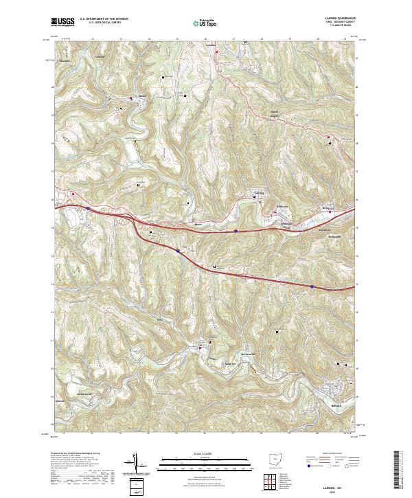 2023 Lansing2023 Print · USGSBelmont County’s deep valleys and high ridges are shown here in the 2020s, tracing a landscape defined by historic coal towns and transit routes. Genealogists can locate numerous burial sites, including Linwood Cem and Mount Calvary Cem, alongside old settlements like Neffs and Barton.
 - 2023 Map of Piedmont, 2023 Print
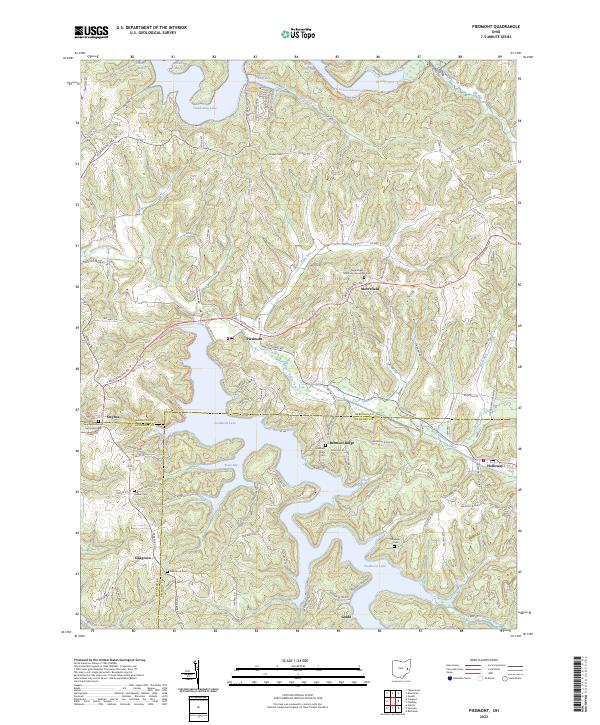 2023 Piedmont2023 Print · USGSThe hill country of eastern Ohio is defined here by the meeting of Harrison, Belmont, and Guernsey counties amid sprawling reservoirs. Researchers can locate long-standing community landmarks like the Quaker Cem and Moorefield Methodist Episcopal Cem near the historic town of Piedmont.
 - 2023 Map of Bethesda, 2023 Print
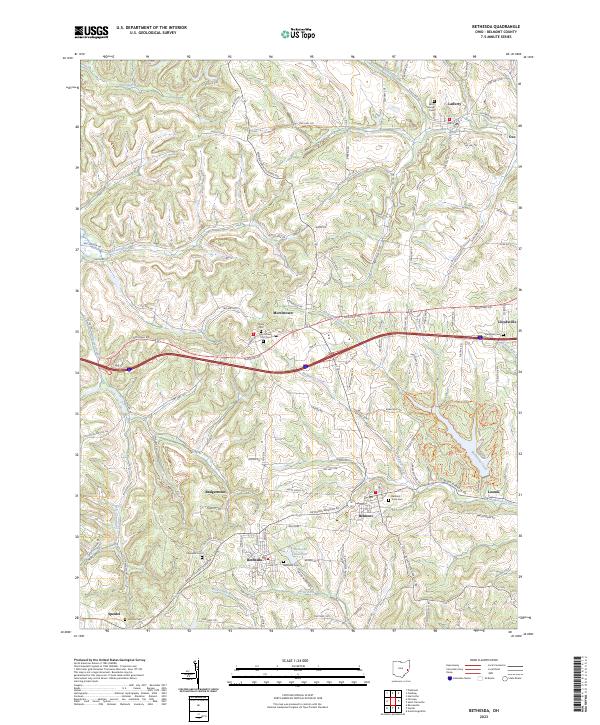 2023 Bethesda2023 Print · USGSBelmont County's ridge-and-valley landscape is documented here in the early twenty-first century, centered on the historic settlements along the National Road. Researchers can trace ancestral roots through numerous local burial sites like Saint Marys Cem, Belmont Town Cem, and the Bethesda Cem.
 - 2023 Map of Tiltonsville, 2023 Print
 2023 Tiltonsville2023 Print · USGSThe riverfront communities of the Ohio Valley come into focus here during the early twenty-first century. Genealogists and local researchers can trace family plots at Warrenton Cem and Short Creek Cem or locate the ancient Indian Mound near Tiltonsville.
End of results
Showing maps 1-19 of 19
Top cities of Belmont County
- Martins Ferry historical maps
- St. Clairsville historical maps
- Colerain historical maps
- Barnesville historical maps
- Bellaire historical maps
- Shadyside historical maps
See more
Frequently asked questions
- What are the different types of historical maps available for Belmont County?
- What is the oldest map of Belmont County?
- Where can I purchase historical maps of Belmont County for my home or office?
- Where can I download high-res historical maps of Belmont County?
- Are there historical topographic maps available for Belmont County?
- Is there historical aerial imagery available for Belmont County?
- Where are historical maps of Belmont County sourced from?