1960s Maps of Belmont County, Ohio
Explore 21 historic maps of Belmont County from the 1960s. These maps offer a rare glimpse into what life looked like during the 1960s — showing old roads, neighborhoods, homes, and landmarks that have changed or disappeared over time.
Whether you're researching your family's past, planning a metal detecting trip, or studying how Belmont County's landscape evolved across the 1960s, these high-resolution maps are a powerful tool for exploring the history of this region.
- Focus on a specific era: All maps on this page are from the 1960s, giving you a focused view of this time period.
- See what’s changed: Compare century-old streets, trails, and buildings to today's modern landscape using overlays and satellite layers.
- Research with precision: Use these maps for genealogy, historical research, land use analysis, or educational projects.
- View, download, or print: Maps are fully viewable online in high resolution, and can be downloaded or printed for your own records.
Start exploring Belmont County's history through authentic maps from the 1960s. This is your window into the past.
Belmont County, OH maps
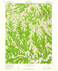
(21)- 1960 Map of Dillonvale, 1961 Print
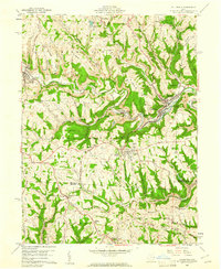 1960 Dillonvale1961 Print · USGSEastern Ohio coal country was in the midst of a mining boom in the early sixties, leaving a landscape defined by industry and deep-seated local roots. Genealogists and historians can trace family locations through numerous sites like St Casimirs Ch, Olszeski Town, and Highland Cem.5 unique versions available
 - 1960 Map of Moundsville, 1961 Print
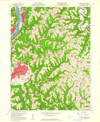 1960 Moundsville1961 Print · USGSMarshall County's riverfront industry and correctional history are on full display in this mid-century survey of the Ohio River valley. Genealogists and researchers can locate the State Penitentiary, trace rural churches on Waymans Ridge, and find local landmarks like the Grave Creek Indian Mound Museum.4 unique versions available
 - 1960 Map of Businessburg, 1961 Print
 1960 Businessburg1961 Print · USGSThe industrial and rural landscape along the Ohio River comes into focus in the early sixties. Genealogists can trace family names and local landmarks from Shadyside down to McKeefrey, including Mt Zion Cem and the Mead Local Sch.5 unique versions available
 - 1960 Map of Lansing, 1961 Print
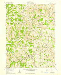
 1960 Lansing1961 Print · USGSBelmont County in the early sixties reveals a landscape shaped by coal mining and historic transit routes. Genealogists and historians can trace family plots at Linwood Cemetery or High Ridge Cem and follow the old National Road through Lansing and Blaine.5 unique versions available
 - 1960 Map of St. Clairsville, 1961 Print
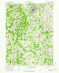
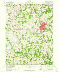 1960 St. Clairsville1961 Print · USGSBelmont County at the start of the 1960s shows a landscape defined by the National Road and the coal industry. Trace family roots at Union Cemetery or Friends Cem, and locate long-standing sites like the County Sanatorium.5 unique versions available
 - 1960 Map of Powhatan Point, 1961 Print
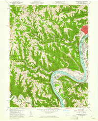
 1960 Powhatan Point1961 Print · USGSThe Ohio River valley at the start of the 1960s shows a landscape of industrial growth and rail transit. Trace the river-and-rail economy through Powhatan Point, Natrium, and the facilities at Lock No. 14.5 unique versions available
 - 1960 Map of Armstrongs Mills, 1961 Print
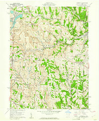
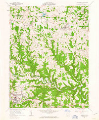
 1960 Armstrongs Mills1961 Print · USGSBelmont County is captured here in the early sixties, showing a landscape of ridge-top farms and creek-bottom villages. You can trace family roots at Scatterday Cem, locate the old Township Sch, or find industrial sites like the Strip Mine and local Gas Well clusters.2 unique versions available
 - 1960 Map of Harrisville, 1961 Print
 1960 Harrisville1961 Print · USGSEastern Ohio's coal country comes into sharp focus during the early sixties, showing a landscape shaped by industrial mining and small-town life. Genealogists and historians can trace family plots at Olive Branch Cem or locate the sprawling Georgetown Coal Preparation Plant and the Glencastle Mine.5 unique versions available
 - 1960 Map of Cameron, 1962 Print
 1960 Cameron1962 Print · USGSMonroe County in the early sixties remains a landscape of high ridges and deep hollows where rural life followed the contours of the land. Genealogists and historians can trace family roots at Pugh Cem, find the rural crossroads of Cameron, and locate old landmarks like Zion Ch.4 unique versions available
 - 1961 Map of Clarksburg
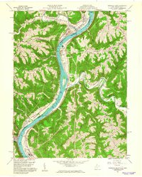
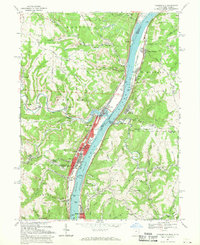
 1961 Clarksburg1961 Print · USGSThe mid-century industrial and river landscapes of West Virginia and Ohio are detailed here, centered on the Ohio River. Researchers can trace the Baltimore and Ohio rail lines connecting towns like Parkersburg, Clarksburg, and Monongah.
 - 1961 Map of Bethesda, 1962 Print
 1961 Bethesda1962 Print · USGSBelmont County in the early sixties was a landscape of coal mining and tight-knit communities along the Baltimore and Ohio railroad. Genealogy and history buffs can trace local landmarks like Epworth Park, the Union High Sch, and the post office at Lafferty.3 unique versions available
 - 1961 Map of Piedmont, 1962 Print
 1961 Piedmont1962 Print · USGSHarrison and Belmont counties in the early sixties show a landscape transformed by the Muskingum Watershed Conservancy District. Genealogists and historians can locate the Quaker Cem, trace the Baltimore and Ohio rail lines, and find early coal Strip Mines.4 unique versions available
 - 1961 Map of Fairview, 1962 Print
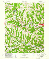
 1961 Fairview1962 Print · USGSThe Guernsey and Belmont county border area was undergoing significant change in the 1960s as highway expansion met traditional coal mining. Researchers can trace family history through Salem Ch and Gibson Cem or locate industrial sites like the Strip Mines and Bradfield Airport.3 unique versions available
 - 1961 Map of Flushing, 1962 Print
 1961 Flushing1962 Print · USGSEastern Ohio hill country at the start of the sixties shows a region of deep-cut valleys and active industry. Researchers can trace the path of the Baltimore and Ohio RR and locate local landmarks like Nottingham Ch and the many Strip Mines that dot the landscape.3 unique versions available
 - 1961 Map of Barnesville, 1963 Print
 1961 Barnesville1963 Print · USGSThe hilltop town of Barnesville thrived in the early sixties as a center for industry and education in eastern Ohio. Researchers can trace family history through the Old Quaker Cemetery, find the Friends School, or locate rural outposts like Baileys Mills and Somerton.3 unique versions available
 - 1961 Map of Hunter, 1963 Print
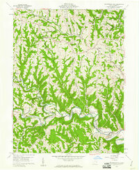
 1961 Hunter1963 Print · USGSThe deep ridges of Belmont County are captured in the early sixties, showing a landscape of small farming hamlets and country churches. Genealogists can trace family roots through Horeb Ch, Pleasant Ridge Ch, and the rural community at Hunter.2 unique versions available
 - 1961 Map of Lewisville, 1963 Print
 1961 Lewisville1963 Print · USGSMonroe County enters the 1960s as a landscape of hilltop farms and emerging energy infrastructure. Genealogists and local historians can trace the locations of numerous family burial sites like the Free Burial Ground and rural centers such as Miltonsburg or Monroefield.2 unique versions available
 - 1961 Map of Woodsfield, 1963 Print
 1961 Woodsfield1963 Print · USGSMonroe County's ridgelands and valleys come into focus in the early sixties, showing a landscape of small farms and gas wells. Genealogists can locate family landmarks like Pioneer Cem, Asbury Chapel, and the village of Beallsville.3 unique versions available
 - 1962 Map of Canton
 1962 Canton1962 Print · USGSThe industrial heartland of Eastern Ohio and Western Pennsylvania thrives in the early sixties as steel mills and rail lines dominate the river valleys. Genealogists and historians can trace local landmarks like McKinley National Memorial, Malone College, and industrial sites such as Republic Steel Corp.2 unique versions available
 - 1968 Map of Tiltonsville, 1970 Print
 1968 Tiltonsville1970 Print · USGSThe Ohio River valley in the late sixties reveals a landscape of heavy industry and riverside towns. Genealogists and historians can trace family roots in Tiltonsville and Yorkville or locate landmarks like Rush Run Chapel and the Pike Island Lock and Dam.3 unique versions available
 - 1968 Map of Wheeling, 1971 Print
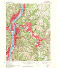 1968 Wheeling1971 Print · USGSThe Ohio River valley thrives during the late sixties as a center of industry and education spanning the West Virginia and Ohio border. Local historians can trace established neighborhoods and institutions like Wheeling Island, Mt de Chantal Academy, and the grounds of Oglebay Park.4 unique versions available
End of results
Showing maps 1-21 of 21
Top cities of Belmont County
- Martins Ferry historical maps
- St. Clairsville historical maps
- Colerain historical maps
- Barnesville historical maps
- Bellaire historical maps
- Shadyside historical maps
See more
Frequently asked questions
- What are the different types of historical maps available for Belmont County?
- What is the oldest map of Belmont County?
- Where can I purchase historical maps of Belmont County for my home or office?
- Where can I download high-res historical maps of Belmont County?
- Are there historical topographic maps available for Belmont County?
- Is there historical aerial imagery available for Belmont County?
- Where are historical maps of Belmont County sourced from?