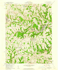
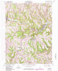
1960 Map of Dillonvale
USGS Topo · Published 1961About this map
The rugged coal-country terrain of the Jefferson and Belmont County line defines this area as it appeared in 1960. The landscape is heavily marked by industrial activity, with numerous Strip Mine excavations scarring the ridges and several railroad lines, including the New York Central and the Chicago and St Louis, following the narrow valley floors. These transit corridors connect a dense network of mining settlements and ethnic enclaves such as Adena, Dillonvale, and Olszeski Town.
Find a feature on this map
68 named features on this map. Tap any name to fly to it.
Don’t see what you’re looking for? This feature index may not catch every label — zoom into the map to look around manually.
Map Details
Editions of this 1960 Dillonvale Map
5 editions found
Other maps of this area

1901 · Cadiz
USGS Topo · 1:62,500

1902 · Wheeling
USGS Topo · 1:62,500

1903 · Cadiz
USGS Topo · 1:62,500

1904 · Steubenville
USGS Topo · 1:62,500

1905 · St. Clairsville
USGS Topo · 1:62,500

1935 · Wheeling
USGS Topo · 1:62,500

1935 · Steubenville
USGS Topo · 1:62,500

1942 · Wheeling
USGS Topo · 1:62,500

1942 · Steubenville
USGS Topo · 1:62,500

1951 · Canton
USGS Topo · 1:250,000