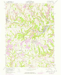
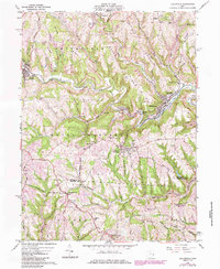
1960 Map of Dillonvale
USGS Topo · Published 1978About this map
The valley of Short Creek serves as the industrial and social heart of this eastern Ohio landscape, where the Norfolk and Western railroad winds through mining-intensive terrain. Significant Strip Mine operations and numerous Mine Dump labels indicate the region's reliance on coal extraction, which shaped the development of company-related settlements like Dunglen and Olszeski Town. The land is divided by a series of prominent ridges, including Cherry Ridge, Brier Ridge, and Scotch Ridge, which separated the various hill-top and valley communities during this period.
Find a feature on this map
80 named features on this map. Tap any name to fly to it.
Don’t see what you’re looking for? This feature index may not catch every label — zoom into the map to look around manually.
Map Details
Editions of this 1960 Dillonvale Map
5 editions found
Other maps of this area

1901 · Cadiz
USGS Topo · 1:62,500

1902 · Wheeling
USGS Topo · 1:62,500

1903 · Cadiz
USGS Topo · 1:62,500

1904 · Steubenville
USGS Topo · 1:62,500

1905 · St. Clairsville
USGS Topo · 1:62,500

1935 · Wheeling
USGS Topo · 1:62,500

1935 · Steubenville
USGS Topo · 1:62,500

1942 · Wheeling
USGS Topo · 1:62,500

1942 · Steubenville
USGS Topo · 1:62,500

1951 · Canton
USGS Topo · 1:250,000