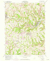
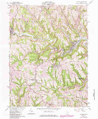
1960 Map of Dillonvale
USGS Topo · Published 1973About this map
Dillonvale and Mount Pleasant anchor this 1960s study of the Jefferson and Belmont County line, where the local economy shifted between agriculture and heavy industry. The map illustrates a landscape defined by the winding course of Short Creek, which provided a natural corridor for the Norfolk and Western and N & W rail lines. These tracks connected coal-rich areas and small settlements like Dunglen, Newtown, and Adena.
Find a feature on this map
80 named features on this map. Tap any name to fly to it.
Don’t see what you’re looking for? This feature index may not catch every label — zoom into the map to look around manually.
Map Details
Editions of this 1960 Dillonvale Map
5 editions found
Other maps of this area

1901 · Cadiz
USGS Topo · 1:62,500

1902 · Wheeling
USGS Topo · 1:62,500

1903 · Cadiz
USGS Topo · 1:62,500

1904 · Steubenville
USGS Topo · 1:62,500

1905 · St. Clairsville
USGS Topo · 1:62,500

1935 · Wheeling
USGS Topo · 1:62,500

1935 · Steubenville
USGS Topo · 1:62,500

1942 · Wheeling
USGS Topo · 1:62,500

1942 · Steubenville
USGS Topo · 1:62,500

1951 · Canton
USGS Topo · 1:250,000