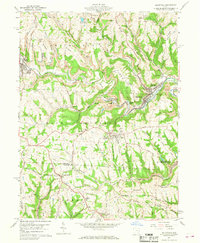
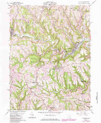
1960 Map of Dillonvale
USGS Topo · Published 1968About this map
Dillonvale and Mount Pleasant anchor this topographic study of southeastern Jefferson County during the late 1950s. The landscape is defined by the deep dissection of the Smithfield Road plateau, where numerous ridges like Scotch Ridge and Brier Ridge separate narrow valley settlements. The industrial footprint of the era is evident in the New York Central rail lines following the watercourses and the presence of several Strip Mines and Mine Dumps near Piney Fork and Dunglen.
Find a feature on this map
71 named features on this map. Tap any name to fly to it.
Don’t see what you’re looking for? This feature index may not catch every label — zoom into the map to look around manually.
Map Details
Editions of this 1960 Dillonvale Map
5 editions found
Other maps of this area

1901 · Cadiz
USGS Topo · 1:62,500

1902 · Wheeling
USGS Topo · 1:62,500

1903 · Cadiz
USGS Topo · 1:62,500

1904 · Steubenville
USGS Topo · 1:62,500

1905 · St. Clairsville
USGS Topo · 1:62,500

1935 · Wheeling
USGS Topo · 1:62,500

1935 · Steubenville
USGS Topo · 1:62,500

1942 · Wheeling
USGS Topo · 1:62,500

1942 · Steubenville
USGS Topo · 1:62,500

1951 · Canton
USGS Topo · 1:250,000