Old Maps of Belmont County, Ohio for Metal Detecting
Plan your next treasure hunt with 155 historic maps of Belmont County. Find old homesites, ghost towns, trails, and gathering spots that may be lost to time — perfect for identifying promising metal detecting locations.
- Locate forgotten sites: Uncover places like long-lost settlements, abandoned rail lines, or gathering spots.
- Plan better hunts: Use map overlays combined with LiDAR or satellite views to narrow in on historically rich areas.
- Made for detectorists: Thousands of hobbyists use these maps to discover relics, coins, and hidden history.
Use these historic maps to boost your research and find new opportunities beneath the surface of Belmont County.
Belmont County, OH maps
(155)- 1902 Map of Wheeling
 1902 Wheeling1902 Print · USGSThe Ohio River valley at the start of the 1900s was a powerhouse of rail and river industry across West Virginia, Ohio, and Pennsylvania. Genealogists can trace family roots in early industrial hubs like Martins Ferry, locate historic landmarks like the S Bridge, or find riverfront settlements such as Beach Bottom and Yorkville.7 unique versions available
 - 1903 Map of Flushing, 1959 Print
 1903 Flushing1959 Print · USGSEastern Ohio at the turn of the century is defined here by the meeting of major rail lines and the historic National Road. Trace the path of the Cleveland Lorain and Wheeling railroad through Holloway or locate homes in Flushing.
 - 1904 Map of Cameron
 1904 Cameron1904 Print · USGSMarshall County's river-and-rail economy is frozen in time at the dawn of the century, showing the dense settlement patterns of the West Virginia panhandle. Researchers can trace the Baltimore and Ohio R R through Rosbys Rock or locate rural landmarks like Beelers Station and the Waynesburg Turnpike.4 unique versions available
 - 1905 Map of Clarington, 1913 Print
 1905 Clarington1913 Print · USGSThe Ohio River valley at the turn of the century shows a bustling corridor of coal mining and rail transport between Ohio and West Virginia. Genealogists can locate family homesteads near Armstrongs Mills, Powhatan Point, and several rural post offices like Welcome P.O.
 - 1905 Map of St. Clairsville, 1942 Print
 1905 St. Clairsville1942 Print · USGSBelmont County at the start of the twentieth century was a landscape of steep ridges and vital transportation corridors. Researchers can trace the path of the National Road and locate early settlements and rail junctions like Fairpoint, Colerain, and Harrisville.2 unique versions available
 - 1905 Map of Woodsfield, 1946 Print
 1905 Woodsfield1946 Print · USGSMonroe and Belmont counties are shown here in the first years of the twentieth century, when the rural landscape was tied together by small postal hubs and creek-side settlements. Genealogists can trace early homesteads near Baileys Mills, Somerton, or Beallsville along the Baltimore and Ohio RR.2 unique versions available
 - 1905 Map of Flushing, 1946 Print
 1905 Flushing1946 Print · USGSEastern Ohio at the turn of the century shows a landscape defined by the National Turnpike and early rail lines. Genealogists can trace family footprints in Holloway, Sewellsville, and Morristown or along the winding Cleveland Lorain and Wheeling railroad.
 - 1935 Map of Cameron, 1957 Print
 1935 Cameron1957 Print · USGSMarshall County in the mid-thirties was a landscape of deep hollows and high ridges linked by the Baltimore and Ohio RR. Genealogists and historians can locate dozens of country institutions like Wood Hill Ch, Beeler's Station, and Adaline Sch during the era of one-room schoolhouses.2 unique versions available
 - 1935 Map of Clarington, 1957 Print
 1935 Clarington1957 Print · USGSThe Ohio River valley during the mid-1930s reveals a landscape of ridge-top schools and creek-side coal works. Genealogists can locate family landmarks like McLain Chapel, Centerville Demos P.O., and the Woodland Hill Sch.2 unique versions available
 - 1935 Map of Wheeling, 1957 Print
 1935 Wheeling1957 Print · USGSThe industrial Ohio River valley is captured here in the mid-thirties, showing the complex rail and river networks of the tri-state area. Genealogists can trace family footprints across dozens of rural schools like Wells Sch and local landmarks such as Oglebay Park or the Mt Union Ch.
 - 1940 Map of Clarington
 1940 Clarington1940 Print · USGSThe Ohio River borderlands between Belmont, Monroe, and Marshall counties are captured here just before the mid-century industrial shift. Genealogists can trace family names and small-town roots at Armstrongs Mills, McLain Chapel, and many rural schoolhouses like Mt Hobart Sch.
 - 1942 Map of Cameron
 1942 Cameron1942 Print · USGSThe northern panhandle in the early 1940s reveals a landscape of riverfront industry and remote ridge-top schools. Genealogists can locate family landmarks like Beelers Station, Blairs Ridge Ch, and the curiously named Squirrel Alley Sch.2 unique versions available
 - 1942 Map of Wheeling
 1942 Wheeling1942 Print · USGSThe Northern Panhandle and Ohio Valley are shown at their industrial peak during the mid-forties, spanning three states. Researchers can trace the riverfront rail networks and rural school districts like Hammond Sch, plus regional landmarks such as Oglebay Park and the Teachers College at West Liberty.2 unique versions available
 - 1949 Map of Clarksburg
 1949 Clarksburg1949 Print · USGSThe upper Ohio River valley and the industrial heart of West Virginia come into focus during this post-war period. Genealogists and researchers can trace the rail corridors of the Baltimore and Ohio and locate centers like Fairmont, Grafton, and Waynesburg.
 - 1951 Map of Canton
 1951 Canton1951 Print · USGSThe industrial heartland of Ohio and Pennsylvania reached its mid-century peak during this era of heavy rail and river transit. Genealogists and historians can trace the development of steel towns like Aliquippa and Weirton alongside the Ohio River and major lines of the Pennsylvania RR.
 - 1953 Map of Canton
 1953 Canton1953 Print · USGSThe industrial heartland of Ohio and Pennsylvania is captured at its mid-century peak in this detailed regional survey. Genealogists and historians can trace the vast rail networks of the Pennsylvania RR and find local landmarks like Nimisila Reservoir and Tappan Reservoir.
 - 1956 Map of Wheeling, 1958 Print
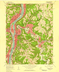 1956 Wheeling1958 Print · USGSThe Ohio River valley and its steep surrounding hills hum with mid-century industry and growth as West Virginia and Ohio cities face off across the water. Genealogists and historians can trace neighborhood developments from Martins Ferry to Elm Grove, locating landmarks like Greenwood Cemetery and the Mt de Chantal Academy.2 unique versions available
 - 1956 Map of Clarksburg, 1966 Print
 1956 Clarksburg1966 Print · USGSThe Ohio River valley and the industrial heart of West Virginia are seen here in the mid-1950s as rail and river commerce thrived. Researchers can trace historic transport lines like the Baltimore and Ohio RR and locate ancestral homes in Clarksburg, Moundsville, or Parkersburg.2 unique versions available
 - 1957 Map of Tiltonsville, 1959 Print
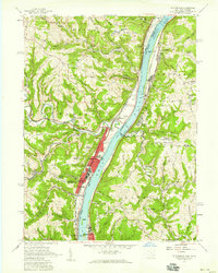 1957 Tiltonsville1959 Print · USGSThe industrial Ohio River valley is captured here in the late fifties, showcasing the dense rail-and-river network of the Jefferson and Brooke County border. Researchers can trace family roots through sites like Hopewell Cem or explore the mid-century layout of Tiltonsville and the Wheeling-Ohio County Airport.2 unique versions available
 - 1957 Map of Canton, 1971 Print
 1957 Canton1971 Print · USGSThe industrial heartland of eastern Ohio and western Pennsylvania comes alive in this mid-century survey of the Ohio River Valley. Trace the heritage of rail and river commerce through Pittsburgh, the massive steel towns along the Ohio River, and major junctions on the Pennsylvania RR.3 unique versions available
 - 1960 Map of Dillonvale, 1961 Print
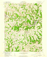 1960 Dillonvale1961 Print · USGSEastern Ohio coal country was in the midst of a mining boom in the early sixties, leaving a landscape defined by industry and deep-seated local roots. Genealogists and historians can trace family locations through numerous sites like St Casimirs Ch, Olszeski Town, and Highland Cem.5 unique versions available
 - 1960 Map of Moundsville, 1961 Print
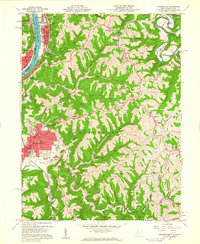 1960 Moundsville1961 Print · USGSMarshall County's riverfront industry and correctional history are on full display in this mid-century survey of the Ohio River valley. Genealogists and researchers can locate the State Penitentiary, trace rural churches on Waymans Ridge, and find local landmarks like the Grave Creek Indian Mound Museum.4 unique versions available
 - 1960 Map of Businessburg, 1961 Print
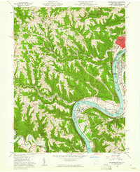 1960 Businessburg1961 Print · USGSThe industrial and rural landscape along the Ohio River comes into focus in the early sixties. Genealogists can trace family names and local landmarks from Shadyside down to McKeefrey, including Mt Zion Cem and the Mead Local Sch.5 unique versions available
 - 1960 Map of Lansing, 1961 Print
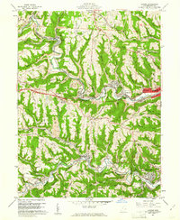 1960 Lansing1961 Print · USGSBelmont County in the early sixties reveals a landscape shaped by coal mining and historic transit routes. Genealogists and historians can trace family plots at Linwood Cemetery or High Ridge Cem and follow the old National Road through Lansing and Blaine.5 unique versions available
 - 1960 Map of St. Clairsville, 1961 Print
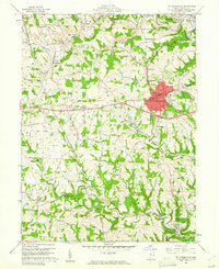 1960 St. Clairsville1961 Print · USGSBelmont County at the start of the 1960s shows a landscape defined by the National Road and the coal industry. Trace family roots at Union Cemetery or Friends Cem, and locate long-standing sites like the County Sanatorium.5 unique versions available
Showing maps 1-25 of 155
Top cities of Belmont County
- Martins Ferry historical maps
- St. Clairsville historical maps
- Colerain historical maps
- Barnesville historical maps
- Bellaire historical maps
- Shadyside historical maps
See more
Frequently asked questions
- What are the different types of historical maps available for Belmont County?
- What is the oldest map of Belmont County?
- Where can I purchase historical maps of Belmont County for my home or office?
- Where can I download high-res historical maps of Belmont County?
- Are there historical topographic maps available for Belmont County?
- Is there historical aerial imagery available for Belmont County?
- Where are historical maps of Belmont County sourced from?