2020s Maps of Brown County, Ohio
Explore 18 historic maps of Brown County from the 2020s. These maps offer a rare glimpse into what life looked like during the 2020s — showing old roads, neighborhoods, homes, and landmarks that have changed or disappeared over time.
Whether you're researching your family's past, planning a metal detecting trip, or studying how Brown County's landscape evolved across the 2020s, these high-resolution maps are a powerful tool for exploring the history of this region.
- Focus on a specific era: All maps on this page are from the 2020s, giving you a focused view of this time period.
- See what’s changed: Compare century-old streets, trails, and buildings to today's modern landscape using overlays and satellite layers.
- Research with precision: Use these maps for genealogy, historical research, land use analysis, or educational projects.
- View, download, or print: Maps are fully viewable online in high resolution, and can be downloaded or printed for your own records.
Start exploring Brown County's history through authentic maps from the 2020s. This is your window into the past.
Brown County, OH maps
(18)- 2022 Map of Maysville West, 2022 Print
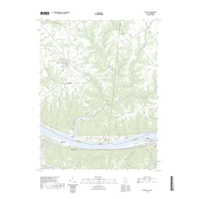
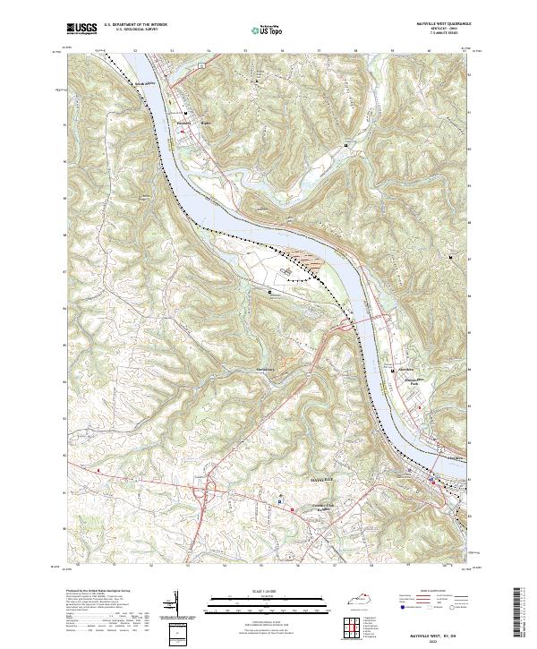 2022 Maysville West2022 Print · USGSThe Ohio River valley serves as a bustling corridor between Kentucky and Ohio in this contemporary survey. Researchers can trace family history through sites like Maplewood Cem, the community of Hestoria, and the transition from riverfront Maysville to the heights of Moranburg.
 - 2022 Map of Maysville East, 2022 Print
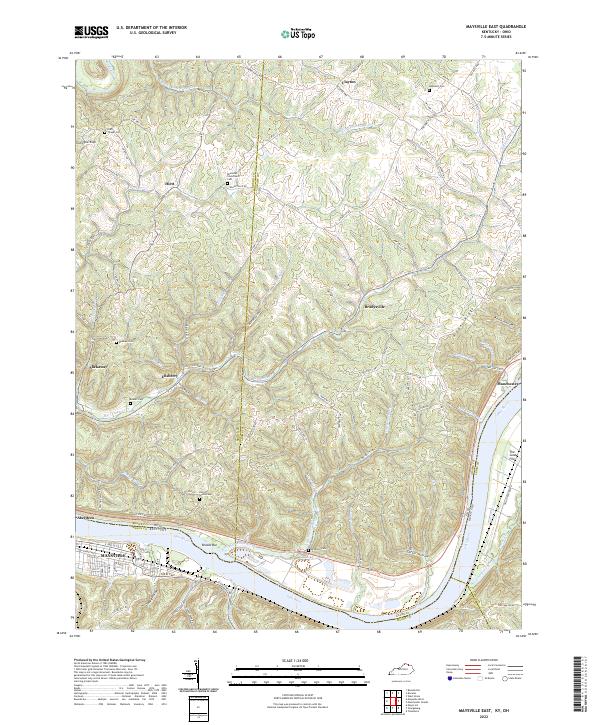 2022 Maysville East2022 Print · USGSThe riverfronts of Kentucky and Ohio meet along the Ohio River in the early 2020s, revealing a landscape of steep ridges and deep hollows. Researchers can locate several ancestral burial sites including Beasley Cem and Hopewell Cem or trace the old paths of Lick Skillet Loop.
 - 2023 Map of Blanchester, 2023 Print
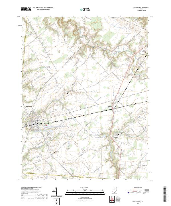 2023 Blanchester2023 Print · USGSClinton County’s rural character and small-town rail hubs are preserved here in the modern era. Genealogists and historians can trace family plots at Moore-Johns Cem or explore the civic roots of Blanchester and the crossroads at Midland.
 - 2023 Map of Lynchburg, 2023 Print
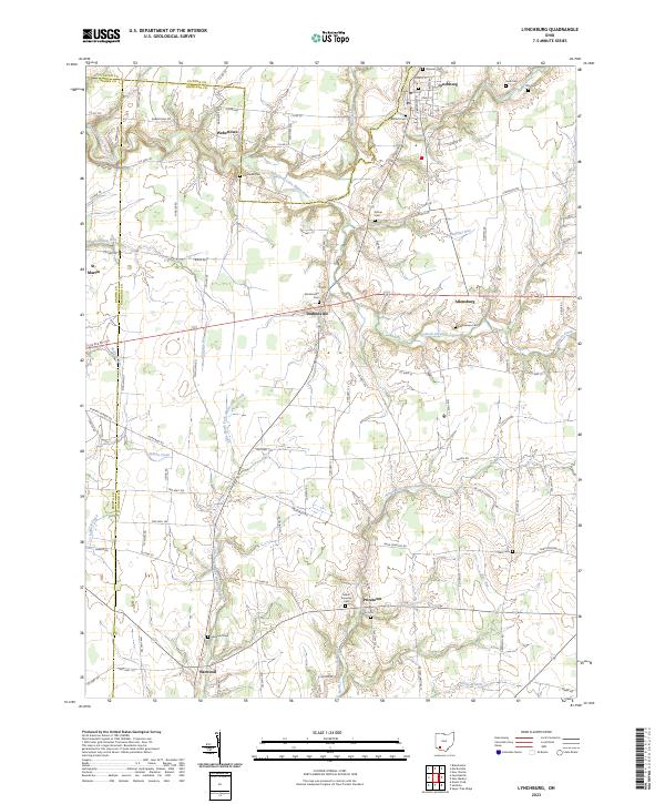 2023 Lynchburg2023 Print · USGSHighland County farming communities and river valleys are captured here in the early twenty-first century. Researchers can trace family roots through numerous burial sites like Bobbitt Cem and Dodsonville Cem or locate the village of Harwood.
 - 2023 Map of Sugar Tree Ridge, 2023 Print
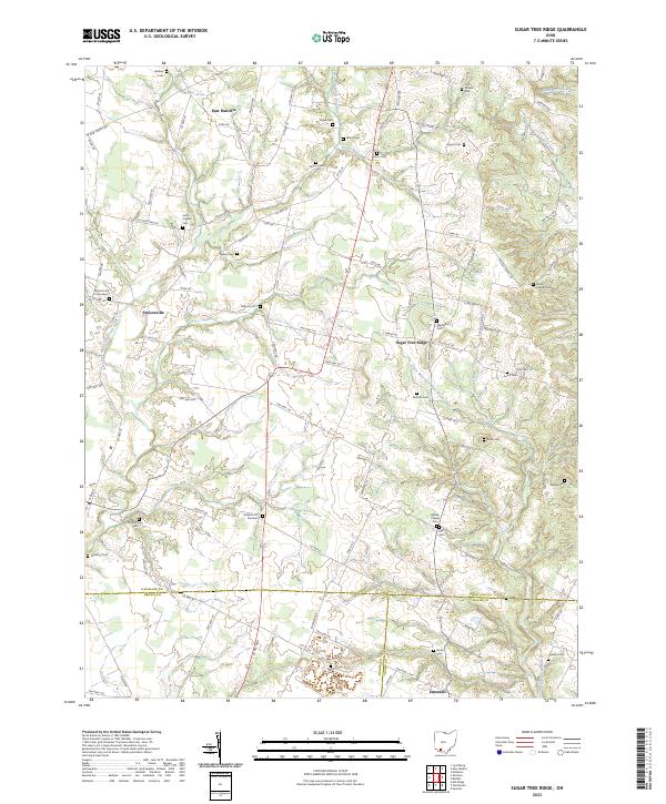 2023 Sugar Tree Ridge2023 Print · USGSSouthern Highland County and its neighbors appear in this detailed study of rural Ohio life. Researchers can trace family history through dozens of landmarks like Union Chapel, Sugar Tree Ridge, and the Mownytown Cem.
 - 2023 Map of Mount Orab, 2023 Print
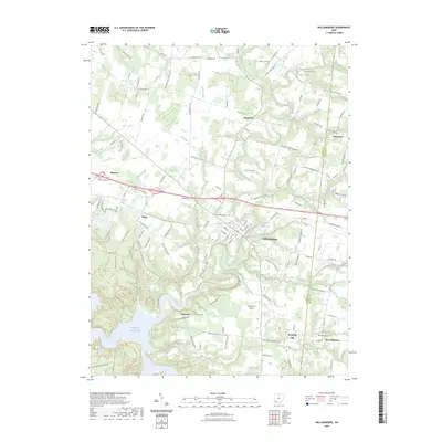
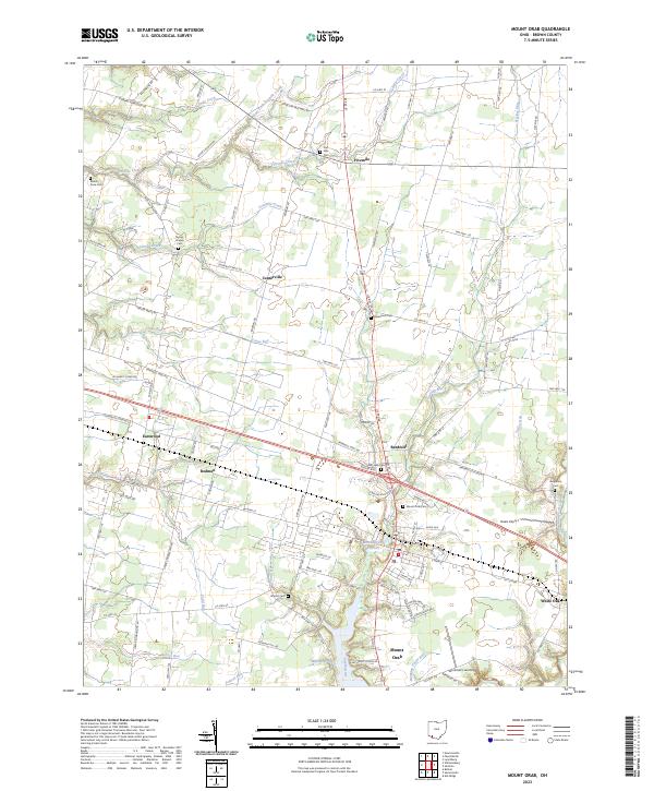 2023 Mount Orab2023 Print · USGSBrown County’s rural crossroads and family cemeteries are documented here in the early 2020s. Genealogists can locate family landmarks like Bloom Rose Cem, Brooks Cem, and the small settlement of Bodman along the rail and road corridors.
 - 2023 Map of Fayetteville, 2023 Print
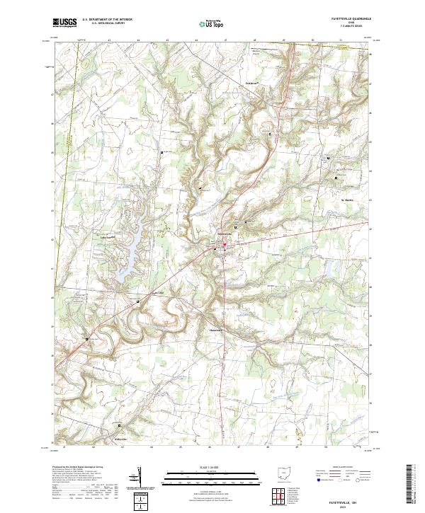 2023 Fayetteville2023 Print · USGSBrown County's rural landscape is captured here in the 2020s, centered on the historic crossroads of Fayetteville and the winding East Fork Little Miami River. Genealogists can trace family names at Ursuline Cem, Engle Cem, and the institutional grounds of Chatfield College.
 - 2023 Map of Sardinia, 2023 Print
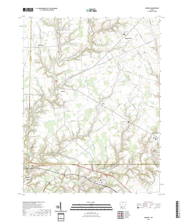 2023 Sardinia2023 Print · USGSSouthern Ohio's agricultural heartland is documented here in the early twenty-first century as it spans the Brown and Highland county line. Researchers can locate numerous local burial grounds including Bratton Cem, Higgins Cem, and the Ebenezer Cem.
 - 2023 Map of Higginsport, 2023 Print
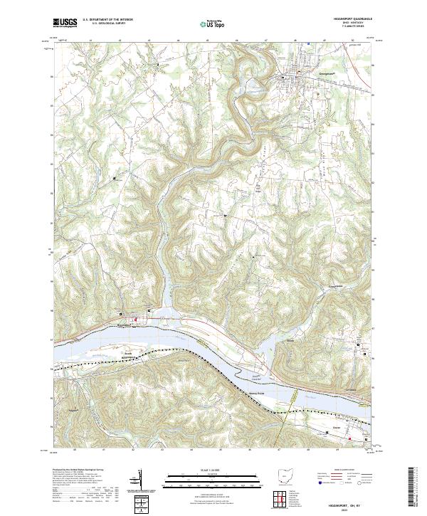 2023 Higginsport2023 Print · USGSThe Ohio River valley at the Ohio-Kentucky border remains a landscape of river towns and family-held ridges. Local historians can trace family ties through several rural sites like Thomas Cemetery, the Brown County Courthouse, and Shinkles Ridge.
 - 2023 Map of Winchester, 2023 Print
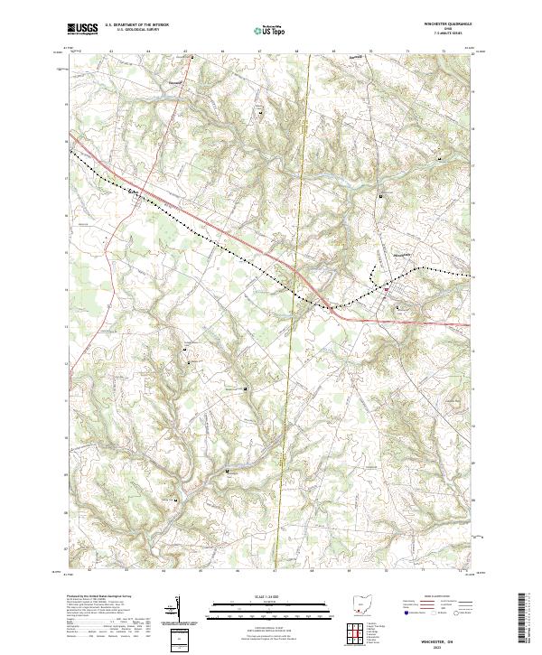 2023 Winchester2023 Print · USGSSouthern Ohio at the junction of Adams and Brown Counties reveals a landscape of scattered family farms and quiet rural villages. Genealogists can trace decades of local history through sites like Wilson Cem, Horner Cem, and the settlement of Emerald.
 - 2023 Map of Ash Ridge, 2023 Print
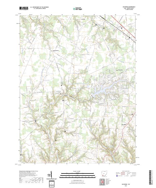 2023 Ash Ridge2023 Print · USGSThis modern survey of northern Brown County captures a landscape where centuries-old rural traditions meet contemporary lakeside development. Genealogists can trace family heritage through numerous burial sites like Saint Marys Cem, the Biehn Cem, and the Methodist African American Cem.
 - 2023 Map of Russellville, 2023 Print
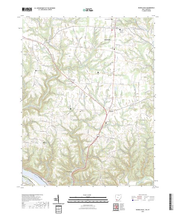 2023 Russellville2023 Print · USGSThe rural landscape of Brown County is captured in this survey, where ridges and hollows meet the southern boundary at the Ohio River. Genealogists can trace local roots through numerous sites like Old Redoak Cem, Devore Family Cem, and Linwood Cem.
 - 2023 Map of Decatur, 2023 Print
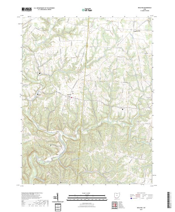 2023 Decatur2023 Print · USGSSettled along the Brown and Adams county line, this southern Ohio region is documented here in its modern agricultural state. Researchers can locate numerous family burial grounds like Bissinger Cem or trace the early paths of Stony Lonesome Rd.
 - 2023 Map of Hamersville, 2023 Print
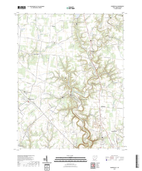 2023 Hamersville2023 Print · USGSBrown County's rural communities and cemetery networks are detailed here in this recent survey of the Ohio landscape. Researchers can trace ancestral roots through numerous family and community sites like Hendrixson Cem, Young Cem, and the settlement at White Oak Valley.
 - 2023 Map of Newtonsville, 2023 Print
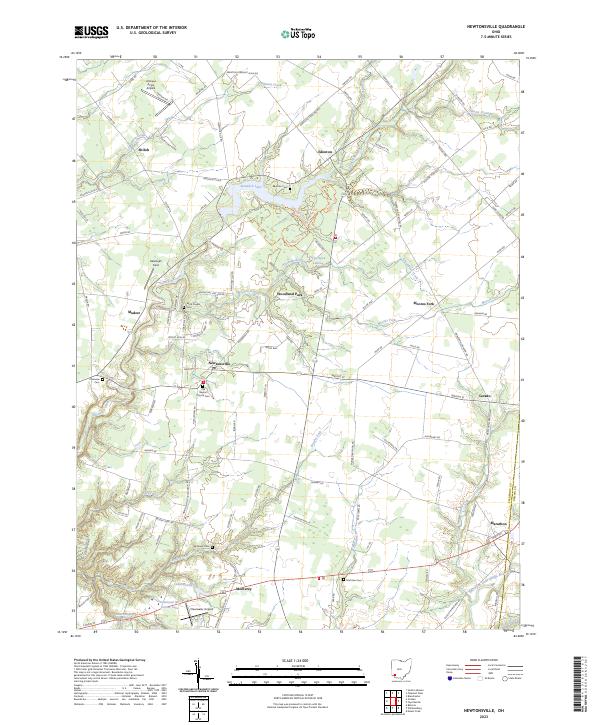 2023 Newtonsville2023 Print · USGSClermont County in the early twenty-first century remains a landscape of historic crossroads like Newtonsville and Edenton. Genealogists can locate several family and community burial grounds including Brick Chapel Cem and Monterey Cem, or trace the winding course of Stonelick Creek.
 - 2023 Map of Bethel, 2023 Print
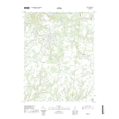 2023 Bethel2023 Print · USGSClermont County's rural crossroads and small-town centers are shown here in the contemporary era. Researchers can trace family sites at Clover Cemetery or follow the water towards Feesburg and the Big Indian Creek valley.
 - 2023 Map of Williamsburg, 2023 Print
 2023 Williamsburg2023 Print · USGSThe East Fork Little Miami River valley in Clermont County shows a landscape of rural crossroads and river-fed lakes in the 2020s. Researchers can locate burial sites like New Harmony Cem and historic landmarks such as Hennings Mill and the Old Boston Airport.
 - 2023 Map of Felicity, 2023 Print
 2023 Felicity2023 Print · USGSIn this modern era, the riverbank settlements along the Ohio River maintain a quiet character south of Felicity. Researchers can trace old family burial grounds like Smyrna Cem and Hard Scrabble Cem or explore the riverfront at Utopia and Augusta Bar.
End of results
Showing maps 1-18 of 18
Top cities of Brown County
- Georgetown historical maps
- Mount Orab historical maps
- Ripley historical maps
- Aberdeen historical maps
- Sardinia historical maps
- Russellville historical maps
See more
Frequently asked questions
- What are the different types of historical maps available for Brown County?
- What is the oldest map of Brown County?
- Where can I purchase historical maps of Brown County for my home or office?
- Where can I download high-res historical maps of Brown County?
- Are there historical topographic maps available for Brown County?
- Is there historical aerial imagery available for Brown County?
- Where are historical maps of Brown County sourced from?