Old Maps of Brown County, Ohio for Metal Detecting
Plan your next treasure hunt with 146 historic maps of Brown County. Find old homesites, ghost towns, trails, and gathering spots that may be lost to time — perfect for identifying promising metal detecting locations.
- Locate forgotten sites: Uncover places like long-lost settlements, abandoned rail lines, or gathering spots.
- Plan better hunts: Use map overlays combined with LiDAR or satellite views to narrow in on historically rich areas.
- Made for detectorists: Thousands of hobbyists use these maps to discover relics, coins, and hidden history.
Use these historic maps to boost your research and find new opportunities beneath the surface of Brown County.
Brown County, OH maps
(146)- 1907 Map of Blanchester
 1907 Blanchester1907 Print · USGSClinton County at the dawn of the twentieth century was a landscape of well-connected rail towns and country parishes. Genealogists can trace family roots through numerous landmarks like Macedonia Chapel, Dutch School, and the Childrens Home near Wilmington.3 unique versions available
 - 1914 Map of Batavia
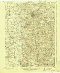
 1914 Batavia1914 Print · USGSClermont County at the start of the Great War shows a landscape connected by steam and electric rail. Genealogists can locate family landmarks like Spread Eagle School, Mt Zion Church, and the winding East Fork Little Miami River.
 - 1915 Map of Maysville, 1962 Print
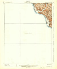
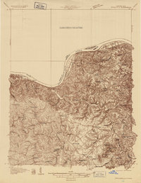
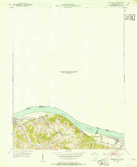
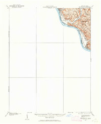 1915 Maysville1962 Print · USGSThe Ohio River valley near the Kentucky border comes to life in this survey from the years before the Great War. Genealogists and local historians can trace rural family-named landmarks like Porter Ridge and remote schoolhouses including Stephenson School and Flaugher School.
 - 1916 Map of Batavia
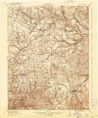
 1916 Batavia1916 Print · USGSClermont County's river valleys and electric railway networks are frozen in time just before the First World War. Researchers can trace dozens of rural school sites like Zionsville School and follow the old Chillicothe Road through Batavia.4 unique versions available
 - 1917 Map of Hillsboro, 1941 Print
 1917 Hillsboro1941 Print · USGSHighland County during the First World War era was a bustling network of electric rail lines and one-room schoolhouses. Genealogists can locate family landmarks like the Highland County Infirmary or schools such as Kansas College School and Brier College School.2 unique versions available
 - 1917 Map of Sardinia, 1946 Print
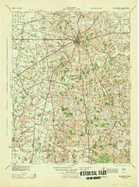
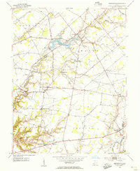
 1917 Sardinia1946 Print · USGSSouthwestern Ohio at the close of the Great War era reveals a landscape of thriving rural schoolhouses and bustling railroad junctions. Genealogists can trace family footprints across dozens of local districts like Richland School or near the Ursuline Convent and Mount Orab.
 - 1918 Map of Seaman, 1943 Print
 1918 Seaman1943 Print · USGSAdams and Brown counties appear in the years following the Great War, showing a landscape defined by small hamlets and the steam-era railroads. Researchers can trace family roots through dozens of rural landmarks like the County Infirmary, Eckmansville, and the Harper Ferry School.
 - 1919 Map of Maysville, 1936 Print
 1919 Maysville1936 Print · USGSThe Ohio River bluffs above Ripley were a patchwork of ridge-top farms and rural school districts during the early twentieth century. Researchers can trace the paths of old township roads to find Hawk School, the landing at Aberdeen, and family-named landmarks like Flaugher Ridge.
 - 1928 Map of Higginsport
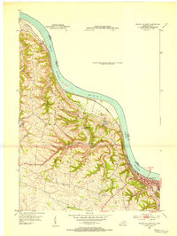
 1928 Higginsport1928 Print · USGSThe Kentucky side of the Ohio River is captured in the late twenties just as the rail-and-river economy flourished. Researchers can trace the riverbank rail lines of the Chesapeake and Ohio or locate early rural landmarks like Locust Grove Sch and the town of Augusta.
 - 1929 Map of Springdale
 1929 Springdale1929 Print · USGSThe Ohio River valley and Kentucky's northern hills are captured here in the late twenties, showing a landscape defined by the Chesapeake and Ohio railroad. Genealogists can trace early homesteads and landmarks near Tollesboro, Ruggles Camp, and the many rural sites like Ebenezer Ch.2 unique versions available
 - 1931 Map of Felicity
 1931 Felicity1931 Print · USGSClermont County's riverfront and rolling uplands are captured here in the early thirties as a network of small schoolhouses and rail lines defined rural life. Researchers can trace the path of the Cincinnati Georgetown and Portsmouth RR or locate family sites near Felicity, Utopia, and Lock 34.2 unique versions available
 - 1931 Map of Higginsport, 1948 Print
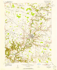
 1931 Higginsport1948 Print · USGSThe Ohio River corridor and Brown County hinterlands come alive in this early twentieth-century survey of the borderlands near Georgetown. Local historians can trace long-gone rural schoolhouses like McFadden School or locate the historic Brown County Infirmary and the Abandoned Columbus and Sardinia Road.
 - 1935 Map of Springdale
 1935 Springdale1935 Print · USGSThe Ohio River valley at the height of the mid-1930s reveals a landscape shaped by river commerce and the Chesapeake and Ohio railroad. Researchers can locate numerous vanished country schools like Hamilton School, the infrastructure of Dam 33, and rural centers such as Tollesboro.
 - 1944 Map of Hillsboro
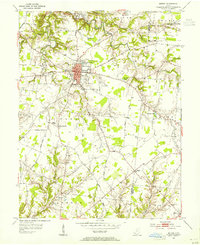
 1944 Hillsboro1944 Print · USGSHighland County is documented here during the mid-forties, showing the vital rail junction at Hillsboro and a dense network of rural schools. Trace ancestral roots through localized landmarks like Brier College Sch, Mowrystown, and Millers Chapel Ch.
 - 1944 Map of Sardinia
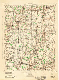 1944 Sardinia1944 Print · USGSSouthwestern Ohio during the Second World War was a landscape of dense rail networks and dozens of small school districts. Genealogists can trace family footprints through numerous rural landmarks like Richland Sch, Bardwell Corners, and the historic Ursuline Convent.
 - 1947 Map of Columbus, 1948 Print
 1947 Columbus1948 Print · USGSCentral Ohio in the late 1940s is captured in this survey, showing the post-war transition of its rail hubs and military airfield expansions. Genealogists and historians can trace the paths of the Ohio Canal, the Pennsylvania RR lines, and the Camp Sherman Military Reservation.
 - 1952 Map of Maysville East, 1953 Print
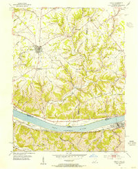
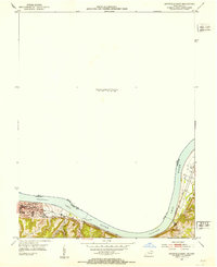 1952 Maysville East1953 Print · USGSThe Ohio River valley near the Mason County line is captured here in the early fifties, showing the vital river-and-rail corridor. Researchers can trace the riverfront development of Maysville or locate landmarks near Sand Hill and the Chesapeake and Ohio railroad.
 - 1952 Map of Higginsport, 1953 Print
 1952 Higginsport1953 Print · USGSThe Ohio River borderlands of Kentucky and Ohio come into focus in the early 1950s, showing the riverside rail and road networks. Genealogists and local historians can trace family locations near Augusta, Dover, and the Rosemont Cem on the Kentucky shore.
 - 1952 Map of Maysville West, 1953 Print
 1952 Maysville West1953 Print · USGSThe Mason County riverfront comes to life in the early 1950s, centered on the historic river town of Maysville and its vital rail connections. Genealogists can trace family footprints near Pleasant Green Ch or follow the old Chesapeake and Ohio line past South Ripley.
 - 1953 Map of Bethel, 1955 Print
 1953 Bethel1955 Print · USGSClermont and Brown County rural life is captured here in the early fifties, centered on the growing village of Bethel. Genealogists can trace family landmarks like Lakin Chapel, Mt Olive, and the Rose Hill Cem near Feesburg.
 - 1953 Map of Felicity, 1955 Print
 1953 Felicity1955 Print · USGSThe Ohio River valley at the mid-century shows the river-and-rail economy of Clermont and Bracken counties. Researchers can trace the Chesapeake and Ohio line through Augusta or locate sites like Utopia, Boudes Ferry, and Mt Zion Ch.2 unique versions available
 - 1953 Map of Newtonsville, 1955 Print
 1953 Newtonsville1955 Print · USGSClermont County's rural landscape is captured here in the early fifties, just as new recreation areas like Stonelick Lake were being established. Local historians can trace the foundations of old crossroads settlements like Newtonsville, Edenton, and Pringle Corners, alongside numerous family burial grounds including Monterey Cem.2 unique versions available
 - 1953 Map of Williamsburg, 1955 Print
 1953 Williamsburg1955 Print · USGSClermont County's rural townships are shown here in the early fifties, centering on the river bends of Williamsburg. Genealogists and researchers can trace family landmarks like Hennings Mills, Alpine Sch, and the Covered Bridge over the river.2 unique versions available
 - 1953 Map of Cincinnati, 1965 Print
 1953 Cincinnati1965 Print · USGSThe Ohio River valley and the industrial heartland of Indiana and Ohio are captured here during the mid-century peak of rail and river commerce. Genealogists and historians can trace connections between Cincinnati and outlying military sites like Camp Atterbury and Bakalar AFB.3 unique versions available
 - 1956 Map of Louisville, 1971 Print
 1956 Louisville1971 Print · USGSThe Ohio River valley and the Kentucky Bluegrass are captured here during a period of rapid mid-century growth and industrial activity. Genealogists and historians can trace rail-centered towns and military land use at Fort Knox and the Jefferson Proving Ground.2 unique versions available
Showing maps 1-25 of 146
Top cities of Brown County
- Georgetown historical maps
- Mount Orab historical maps
- Ripley historical maps
- Aberdeen historical maps
- Sardinia historical maps
- Russellville historical maps
See more
Frequently asked questions
- What are the different types of historical maps available for Brown County?
- What is the oldest map of Brown County?
- Where can I purchase historical maps of Brown County for my home or office?
- Where can I download high-res historical maps of Brown County?
- Are there historical topographic maps available for Brown County?
- Is there historical aerial imagery available for Brown County?
- Where are historical maps of Brown County sourced from?