1960s Maps of Fairfield County, Ohio
Explore 16 historic maps of Fairfield County from the 1960s. These maps offer a rare glimpse into what life looked like during the 1960s — showing old roads, neighborhoods, homes, and landmarks that have changed or disappeared over time.
Whether you're researching your family's past, planning a metal detecting trip, or studying how Fairfield County's landscape evolved across the 1960s, these high-resolution maps are a powerful tool for exploring the history of this region.
- Focus on a specific era: All maps on this page are from the 1960s, giving you a focused view of this time period.
- See what’s changed: Compare century-old streets, trails, and buildings to today's modern landscape using overlays and satellite layers.
- Research with precision: Use these maps for genealogy, historical research, land use analysis, or educational projects.
- View, download, or print: Maps are fully viewable online in high resolution, and can be downloaded or printed for your own records.
Start exploring Fairfield County's history through authentic maps from the 1960s. This is your window into the past.
Fairfield County, OH maps
(16)- 1961 Map of Columbus
 1961 Columbus1961 Print · USGSCentral and Southern Ohio are captured here in the early sixties, as the region's industrial rail hubs and military bases reached their peak. Genealogists and historians can trace the transition from urban Columbus to rural townships along the Scioto River, locating Lockbourne USAF and old junctions like Washington Court House.
 - 1961 Map of Millersport, 1962 Print
 1961 Millersport1962 Print · USGSCentral Ohio in the early sixties is captured here at the intersection of early canal history and mid-century recreation. Trace the path of the OHIO CANAL (ABANDONED) near Millersport or locate family roots at Refugee Cem and Fletcher Chapel.3 unique versions available
 - 1961 Map of Rushville, 1962 Print
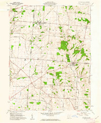
 1961 Rushville1962 Print · USGSRushville and the Fairfield County borderlands are captured here in the early 1960s as a quiet network of farmsteads and creek-side settlements. Researchers can locate many family burial sites like Woolard Cem or trace the old New York Central rail line near New Salem.4 unique versions available
 - 1961 Map of Thornville, 1962 Print
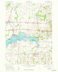 1961 Thornville1962 Print · USGSThe Buckeye Lake region in the early sixties showcases a landscape defined by lakeside recreation and historic surveying boundaries. Trace family roots at Friendship Cem or study the rail connections at Thornport and Thornville.5 unique versions available
 - 1961 Map of Baltimore, 1962 Print
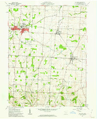 1961 Baltimore1962 Print · USGSFairfield County in the early sixties remains a landscape of rail-connected villages and legacy waterways. Genealogists can trace family lines through Hampson Cem and Union Cem, or follow the Ohio Canal (Abandoned) past Thurston.4 unique versions available
 - 1961 Map of Stoutsville, 1962 Print
 1961 Stoutsville1962 Print · USGSStoutsville and the rural townships of Pickaway and Fairfield counties are shown here just after the turn of the decade. Genealogists can trace family names through sites like the County Infirmary, Bunker Hill Cem, and the old Dresbach Ch.3 unique versions available
 - 1961 Map of Clearport, 1963 Print
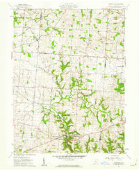
 1961 Clearport1963 Print · USGSFairfield County in the early sixties was a landscape of high ridges and rural crossroads where three counties meet. Genealogists can trace family names at Shaeffer Cemetery or Kern Cemetery, and locate old meeting houses like Hopewell Church and Morgan Chapel.4 unique versions available
 - 1961 Map of Logan, 1963 Print
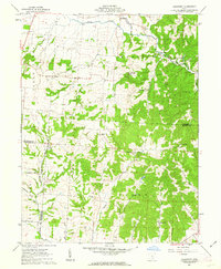
 1961 Logan1963 Print · USGSHocking County at the start of the 1960s shows a landscape defined by the winding Hocking River and the steady hum of the oil and rail industries. Researchers can locate family sites at Oak Grove Cemetery, the Marion Sch, or trace the old Chesapeake and Ohio rail corridor.4 unique versions available
 - 1961 Map of Lancaster, 1963 Print
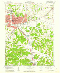 1961 Lancaster1963 Print · USGSFairfield County’s valley floor is captured here in the early sixties, showing the expansion of Lancaster and the rural stretches toward Sugar Grove. Genealogists can trace family plots at Forest Rose Cem or locate local landmarks like Horns Mill and the State Industrial Sch.4 unique versions available
 - 1961 Map of Bremen, 1963 Print
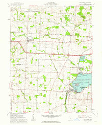
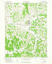 1961 Bremen1963 Print · USGSThe rail-and-oil economy of Fairfield County is on full display in the early 1960s, centered on the village of Bremen. Trace family history through numerous rural sites like Swartz Mill, Mendonite Cem, and Olive Branch Ch scattered among the hills and creek valleys.3 unique versions available
 - 1961 Map of Rockbridge, 1963 Print
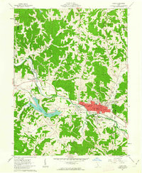
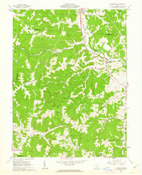 1961 Rockbridge1963 Print · USGSThe Hocking River valley in the early sixties shows a landscape of deep hollows and ridge-top settlements. Genealogists can trace family names through numerous burial sites like Whippoorwill Cem and the Old Catholic Cem near Rockbridge.3 unique versions available
 - 1961 Map of Junction City, 1963 Print
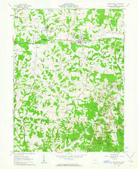 1961 Junction City1963 Print · USGSPerry County's industrial and rural character is on full display in the early 1960s, centered on the rail crossroads of Junction City. Genealogists can trace family names and sites like the Ohio State Penitentiary Branch, Old Zion Ch Cem, and Crossenville.3 unique versions available
 - 1962 Map of Columbus
 1962 Columbus1962 Print · USGSCentral Ohio during the early sixties reveals a transition from the industrial corridors of Columbus to the forested ridges of the south. Genealogists and historians can trace the rail networks of the Baltimore & Ohio RR and find local landmarks like Washington Court House and Camp Sherman Military Reservation.
 - 1964 Map of Reynoldsburg, 1965 Print
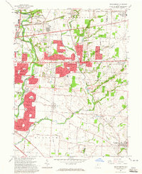 1964 Reynoldsburg1965 Print · USGSEastern Franklin County and parts of Licking and Fairfield counties are captured in the mid-sixties during a period of significant suburban growth. Researchers can trace old family cemetery sites like Pisgah Cem, early rail lines, and the footprint of Port Columbus as it stood decades ago.5 unique versions available
 - 1966 Map of Canal Winchester, 1967 Print
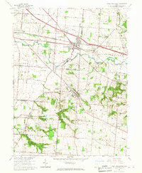 1966 Canal Winchester1967 Print · USGSThe mid-century landscape of Canal Winchester and Lithopolis is detailed here as the suburban expansion of Columbus began reaching these historic villages. Trace family roots at Union Grove Cem, follow the Chesapeake and Ohio rail line, or locate early schools like Township Sch.5 unique versions available
 - 1967 Map of Columbus, 1969 Print
 1967 Columbus1969 Print · USGSCentral Ohio during the late sixties serves as a vital corridor of rail and aviation, from the industrial streets of Springfield to the hangar lines of Lockbourne Air Force Base. Genealogists and researchers can trace the growth of towns like Circleville and London or locate rural landmarks such as St Paul church and the London Correctional Institution.2 unique versions available
End of results
Showing maps 1-16 of 16
Top cities of Fairfield County
Frequently asked questions
- What are the different types of historical maps available for Fairfield County?
- What is the oldest map of Fairfield County?
- Where can I purchase historical maps of Fairfield County for my home or office?
- Where can I download high-res historical maps of Fairfield County?
- Are there historical topographic maps available for Fairfield County?
- Is there historical aerial imagery available for Fairfield County?
- Where are historical maps of Fairfield County sourced from?