1990s Maps of Fairfield County, Ohio
Explore 7 historic maps of Fairfield County from the 1990s. These maps offer a rare glimpse into what life looked like during the 1990s — showing old roads, neighborhoods, homes, and landmarks that have changed or disappeared over time.
Whether you're researching your family's past, planning a metal detecting trip, or studying how Fairfield County's landscape evolved across the 1990s, these high-resolution maps are a powerful tool for exploring the history of this region.
- Focus on a specific era: All maps on this page are from the 1990s, giving you a focused view of this time period.
- See what’s changed: Compare century-old streets, trails, and buildings to today's modern landscape using overlays and satellite layers.
- Research with precision: Use these maps for genealogy, historical research, land use analysis, or educational projects.
- View, download, or print: Maps are fully viewable online in high resolution, and can be downloaded or printed for your own records.
Start exploring Fairfield County's history through authentic maps from the 1990s. This is your window into the past.
Fairfield County, OH maps
(7)- 1992 Map of Thornville, 1995 Print
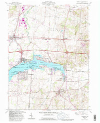 1992 Thornville1995 Print · USGSBuckeye Lake and its surrounding communities are captured here in the early nineties, showing a landscape defined by water and rural heritage. Researchers can trace historic property boundaries like the Refugee Lands line or locate family names at Hebron Cem and Thornville.
 - 1992 Map of Logan, 1995 Print
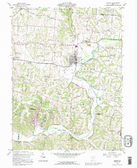
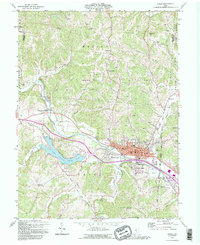 1992 Logan1995 Print · USGSThe Hocking River valley in the early nineties shows a busy transition between the industrial hub of Logan and the recreational waters of Lake Logan. Local researchers can locate numerous historic country churches and burial grounds, including Antioch Cem, Bethany Ch, and the Marion Sch Cem.
 - 1992 Map of East Ringgold, 1995 Print
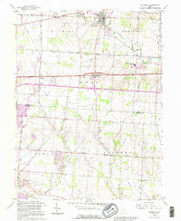
 1992 East Ringgold1995 Print · USGSFairfield and Pickaway counties are shown in the 1990s, revealing a landscape of rural crossroads and historic cemeteries. Genealogists can trace East Union Cem, Ritter Cem, and family-named landmarks like Cedar Hill and Royalton.
 - 1992 Map of Pataskala, 1995 Print
 1992 Pataskala1995 Print · USGSLicking and Fairfield counties are shown during a period of suburban expansion in the early nineties, centered on the historic Refugee Tract. Genealogists can trace family connections at Mt Zion Ch, Wagram, and the Union Cem along the old National Road.
 - 1992 Map of Bremen, 1995 Print
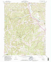
 1992 Bremen1995 Print · USGSFairfield County at the end of the twentieth century shows a landscape where old oil fields meet developing rural communities. Researchers can trace family history through dozens of landmarks like Grandview Cem, Olive Branch Ch, and the crossroads at North Berne.
 - 1992 Map of Rockbridge, 1995 Print
 1992 Rockbridge1995 Print · USGSHocking County’s famous hills and river valleys are captured here in the early nineties, showing a landscape defined by forest reserves and rural homesteads. Genealogists can locate family landmarks like McBroom Cem or Pisgah Ch and explore the rugged Cantwell Cliffs.
 - 1992 Map of Stoutsville, 1995 Print
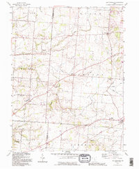
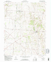 1992 Stoutsville1995 Print · USGSFairfield and Pickaway counties are shown in the early nineties, centered on the railroad crossing at Stoutsville. Genealogists can trace family names through landmarks like Maple Hill Cem, Imler Cem, and the old Township Sch near Stringtown.
End of results
Showing maps 1-7 of 7
Top cities of Fairfield County
Frequently asked questions
- What are the different types of historical maps available for Fairfield County?
- What is the oldest map of Fairfield County?
- Where can I purchase historical maps of Fairfield County for my home or office?
- Where can I download high-res historical maps of Fairfield County?
- Are there historical topographic maps available for Fairfield County?
- Is there historical aerial imagery available for Fairfield County?
- Where are historical maps of Fairfield County sourced from?