Old Maps of Fairfield County, Ohio for Metal Detecting
Plan your next treasure hunt with 128 historic maps of Fairfield County. Find old homesites, ghost towns, trails, and gathering spots that may be lost to time — perfect for identifying promising metal detecting locations.
- Locate forgotten sites: Uncover places like long-lost settlements, abandoned rail lines, or gathering spots.
- Plan better hunts: Use map overlays combined with LiDAR or satellite views to narrow in on historically rich areas.
- Made for detectorists: Thousands of hobbyists use these maps to discover relics, coins, and hidden history.
Use these historic maps to boost your research and find new opportunities beneath the surface of Fairfield County.
Fairfield County, OH maps
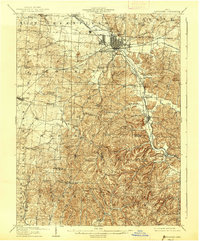
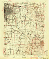
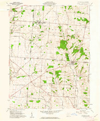
(128)- 1907 Map of Logan, 1954 Print
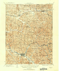 1907 Logan1954 Print · USGSSoutheast Ohio's industrial and rural landscape is captured here during the height of the local iron and rail era. Genealogists and historians can trace family roots through numerous country schools like Nickelplate School and landmarks such as Bessie Furnace or the County Infirmary.2 unique versions available
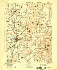
 - 1907 Map of Lancaster, 1958 Print
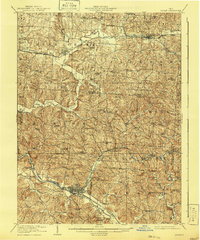
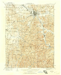 1907 Lancaster1958 Print · USGSFairfield and Hocking counties are captured here in the early twentieth century, showing a landscape defined by the Hocking River valley and early rail corridors. Researchers can locate vanished landmarks like the Abandoned Hocking Canal and the State Industrial School alongside numerous rural schools and churches.
 - 1907 Map of Thurston, 1960 Print
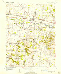
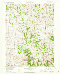
 1907 Thurston1960 Print · USGSFairfield and Licking counties at the turn of the century are shown here as a bustling landscape of rail junctions and early canal segments. Researchers can trace family roots at New Zion Church, locate the Baltimore Campground, or follow the Hocking Canal near Lockville.
 - 1909 Map of Thornville, 1938 Print
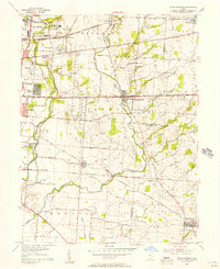
 1909 Thornville1938 Print · USGSLicking, Perry, and Fairfield counties are shown at the turn of the century as the local rail and canal-era economy remained vibrant. Researchers can trace the ancestral locations of numerous rural institutions including Porter School, Fairmount Church, and the Atherton P O at Jacksontown.2 unique versions available
 - 1909 Map of Lancaster, 1938 Print
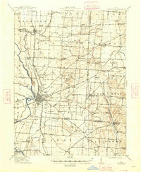
 1909 Lancaster1938 Print · USGSFairfield County at the turn of the century shows a bustling rail hub and the remnants of the canal era. Historians can trace the Abandoned Hocking Canal or locate local landmarks like the State Industrial School and Hopewell Church.2 unique versions available
 - 1909 Map of Logan, 1941 Print
 1909 Logan1941 Print · USGSSoutheastern Ohio at the start of the twentieth century shows a landscape defined by heavy iron works and a complex rail network. Genealogists can locate family-named landmarks like Britain School or Harvey Chapel and trace the lines of the Hocking Valley R. R. through Logan.
 - 1909 Map of Thurston, 1946 Print
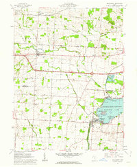
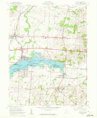
 1909 Thurston1946 Print · USGSCentral Ohio at the start of the twentieth century was a landscape of bustling rail junctions and lakeside retreats. Trace the vanished canal ways and historic rail stops like Lockville, find family landmarks such as Ritter School, or explore the early layout of BUCKEYE LAKE.
 - 1914 Map of Circleville, 1948 Print
 1914 Circleville1948 Print · USGSThe Scioto River valley and Pickaway Plains are captured here during a period of thriving rail commerce and rural schoolhouse districts. Researchers can find ancestral sites from the Reber Hill Cemetery to vanished stops along the Scioto Valley and New England RR.
 - 1925 Map of East Columbus, 1940 Print
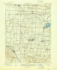
 1925 East Columbus1940 Print · USGSGreater Columbus and its eastern suburbs were rapidly expanding in the 1920s as industry and transit lines bridged the gap between city and farm. Genealogists and historians can trace the paths of the ABANDONED CANAL, the legacy of NORTON FIELD, and old village centers like Canal Winchester and Lithopolis.3 unique versions available
 - 1943 Map of Circleville
 1943 Circleville1943 Print · USGSMid-century Pickaway County is defined here by its intersection of rail power and ancient landmarks along the Scioto River. Genealogists and historians can trace dozens of rural schoolhouses like Bushwhack Sch, the county Infirmary, and the site of the Logan Elm.
 - 1943 Map of East Columbus
 1943 East Columbus1943 Print · USGSEastern Columbus and the Refugee Tract are captured here during the mobilization of the early 1940s. Genealogists and historians can trace the foundations of modern aviation at Port Columbus or find vanished landmarks like the Childrens Home and Norton Field.
 - 1947 Map of Columbus, 1948 Print
 1947 Columbus1948 Print · USGSCentral Ohio in the late 1940s is captured in this survey, showing the post-war transition of its rail hubs and military airfield expansions. Genealogists and historians can trace the paths of the Ohio Canal, the Pennsylvania RR lines, and the Camp Sherman Military Reservation.
 - 1955 Map of Canal Winchester, 1956 Print
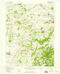
 1955 Canal Winchester1956 Print · USGSThe crossroads of Franklin and Fairfield counties are captured here in the mid-fifties, showing the transition from canal-era commerce to a modern rail-and-road network. Genealogists and local historians can locate early landmarks like The Wagnalls Memorial, Township Sch, and Union Grove Cem.
 - 1955 Map of Reynoldsburg, 1956 Print
 1955 Reynoldsburg1956 Print · USGSThe eastern edges of Columbus and the growing suburbs of Reynoldsburg and Whitehall appear here in the mid-fifties. Genealogists can trace family footprints at Forest Lawn Cemetery or Asbury Ch, while others can find industrial sites like the Claycraft kilns.
 - 1958 Map of Carroll, 1959 Print
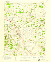 1958 Carroll1959 Print · USGSFairfield County's transportation corridors are frozen in time here, showing the late-1950s transition from rail reliance to modern infrastructure. Researchers can trace family roots at Wildermuth Memorial Ch and Beery Cem or explore the old canal village of Lockville.4 unique versions available
 - 1958 Map of East Ringgold, 1959 Print
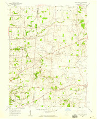 1958 East Ringgold1959 Print · USGSFairfield and Pickaway counties are captured here in the late fifties, showing a rural landscape defined by creek valleys and crossroad hamlets. Researchers can locate family landmarks like Bethany Ch, the East Union Cem, and the rail siding at Amanda.3 unique versions available
 - 1958 Map of Amanda, 1959 Print
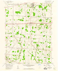
 1958 Amanda1959 Print · USGSFairfield County in the late fifties shows a rural landscape where iron rails and abandoned canal beds trace the path of older commerce. Genealogists and researchers can locate numerous family burial grounds and landmarks like Rock Mill, Mt Zion Ch, and the State Industrial Sch.3 unique versions available
 - 1958 Map of Pataskala, 1959 Print
 1958 Pataskala1959 Print · USGSPataskala and Pickerington are shown here in the late fifties, during a period of transition along the National Road. Genealogists can locate family landmarks such as Union Cem, Mt Zion Ch, and the small settlement of Wagram.4 unique versions available
 - 1961 Map of Columbus
 1961 Columbus1961 Print · USGSCentral and Southern Ohio are captured here in the early sixties, as the region's industrial rail hubs and military bases reached their peak. Genealogists and historians can trace the transition from urban Columbus to rural townships along the Scioto River, locating Lockbourne USAF and old junctions like Washington Court House.
 - 1961 Map of Millersport, 1962 Print
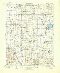
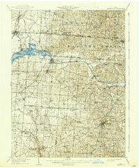
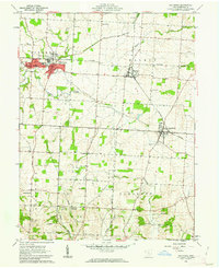
 1961 Millersport1962 Print · USGSCentral Ohio in the early sixties is captured here at the intersection of early canal history and mid-century recreation. Trace the path of the OHIO CANAL (ABANDONED) near Millersport or locate family roots at Refugee Cem and Fletcher Chapel.3 unique versions available
 - 1961 Map of Rushville, 1962 Print
 1961 Rushville1962 Print · USGSRushville and the Fairfield County borderlands are captured here in the early 1960s as a quiet network of farmsteads and creek-side settlements. Researchers can locate many family burial sites like Woolard Cem or trace the old New York Central rail line near New Salem.4 unique versions available
 - 1961 Map of Thornville, 1962 Print
 1961 Thornville1962 Print · USGSThe Buckeye Lake region in the early sixties showcases a landscape defined by lakeside recreation and historic surveying boundaries. Trace family roots at Friendship Cem or study the rail connections at Thornport and Thornville.5 unique versions available
 - 1961 Map of Baltimore, 1962 Print
 1961 Baltimore1962 Print · USGSFairfield County in the early sixties remains a landscape of rail-connected villages and legacy waterways. Genealogists can trace family lines through Hampson Cem and Union Cem, or follow the Ohio Canal (Abandoned) past Thurston.4 unique versions available
 - 1961 Map of Stoutsville, 1962 Print
 1961 Stoutsville1962 Print · USGSStoutsville and the rural townships of Pickaway and Fairfield counties are shown here just after the turn of the decade. Genealogists can trace family names through sites like the County Infirmary, Bunker Hill Cem, and the old Dresbach Ch.3 unique versions available
 - 1961 Map of Clearport, 1963 Print
 1961 Clearport1963 Print · USGSFairfield County in the early sixties was a landscape of high ridges and rural crossroads where three counties meet. Genealogists can trace family names at Shaeffer Cemetery or Kern Cemetery, and locate old meeting houses like Hopewell Church and Morgan Chapel.4 unique versions available
Showing maps 1-25 of 128
Top cities of Fairfield County
Frequently asked questions
- What are the different types of historical maps available for Fairfield County?
- What is the oldest map of Fairfield County?
- Where can I purchase historical maps of Fairfield County for my home or office?
- Where can I download high-res historical maps of Fairfield County?
- Are there historical topographic maps available for Fairfield County?
- Is there historical aerial imagery available for Fairfield County?
- Where are historical maps of Fairfield County sourced from?