Old Maps of Hancock County, Ohio for Genealogy
Trace your family roots with 128 historic maps of Hancock County. These high-res maps reveal old neighborhoods, homesites, landmarks, and streets — helping you uncover where your ancestors lived and how the area evolved over time.
- Explore historic neighborhoods: Identify where your relatives may have lived in the 1800s or 1900s.
- Compare maps over time: Trace the changes in streets, buildings, and landmarks for multi-generational research.
- Perfect for genealogy & ancestry research: Used by family historians and researchers to map out lineage and migration.
These maps are an incredible resource for exploring your personal connection to Hancock County's past.
Hancock County, OH maps
(128)- 1901 Map of Fostoria, 1958 Print
 1901 Fostoria1958 Print · USGSNorthwest Ohio at the turn of the century is captured here as a thriving rail hub where three counties meet. Genealogists and rail historians can trace the early networks of Fostoria and locate long-standing settlements like New Riegel, Alvada, and Bascom.
 - 1903 Map of Fostoria, 1939 Print
 1903 Fostoria1939 Print · USGSFostoria at the turn of the century was a burgeoning rail center where seven major lines crossed paths at a triple-county border. Genealogists can trace family footprints in small outlying settlements like New Riegel, Bascom, and West Independence or follow the path of the Hocking Valley RR.
 - 1903 Map of Findlay, 1939 Print
 1903 Findlay1939 Print · USGSNorthwest Ohio at the turn of the century was a powerhouse of rail commerce and early industrial energy. Genealogists and historians can trace the intricate grid of Findlay or find the boom-era roots of Oil Center, Arcadia, and Cygnet.2 unique versions available
 - 1905 Map of Arlington, 1961 Print
 1905 Arlington1961 Print · USGSNorthwest Ohio at the turn of the century was a landscape of dense rail junctions and drainage-fed farmlands. You can trace the intersecting lines of the Northern Ohio RR and Ohio Central Lines at Arlington, or locate rural landmarks like Mt Moriah Church and the Treece School.
 - 1907 Map of Bluffton
 1907 Bluffton1907 Print · USGSNorthwestern Ohio at the height of the steam and electric rail era shows a landscape of growing college towns and productive farmland. Trace the intersection of the Ohio Northern RR and Lake Erie and Western RR, or find vanished community hubs like Lafayette Herring PO and the Hillsville School.3 unique versions available
 - 1907 Map of Arlington
 1907 Arlington1907 Print · USGSNorthwestern Ohio's fertile landscape is captured here during the peak of its rail-and-river economy. Genealogists can trace family roots through local landmarks like North Washington PO, Jones School, and the Mt Olivet Church.2 unique versions available
 - 1907 Map of Upper Sandusky, 1943 Print
 1907 Upper Sandusky1943 Print · USGSWyandot County at the dawn of the twentieth century was a landscape of thriving rail junctions and dispersed rural school districts. Genealogists and local historians can trace the exact locations of family landmarks like Grace Chapel, the Indian Mill, and numerous rural schools from Moody School to Hendricks School 24.
 - 1950 Map of Marion
 1950 Marion1950 Print · USGSCentral Ohio was a powerhouse of rail and river industry at the mid-century point, serving as a vital corridor between the Great Lakes and the Ohio River valley. Genealogists and rail historians can trace the paths of the Erie RR and Nickel Plate Road through towns like Bucyrus, Galion, and Upper Sandusky.
 - 1956 Map of Toledo, 1968 Print
 1956 Toledo1968 Print · USGSNorthwest Ohio and the Lake Erie shoreline are shown in detail during the late fifties, showcasing a landscape of heavy industry, railroads, and island communities. Genealogists and historians can trace rail networks like the Chesapeake & Ohio RR or locate landmarks such as the Erie Proving Ground and Kelleys Island.4 unique versions available
 - 1960 Map of Deshler, 1961 Print
 1960 Deshler1961 Print · USGSDeshler and Belmore are captured at the height of their rail-era significance in the early 1960s. Researchers can trace the Baltimore and Ohio rail lines, find community landmarks like Oakdale Ch, and locate family plots at Woodlawn Cem.3 unique versions available
 - 1960 Map of Bluffton, 1961 Print
 1960 Bluffton1961 Print · USGSAgricultural life in Allen and Putnam counties reached a mid-century peak when rail lines and country roads still defined the local economy. Genealogists and historians can trace family-named landmarks like Hilty Cem and institutional hubs such as Bluffton College.4 unique versions available
 - 1960 Map of Rawson, 1961 Print
 1960 Rawson1961 Print · USGSHancock County in the early sixties centers on the rail-linked communities of Rawson and Mount Cory. Genealogists and local historians can trace family ties at Flick Cem, visit the Olive Branch Ch, or locate the old Bluffton Landing Field.2 unique versions available
 - 1960 Map of Bloomdale, 1961 Print
 1960 Bloomdale1961 Print · USGSWood and Hancock Counties are captured here in the early sixties as the railroad and rural oil industry shaped the local landscape. Genealogists can trace family footprints near Bloomdale and Bairdstown or locate rural burial sites like Chapel Cem and Ark Cem.3 unique versions available
 - 1960 Map of Alvada, 1961 Print
 1960 Alvada1961 Print · USGSHancock and Seneca counties appear here at the start of the 1960s, where the Old Indian Treaty Boundary still shapes the local landscape. Genealogists can locate family-named sites like Graham Cem and Ewing Cem or trace the route of the Chesapeake and Ohio railroad.2 unique versions available
 - 1960 Map of North Baltimore, 1961 Print
 1960 North Baltimore1961 Print · USGSThe crossroads of Wood and Hancock counties are captured here in the early sixties, showing a landscape shaped by rail, industry, and agriculture. Genealogists can locate family landmarks like Portage Chapel, Bethel Cem, and the historic Township Sch near Hammansburg.4 unique versions available
 - 1960 Map of Arlington, 1961 Print
 1960 Arlington1961 Print · USGSSouthern Hancock County appears at the dawn of the 1960s as a thriving agricultural and energy-producing landscape. Researchers can trace the legacy of small-town Ohio through family cemeteries like Hartman Cem and the rail-side growth of Jenera and Arlington.4 unique versions available
 - 1960 Map of Leipsic, 1961 Print
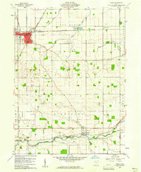 1960 Leipsic1961 Print · USGSPutnam County's rail-and-river landscape is clearly defined in the early sixties at the junction of several major freight lines. Genealogists and local historians can locate early family landmarks such as Cholera Cem, Maidlow Cem, and the County Home.2 unique versions available
 - 1960 Map of Fostoria, 1961 Print
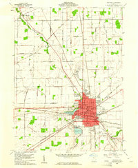 1960 Fostoria1961 Print · USGSFostoria is captured at the height of its mid-century industrial prominence, serving as a vital crossroads for four major railroads. Genealogists and local historians can trace the city's growth alongside rural landmarks like Dysinger Cem, Field Sch, and Lake Lamberjack.2 unique versions available
 - 1960 Map of Hoytville, 1961 Print
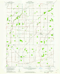 1960 Hoytville1961 Print · USGSNorthwest Ohio's productive farmlands come into sharp focus in the early sixties, showing the vital intersection of rail and road. Genealogists and historians can trace family locations near Hoytville, Deweyville, and the Thomas Cem along the Baltimore and Ohio Railroad.4 unique versions available
 - 1960 Map of Findlay, 1962 Print
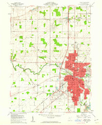 1960 Findlay1962 Print · USGSMid-century Findlay and its surroundings show a thriving hub of education, industry, and rail transport. Researchers can locate family landmarks like Aurand Cem, the Findlay College campus, and the extensive rail yards of the New York Central RR.4 unique versions available
 - 1960 Map of Mt Blanchard, 1962 Print
 1960 Mt Blanchard1962 Print · USGSHancock County farmland and river bends are captured here in the early sixties, as agriculture and early oil extraction defined the local economy. Researchers can locate numerous family-named burial sites like Frontiers Repose Cem and small settlements including Houcktown and Pratts.3 unique versions available
 - 1960 Map of Arcadia, 1962 Print
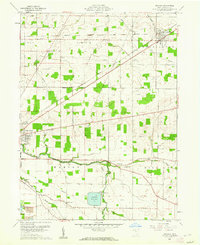 1960 Arcadia1962 Print · USGSHancock County was a landscape of small townships and rail-fed villages in the early sixties. Researchers can trace rural lineages through sites like Hamlin Cem, High Bank Cem, and the waters of the Findlay Reservoir.3 unique versions available
 - 1960 Map of Mc Comb, 1962 Print
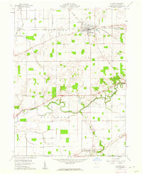 1960 Mc Comb1962 Print · USGSNorthwestern Ohio at the start of the sixties reveals a landscape shaped by rail junctions and river bends. Genealogists and local historians can trace family-named sites like Schwartz Cem and Indian Grave Cem or locate the old Pleasant Hill Sch.2 unique versions available
 - 1961 Map of Toledo
 1961 Toledo1961 Print · USGSThe western basin of Lake Erie and the industrial heart of Northern Ohio are captured here during the post-war era. Researchers can trace historical rail lines like the New York Central or locate landmarks like the Erie Ordnance Depot and Pelee Island.
 - 1961 Map of Forest, 1962 Print
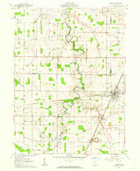 1961 Forest1962 Print · USGSHardin County agriculture and rail industry intersect in the early sixties at the junction of two major lines. Researchers can trace family history through the numerous rural burial sites and churches like Earlywine Cem, Union Chapel, and Patterson Cem.2 unique versions available
Showing maps 1-25 of 128
Top cities of Hancock County
- Findlay historical maps
- McComb historical maps
- Arlington historical maps
- Arcadia historical maps
- Mount Blanchard historical maps
- Vanlue historical maps
See more
Frequently asked questions
- What are the different types of historical maps available for Hancock County?
- What is the oldest map of Hancock County?
- Where can I purchase historical maps of Hancock County for my home or office?
- Where can I download high-res historical maps of Hancock County?
- Are there historical topographic maps available for Hancock County?
- Is there historical aerial imagery available for Hancock County?
- Where are historical maps of Hancock County sourced from?