Old Maps of Morgan County, Ohio for Hiking & Exploration
Hike through history with 152 historic maps of Morgan County. Explore old trails, ghost towns, and forgotten backroads — perfect for outdoor adventurers and local explorers.
- Rediscover forgotten places: Map out old mining camps, roads, and footpaths that no longer exist on modern maps.
- Layer with modern tools: Combine with LiDAR or satellite views to plan hikes through historical terrain.
- Made for exploration: Popular among hikers, overlanders, and local history lovers.
Use these maps to find adventure and explore the hidden past of Morgan County.
Morgan County, OH maps
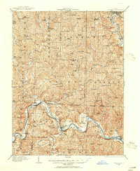
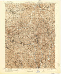
(152)- 1902 Map of Parkersburg
 1902 Parkersburg1902 Print · USGSThe river-and-rail corridor between Ohio and West Virginia comes alive at the dawn of the twentieth century. Researchers can trace the early footprints of Parkersburg and Vienna, the sprawling Blennerhassett Island, and the old rail lines at Belpre.
 - 1903 Map of Athens, 1958 Print
 1903 Athens1958 Print · USGSSoutheast Ohio's Hocking Valley thrives at the height of its coal-mining era, before the shift in regional industry. Researchers can trace historic rail lines like the Electric railway and find vanished company towns such as Orbiston, Buchtel, and Cawthorn.
 - 1904 Map of Parkersburg
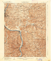
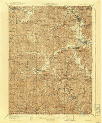
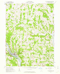
 1904 Parkersburg1904 Print · USGSThe riverfront economies of Wood County and Washington County meet at the turn of the century where the Muskingum and Ohio rivers converge. Researchers can trace the early rail networks of the Baltimore and Ohio R.R. and locate family-named settlements like Gravelbank, Center Belpre, and Vincent.5 unique versions available
 - 1904 Map of Chesterhill, 1957 Print
 1904 Chesterhill1957 Print · USGSSoutheast Ohio's rugged hill country is captured here during the peak of its rail-and-river economy in the early twentieth century. Researchers can locate vanished rural post offices and community landmarks like Calvary P O, Bethany Church, and Patten Mills.
 - 1905 Map of Athens
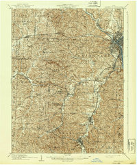
 1905 Athens1905 Print · USGSAthens and the Hocking River valley appear here at the height of the coal and rail era in the early nineteen-hundreds. Genealogists can trace family roots in vanished settlements and industrial junctions like Orbiston, Buchtel, and Marshfield.6 unique versions available
 - 1906 Map of Chesterhill, 1943 Print
 1906 Chesterhill1943 Print · USGSSoutheastern Ohio at the start of the century reveals a landscape of coal-mining hamlets and river valley rail lines. Genealogists and researchers can trace family landmarks like Mills School, Patten Mills, and the scattered post offices of Calvary PO and Federal.
 - 1909 Map of Caldwell, 1956 Print
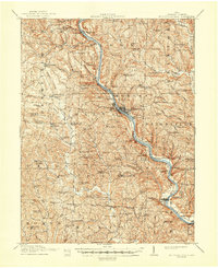
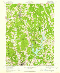
 1909 Caldwell1956 Print · USGSThe Muskingum River valley and the hills of Noble and Morgan counties are shown here in the early twentieth century. Genealogists can locate dozens of country institutions, from Bells Church and Manchester Church to the curiously named Beancatcher School and Poochville School.
 - 1910 Map of Philo, 1938 Print
 1910 Philo1938 Print · USGSThe Muskingum River valley was a bustling corridor of rail and river commerce at the turn of the century. Genealogists can locate dozens of country schoolhouses like Toadtown School and Sleepy Hollow School, or trace family roots near Taylorsville and the National Road.2 unique versions available
 - 1910 Map of Zanesville, 1939 Print
 1910 Zanesville1939 Print · USGSMuskingum and Perry counties are shown here in the early twentieth century as Zanesville emerged as a powerhouse of rail and river commerce. Researchers can trace historic transport routes like the National Road or locate local landmarks such as Moxahala Park and the Fultonham (Axline PO).2 unique versions available
 - 1910 Map of Mc Connelsville, 1948 Print
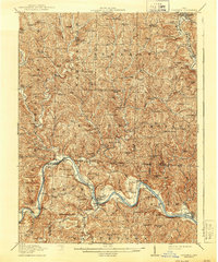
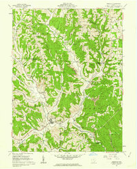
 1910 Mc Connelsville1948 Print · USGSAlong the Muskingum River in the early 1900s, river navigation and rural commerce define the landscape. Genealogists can trace family roots through numerous country schools and churches like Mt Carmel Church and Rokeby Lock.
 - 1911 Map of New Lexington, 1939 Print
 1911 New Lexington1939 Print · USGSPerry County and its neighbors hummed with industrial activity when this survey was conducted. Local researchers can trace old rail lines and family-linked landmarks from St Aloysius Academy down to the mining hubs of Shawnee and New Straitsville.2 unique versions available
 - 1911 Map of Cumberland, 1939 Print
 1911 Cumberland1939 Print · USGSSoutheastern Ohio at the start of the twentieth century was a landscape of ridge-top schools and valley rail junctions. Genealogists can trace family footprints through dozens of rural landmarks like Goshen Church, Dogtown, and the Rough and Ready School.2 unique versions available
 - 1912 Map of Caldwell, 1943 Print
 1912 Caldwell1943 Print · USGSSoutheast Ohio's river valleys and ridge-top settlements are captured here in the years before the Great War. Genealogists can trace family footprints across dozens of rural landmarks, from Manchester Church to the curiously named Poochville School and Valleyburg Woodgrove PO.
 - 1947 Map of Columbus, 1948 Print
 1947 Columbus1948 Print · USGSCentral Ohio in the late 1940s is captured in this survey, showing the post-war transition of its rail hubs and military airfield expansions. Genealogists and historians can trace the paths of the Ohio Canal, the Pennsylvania RR lines, and the Camp Sherman Military Reservation.
 - 1949 Map of Clarksburg
 1949 Clarksburg1949 Print · USGSThe upper Ohio River valley and the industrial heart of West Virginia come into focus during this post-war period. Genealogists and researchers can trace the rail corridors of the Baltimore and Ohio and locate centers like Fairmont, Grafton, and Waynesburg.
 - 1956 Map of Clarksburg, 1966 Print
 1956 Clarksburg1966 Print · USGSThe Ohio River valley and the industrial heart of West Virginia are seen here in the mid-1950s as rail and river commerce thrived. Researchers can trace historic transport lines like the Baltimore and Ohio RR and locate ancestral homes in Clarksburg, Moundsville, or Parkersburg.2 unique versions available
 - 1960 Map of Watertown, 1961 Print
 1960 Watertown1961 Print · USGSSoutheastern Ohio's rural landscape is documented here in the early sixties, showing a region defined by agricultural life and active energy extraction. Genealogists can locate family landmarks like Stanley Cemetery, Oak Hill Church, and the schools serving Barlow and Vincent.3 unique versions available
 - 1960 Map of Amesville, 1962 Print
 1960 Amesville1962 Print · USGSSoutheast Ohio’s hill country in the early sixties reveals a landscape transitioning between its mining roots and modern forestry. Genealogists and historians can trace family locations through Mud Sock Cem, Amesville, and the church at Mt Carmel Ch.4 unique versions available
 - 1961 Map of Columbus
 1961 Columbus1961 Print · USGSCentral and Southern Ohio are captured here in the early sixties, as the region's industrial rail hubs and military bases reached their peak. Genealogists and historians can trace the transition from urban Columbus to rural townships along the Scioto River, locating Lockbourne USAF and old junctions like Washington Court House.
 - 1961 Map of Clarksburg
 1961 Clarksburg1961 Print · USGSThe mid-century industrial and river landscapes of West Virginia and Ohio are detailed here, centered on the Ohio River. Researchers can trace the Baltimore and Ohio rail lines connecting towns like Parkersburg, Clarksburg, and Monongah.
 - 1961 Map of Beverly, 1962 Print
 1961 Beverly1962 Print · USGSThe Muskingum River valley of the early sixties is shown here in detail, from the rail-side hamlets of the Morgan County line to the hubs of Beverly and Waterford. Genealogists can locate family landmarks like Milnor Cem, Smiths Chapel, and the vanished site of Moscow Mills.4 unique versions available
 - 1961 Map of Mc Connelsville, 1962 Print
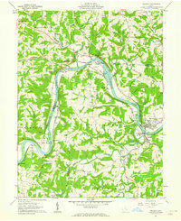
 1961 Mc Connelsville1962 Print · USGSThe riverfront towns of Mc Connelsville and Malta anchor this early 1960s survey of the Muskingum valley. Researchers can trace rural life through McKendree Ch, Jackpot Cem, and the industry of local Strip Mines.4 unique versions available
 - 1961 Map of Corning, 1962 Print
 1961 Corning1962 Print · USGSThe Hocking Valley coal country is captured here in the early sixties as the landscape shifted from mining toward new recreation. Researchers can locate old rail stops along the New York Central Railroad and trace rural roots at Mt Carmel Cem or Spencer Ridge Ch.5 unique versions available
 - 1961 Map of Jacksonville, 1962 Print
 1961 Jacksonville1962 Print · USGSThe coal and rail valleys of Athens County are captured here in the early sixties, showing the busy corridor from Glouster down to Chauncey. Genealogists and local historians can locate family plots at Sands Cem or Brown Cem and trace the old NEW YORK CENTRAL rail line through Millfield.5 unique versions available
 - 1961 Map of Chesterhill, 1962 Print
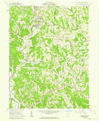
 1961 Chesterhill1962 Print · USGSMorgan and Washington Counties are shown here in the early 1960s, a landscape of ridge-top farms and valley settlements along the West Branch Wolf Creek. Genealogists and local historians can trace family roots through numerous sites like Chesterhill, Patten Mills, and the Quaker Cem.4 unique versions available
Showing maps 1-25 of 152
Top cities of Morgan County
- McConnelsville historical maps
- Malta historical maps
- Stockport historical maps
- Chesterhill historical maps
- Bristol historical maps
Frequently asked questions
- What are the different types of historical maps available for Morgan County?
- What is the oldest map of Morgan County?
- Where can I purchase historical maps of Morgan County for my home or office?
- Where can I download high-res historical maps of Morgan County?
- Are there historical topographic maps available for Morgan County?
- Is there historical aerial imagery available for Morgan County?
- Where are historical maps of Morgan County sourced from?