1900s (20th Century) Maps of Put-in-Bay Township, Ohio
Explore 17 historic maps of Put-in-Bay Township from the 1900s (20th Century). These maps offer a rare glimpse into what life looked like during the 1900s — showing old roads, neighborhoods, homes, and landmarks that have changed or disappeared over time.
Whether you're researching your family's past, planning a metal detecting trip, or studying how Put-in-Bay Township's landscape evolved across the 1900s, these high-resolution maps are a powerful tool for exploring the history of this region.
- Focus on a specific era: All maps on this page are from the 1900s, giving you a focused view of this time period.
- See what’s changed: Compare century-old streets, trails, and buildings to today's modern landscape using overlays and satellite layers.
- Research with precision: Use these maps for genealogy, historical research, land use analysis, or educational projects.
- View, download, or print: Maps are fully viewable online in high resolution, and can be downloaded or printed for your own records.
Start exploring Put-in-Bay Township's history through authentic maps from the 1900s. This is your window into the past.
Put-in-Bay Township, OH maps
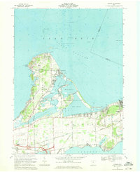
(17)- 1900 Map of Oak Harbor, 1943 Print
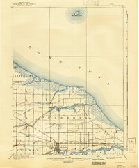 1900 Oak Harbor1943 Print · USGSCovers Put-in-Bay Township, including Oak Harbor, Rocky Ridge, and other nearby areas2 unique versions available
 - 1901 Map of Put-In-Bay, 1958 Print
 1901 Put-In-Bay1958 Print · USGSCovers Put-in-Bay Township, including Kingsville, Port Clinton, and other nearby areas
 - 1903 Map of Put In Bay, 1939 Print
 1903 Put In Bay1939 Print · USGSCovers Put-in-Bay Township, including Kingsville, Port Clinton, and other nearby areas
 - 1916 Map of Kelleys Island, 1958 Print
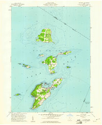
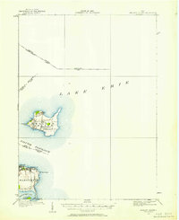 1916 Kelleys Island1958 Print · USGSCovers Put-in-Bay Township, including Leamington, Kingsville, and other nearby areas
 - 1919 Map of Kelleys Island, 1936 Print
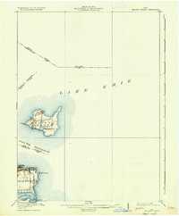 1919 Kelleys Island1936 Print · USGSCovers Put-in-Bay Township, including Leamington, Kingsville, and other nearby areas
 - 1952 Map of Oak Harbor, 1960 Print
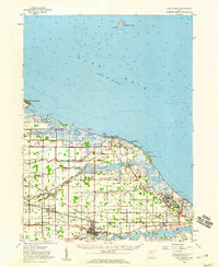 1952 Oak Harbor1960 Print · USGSCovers Put-in-Bay Township, including Oak Harbor, Rocky Ridge, and other nearby areas
 - 1956 Map of Toledo, 1968 Print
 1956 Toledo1968 Print · USGSCovers Put-in-Bay Township, including Toledo, Lorain, and other nearby areas4 unique versions available
 - 1959 Map of Port Clinton, 1960 Print
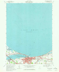
 1959 Port Clinton1960 Print · USGSCovers Put-in-Bay Township, including Port Clinton, Portage Township, and other nearby areas
 - 1959 Map of Gypsum, 1961 Print
 1959 Gypsum1961 Print · USGSCovers Put-in-Bay Township, including Catawba Island, Harbor Acres, and other nearby areas
 - 1959 Map of Put-In-Bay, 1961 Print
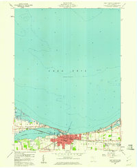
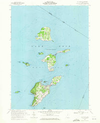
 1959 Put-In-Bay1961 Print · USGSCovers Put-in-Bay Township, including Kingsville, Put-in-Bay, and other nearby areas
 - 1961 Map of Toledo
 1961 Toledo1961 Print · USGSCovers Put-in-Bay Township, including Toledo, Lorain, and other nearby areas
 - 1964 Map of Metzger Marsh, 1965 Print
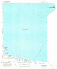 1964 Metzger Marsh1965 Print · USGSCovers Put-in-Bay Township, including Howard Farms Beach, Carroll Township, and other nearby areas
 - 1969 Map of Put-In-Bay, 1971 Print
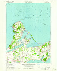
 1969 Put-In-Bay1971 Print · USGSCovers Put-in-Bay Township, including Kingsville, Put-in-Bay, and other nearby areas
 - 1969 Map of Gypsum, 1971 Print
 1969 Gypsum1971 Print · USGSCovers Put-in-Bay Township, including Catawba Island, Harbor Acres, and other nearby areas3 unique versions available
 - 1969 Map of Port Clinton, 1971 Print
 1969 Port Clinton1971 Print · USGSCovers Put-in-Bay Township, including Port Clinton, Portage Township, and other nearby areas
 - 1986 Map of Put-In-Bay
 1986 Put-In-Bay1986 Print · USGSCovers Put-in-Bay Township, including Leamington, Avon Lake, and other nearby areas2 unique versions available
 - 1986 Map of Toledo
 1986 Toledo1986 Print · USGSCovers Put-in-Bay Township, including Toledo, Bedford Township, and other nearby areas2 unique versions available
End of results
Showing maps 1-17 of 17
Top cities near Put-in-Bay Township
- Sandusky historical maps
- Port Clinton historical maps
- Catawba Island historical maps
- Oak Harbor historical maps
- Marblehead historical maps
- Kelleys Island historical maps
See more
Top neighborhoods of Put-in-Bay Township
- Middle Bass historical maps
- Isle Saint George historical maps
- Put-in-Bay historical maps
- East Point historical maps
- Island Bay Estates historical maps
- Middle Bass Club Historic District historical maps
See more
Frequently asked questions
- What are the different types of historical maps available for Put-in-Bay Township?
- What is the oldest map of Put-in-Bay Township?
- Where can I purchase historical maps of Put-in-Bay Township for my home or office?
- Where can I download high-res historical maps of Put-in-Bay Township?
- Are there historical topographic maps available for Put-in-Bay Township?
- Is there historical aerial imagery available for Put-in-Bay Township?
- Where are historical maps of Put-in-Bay Township sourced from?