2020s Maps of Put-in-Bay Township, Ohio
Explore 5 historic maps of Put-in-Bay Township from the 2020s. These maps offer a rare glimpse into what life looked like during the 2020s — showing old roads, neighborhoods, homes, and landmarks that have changed or disappeared over time.
Whether you're researching your family's past, planning a metal detecting trip, or studying how Put-in-Bay Township's landscape evolved across the 2020s, these high-resolution maps are a powerful tool for exploring the history of this region.
- Focus on a specific era: All maps on this page are from the 2020s, giving you a focused view of this time period.
- See what’s changed: Compare century-old streets, trails, and buildings to today's modern landscape using overlays and satellite layers.
- Research with precision: Use these maps for genealogy, historical research, land use analysis, or educational projects.
- View, download, or print: Maps are fully viewable online in high resolution, and can be downloaded or printed for your own records.
Start exploring Put-in-Bay Township's history through authentic maps from the 2020s. This is your window into the past.
Put-in-Bay Township, OH maps
(5)- 2023 Map of Port Clinton, 2023 Print
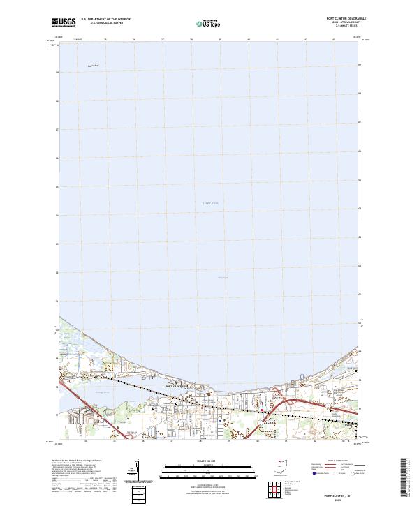 2023 Port Clinton2023 Print · USGSPort Clinton and the Lake Erie shoreline are shown in detail at the start of the 2020s. Researchers can locate family sites at Riverview Cem or Shook Cem and trace the waterfront near the Portage River and Gypsum.
 - 2023 Map of Metzger Marsh OE E, 2023 Print
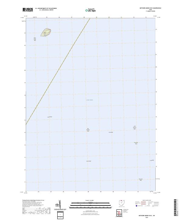 2023 Metzger Marsh OE E2023 Print · USGSLake Erie's western basin is documented in this modern survey of the waters off Ottawa County. Maritime researchers and anglers can trace the precise locations of notable underwater features like West Sister Island, Big Pickerel Reef, and Toussaint Reef.
 - 2023 Map of Metzger Marsh, 2023 Print
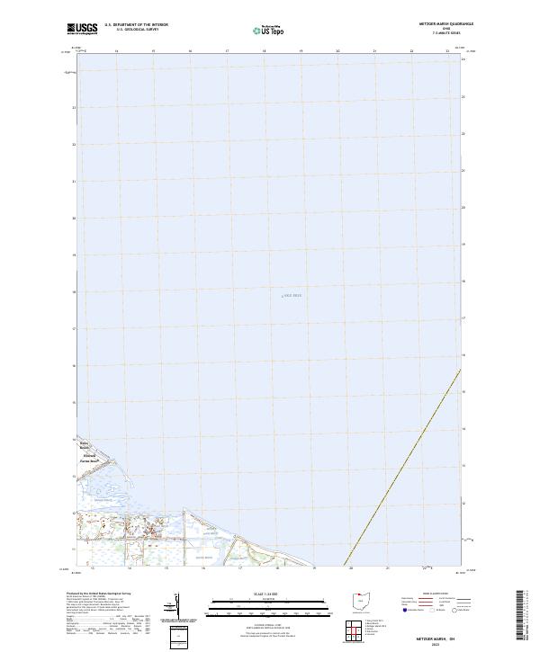 2023 Metzger Marsh2023 Print · USGSCoastal Lucas County meets the western basin of the lake in this recent survey of the Ohio shoreline. Genealogists and environmental historians can trace the residential layout of Reno Beach and Howard Farms Beach alongside protected areas like Pintail Marsh and Crane Creek.
 - 2023 Map of Gypsum, 2023 Print
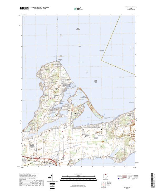 2023 Gypsum2023 Print · USGSThe Lake Erie shoreline in the early 2020s reveals a detailed landscape of coastal communities and maritime hazards. Researchers can trace local history through sites like Catawba Island Cem or explore the resort layout of Lakeside and Gem Beach.
 - 2023 Map of Put-in-Bay, 2023 Print
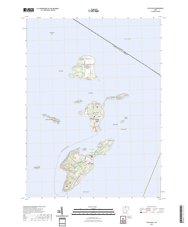 2023 Put-in-Bay2023 Print · USGSThe Bass Islands of Lake Erie are captured in detail during the early 2020s, showing the modern layout of this famous archipelago. Trace family sites at Crown Hill Cem and locate local landmarks like the Perry's Victory and International Peace Memorial.
End of results
Showing maps 1-5 of 5
Top cities near Put-in-Bay Township
- Sandusky historical maps
- Port Clinton historical maps
- Catawba Island historical maps
- Oak Harbor historical maps
- Marblehead historical maps
- Kelleys Island historical maps
See more
Top neighborhoods of Put-in-Bay Township
- Isle Saint George historical maps
- Middle Bass historical maps
- Put-in-Bay historical maps
- East Point historical maps
- Island Bay Estates historical maps
- Lakeview Allotment historical maps
See more
Frequently asked questions
- What are the different types of historical maps available for Put-in-Bay Township?
- What is the oldest map of Put-in-Bay Township?
- Where can I purchase historical maps of Put-in-Bay Township for my home or office?
- Where can I download high-res historical maps of Put-in-Bay Township?
- Are there historical topographic maps available for Put-in-Bay Township?
- Is there historical aerial imagery available for Put-in-Bay Township?
- Where are historical maps of Put-in-Bay Township sourced from?