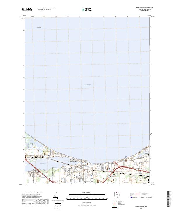
2023 Map of Port Clinton
USGS Topo · Published 2023About this map
Port Clinton and the surrounding Lake Erie shoreline are meticulously documented in this contemporary topographic study. The landscape is defined by its maritime geography, from the broad waters of Lake Erie and Perry Cove to the winding course of the Portage River. In the eastern section, the settlement of Gypsum and the expansive Erie-Ottawa International Airport mark the industrial and transit hubs of Ottawa County. The map provides significant detail for genealogists and local historians, locating several distinct burial grounds including Riverview Cem, Lakeview Cem, Shook Cem, and Christy Chapel Cem. Civic life is anchored near the lakefront by the Ottawa County Court of Common Pleas and the municipal court. To the northwest, the preserved wetlands of Darby Marsh contrast with the offshore navigation hazard at Round Reef, illustrating the area's dual nature as a recreational destination and a working Great Lakes port.
Find a feature on this map
40 named features on this map. Tap any name to fly to it.
Don’t see what you’re looking for? This feature index may not catch every label — zoom into the map to look around manually.
Map Details
Editions of this 2023 Port Clinton Map
This is the sole edition of this map. No revisions or reprints were ever made.
Other maps of this area

1900 · Oak Harbor
USGS Topo · 1:62,500

1901 · Put-In-Bay
USGS Topo · 1:62,500

1901 · Bellevue
USGS Topo · 1:62,500

1901 · Fremont
USGS Topo · 1:62,500

1903 · Bellevue
USGS Topo · 1:62,500

1903 · Fremont
USGS Topo · 1:62,500

1903 · Put In Bay
USGS Topo · 1:62,500

1952 · Lacarne
USGS Topo · 1:24,000

1952 · Oak Harbor
USGS Topo · 1:62,500

1956 · Toledo
USGS Topo · 1:250,000
Featured Places
- Port Clinton, OH
- Put-in-Bay Township, OH
- Catawba Island Township, OH
- Erie Township, OH
- Portage Township, OH