Old Maps of Perrysburg, Ohio for Hiking & Exploration
Hike through history with 35 historic maps of Perrysburg. Explore old trails, ghost towns, and forgotten backroads — perfect for outdoor adventurers and local explorers.
- Rediscover forgotten places: Map out old mining camps, roads, and footpaths that no longer exist on modern maps.
- Layer with modern tools: Combine with LiDAR or satellite views to plan hikes through historical terrain.
- Made for exploration: Popular among hikers, overlanders, and local history lovers.
Use these maps to find adventure and explore the hidden past of Perrysburg.
Perrysburg, OH maps
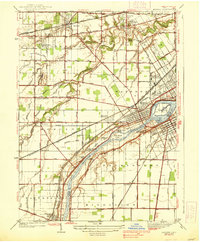
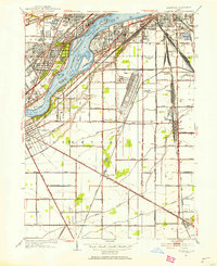
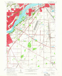
(35)- 1900 Map of Toledo, 1932 Print
 1900 Toledo1932 Print · USGSToledo and the lower Maumee River valley are shown at the height of the railroad era, as the city expanded into an industrial powerhouse. Researchers can trace early infrastructure like the Michigan Division Canal and locate historic sites like the Toledo Insane Asylum or the Oil Wells near Lime City.
 - 1901 Map of Bowling Green, 1958 Print
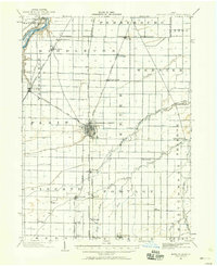 1901 Bowling Green1958 Print · USGSWood County at the turn of the century is a hub of steam and rail traffic centered on the growing seat of Bowling Green. Researchers can trace old family sites and rural settlements like Hull Prairie, Tontogany, and Jerry City across a landscape of early railroad lines.
 - 1903 Map of Bowling Green
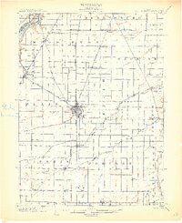 1903 Bowling Green1903 Print · USGSWood County at the turn of the century is a dense web of steam railroads and electric interurban lines connecting agricultural hubs. Researchers can trace the path of the Miami and Erie Canal or locate small settlements like Sugar Ridge, Tontogany, and Jerry City.3 unique versions available
 - 1934 Map of Rossford
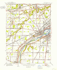
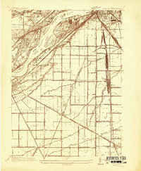 1934 Rossford1934 Print · USGSWood County was a hub of transit and industry in the 1930s, where the Maumee River met a complex web of rail yards and highways. Genealogists can locate family landmarks like Eagle Point Colony, Sunshine Cem, and the old schools at Lark Sch and Glenwood Sch.
 - 1935 Map of Maumee
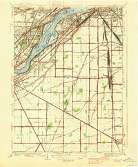
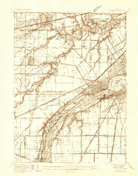 1935 Maumee1935 Print · USGSThe Maumee River valley is shown in the mid-1930s, just as electric railways and state highways began to reshape the old river towns. Genealogists and researchers can locate Springfield Chapel, trace the Cincinnati and Lake Erie line, or find the Hulls Crossing Mill.
 - 1938 Map of Maumee
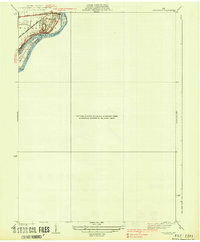
 1938 Maumee1938 Print · USGSThe riverfront communities of Northwest Ohio thrive during the mid-1930s as rail and road networks begin to overtake the old canal system. Researchers can trace the legacy of the Miami and Erie Canal and explore historical sites like Fort Meigs and Fallen Timber State Park.2 unique versions available
 - 1938 Map of Tontogany
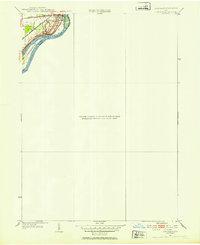
 1938 Tontogany1938 Print · USGSThe Maumee River corridor in the late thirties is captured here at a major rail and road junction. Local historians can trace the early industrial footprint of Waterville and the Waterville Quarry, or locate river landmarks like Roche de Boeuf.2 unique versions available
 - 1938 Map of Rossford
 1938 Rossford1938 Print · USGSThe industrial Maumee River valley comes to life in the 1930s, showing a landscape defined by massive rail yards and river islands. Genealogists and local historians can trace the foundations of Eagle Point Colony, the remote Jessie Hill Mission, and old rail hubs like Stanley Yard.
 - 1951 Map of Maumee, 1952 Print
 1951 Maumee1952 Print · USGSIn the early 1950s, the Maumee River valley was a corridor of burgeoning industry and deep frontier history. Researchers can trace military sites like Fort Meigs and Fort Miami, alongside local landmarks such as Turkey Foot Rock and Springfield Chapel.2 unique versions available
 - 1951 Map of Rossford, 1953 Print
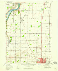
 1951 Rossford1953 Print · USGSWood County’s industrial and rail infrastructure dominates the Maumee River landscape during the early 1950s. Genealogists and local historians can trace the development of Lime City and Moline or locate landmarks like the Rossford Ordnance Depot and Sunshine Cem.
 - 1952 Map of Tontogany, 1953 Print
 1952 Tontogany1953 Print · USGSThe riverfront town of Waterville is captured here in the early fifties, situated along a prominent stretch of the Maumee. Local historians can trace the paths of the New York Chicago and St Louis railroad and landmarks like Roche de Boeuf and Missionary Island.
 - 1956 Map of Toledo, 1968 Print
 1956 Toledo1968 Print · USGSNorthwest Ohio and the Lake Erie shoreline are shown in detail during the late fifties, showcasing a landscape of heavy industry, railroads, and island communities. Genealogists and historians can trace rail networks like the Chesapeake & Ohio RR or locate landmarks such as the Erie Proving Ground and Kelleys Island.4 unique versions available
 - 1958 Map of Bowling Green North, 1960 Print
 1958 Bowling Green North1960 Print · USGSWood County in the late fifties shows a landscape of river-bend settlements and expanding academic grounds. Researchers can trace the mid-century footprint of Bowling Green State University or locate family sites near Tontogany Cem and Haskins.6 unique versions available
 - 1961 Map of Toledo
 1961 Toledo1961 Print · USGSThe western basin of Lake Erie and the industrial heart of Northern Ohio are captured here during the post-war era. Researchers can trace historical rail lines like the New York Central or locate landmarks like the Erie Ordnance Depot and Pelee Island.
 - 1964 Map of Maumee, 1965 Print
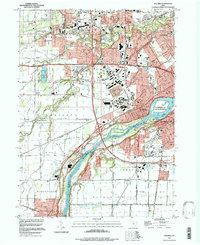
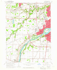 1964 Maumee1965 Print · USGSGreater Toledo and the riverfront communities of Maumee and Perrysburg are captured here during a period of mid-century suburban and industrial expansion. Trace the region's frontier roots at Fallen Timbers State Memorial or follow the historic rail paths of the Baltimore and Ohio Railroad.3 unique versions available
 - 1965 Map of Rossford, 1967 Print
 1965 Rossford1967 Print · USGSThe industrial and residential corridors of the Maumee River valley are captured here during the mid-sixties. Local researchers can trace the vast rail yards at Stanley Yard or locate landmarks like the Toledo State Hospital and Eagle Point Cem.3 unique versions available
 - 1986 Map of Toledo
 1986 Toledo1986 Print · USGSGreater Toledo and the Lake Erie shoreline are captured here in the mid-eighties, showcasing a massive network of industrial waterways and rail lines. You can trace the path of the Maumee River past Rossford or explore the conservation lands at Ottawa National Wildlife Refuge.2 unique versions available
 - 1986 Map of Findlay
 1986 Findlay1986 Print · USGSNorthwest Ohio's industrial and agricultural heartland is documented here in the mid-1980s, centered on the major hubs of Findlay, Fostoria, and Tiffin. Researchers can trace the intersections of the BALTIMORE AND OHIO railroad and family sites near Greenlawn Cem or Sagar Ridge.2 unique versions available
 - 1994 Map of Maumee, 1998 Print
 1994 Maumee1998 Print · USGSMaumee and Perrysburg are shown at the end of the twentieth century, anchored by the river and its historic military memorials. Researchers can trace the development of small settlements like Monclova and find sites such as Fort Meigs State Memorial and Riverside Cem.
 - 1994 Map of Bowling Green North, 1998 Print
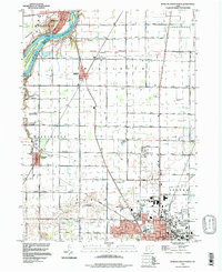 1994 Bowling Green North1998 Print · USGSThe Maumee River and the expanding campus of Bowling Green define this Wood County landscape in the mid-1990s. Genealogists can trace family names through the Union Hill Cem and Miltonville Cem or locate the old Plain Ch among the structured farmlands.
 - 2010 Map of Rossford, 2010 Print
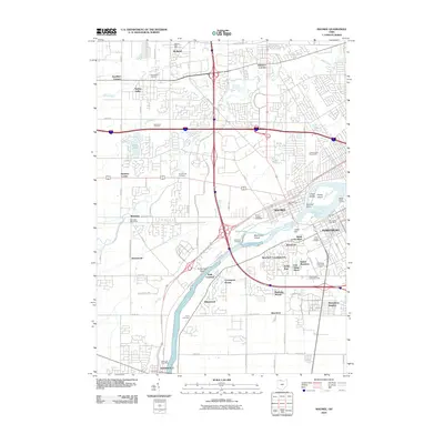
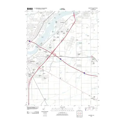 2010 Rossford2010 Print · USGSCovers Perrysburg, including Toledo, Oregon, and other nearby areas
 - 2010 Map of Maumee, 2010 Print
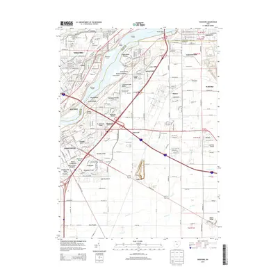
 2010 Maumee2010 Print · USGSCovers Perrysburg, including Toledo, Maumee, and other nearby areas
 - 2010 Map of Bowling Green North, 2010 Print
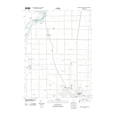 2010 Bowling Green North2010 Print · USGSCovers Perrysburg, including Bowling Green, Waterville, and other nearby areas
 - 2013 Map of Bowling Green North, 2013 Print
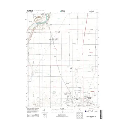 2013 Bowling Green North2013 Print · USGSCovers Perrysburg, including Bowling Green, Waterville, and other nearby areas
 - 2013 Map of Rossford, 2013 Print
 2013 Rossford2013 Print · USGSCovers Perrysburg, including Toledo, Oregon, and other nearby areas
Showing maps 1-25 of 35
Top cities near Perrysburg
- Toledo historical maps
- Bedford Township historical maps
- Bowling Green historical maps
- Oregon historical maps
- Sylvania historical maps
- Maumee historical maps
See more
Top neighborhoods of Perrysburg
Frequently asked questions
- What are the different types of historical maps available for Perrysburg?
- What is the oldest map of Perrysburg?
- Where can I purchase historical maps of Perrysburg for my home or office?
- Where can I download high-res historical maps of Perrysburg?
- Are there historical topographic maps available for Perrysburg?
- Is there historical aerial imagery available for Perrysburg?
- Where are historical maps of Perrysburg sourced from?