Old Maps of Blaine County, Oklahoma for Metal Detecting
Plan your next treasure hunt with 190 historic maps of Blaine County. Find old homesites, ghost towns, trails, and gathering spots that may be lost to time — perfect for identifying promising metal detecting locations.
- Locate forgotten sites: Uncover places like long-lost settlements, abandoned rail lines, or gathering spots.
- Plan better hunts: Use map overlays combined with LiDAR or satellite views to narrow in on historically rich areas.
- Made for detectorists: Thousands of hobbyists use these maps to discover relics, coins, and hidden history.
Use these historic maps to boost your research and find new opportunities beneath the surface of Blaine County.
Blaine County, OK maps
(190)- 1893 Map of Fort Reno
 1893 Fort Reno1893 Print · USGSCentral Oklahoma's frontier landscape is documented here in the final decade of the nineteenth century. Genealogists and historians can locate the Darlington Agency, the early enclave of African City, and the military post at Fort Reno.2 unique versions available
 - 1893 Map of Loyal
 1893 Loyal1893 Print · USGSOklahoma Territory was still in its first decade of settlement when these early communities began to dot the landscape. Researchers can trace the original locations of Omega, Alpha, and Huntsville alongside the borders of the Cheyenne and Arapahoe Reservation.2 unique versions available
 - 1893 Map of Ames
 1893 Ames1893 Print · USGSOklahoma territory is captured here during the early surveying era, showing the river-dominated landscape of Major and Kingfisher counties. Local historians can trace early settlement patterns at Lacey and Parvin or locate the historic Washburns Crossing on the Cimarron River.2 unique versions available
 - 1941 Map of Fort Reno
 1941 Fort Reno1941 Print · USGSThe North Canadian River valley was a center of agricultural and military life in the late thirties. Genealogists can trace family footprints across dozens of country schools and churches like Sunny Hill Sch, Swappingback Indian Chapel, and the historic Fort Reno grounds.3 unique versions available
 - 1942 Map of Fort Reno
 1942 Fort Reno1942 Print · USGSOklahoma's Canadian County plains come alive in this early-forties survey, showcasing a landscape defined by military depots and tribal schools. Researchers can trace rural lineages through dozens of local sites like Banner Sch, Canadian Valley Cem, and the Fort Reno garrison.
 - 1942 Map of Geary
 1942 Geary1942 Print · USGSCentral Oklahoma's agrarian heartland comes alive in this pre-war survey of the winding Canadian River valley. Genealogists and local historians can map out dozens of rural school sites like Victor Sch and Richland Sch alongside the busy Chicago Rock Island and Pacific rail line.3 unique versions available
 - 1949 Map of Fort Reno
 1949 Fort Reno1949 Print · USGSOklahoma's Canadian County comes to life in this mid-century survey, capturing the unique intersection of military history, tribal education, and Route 66 commerce. Genealogists can locate family landmarks like Swappingback Indian Chapel, Calumet, and the expansive Fort Reno Military Reservation.
 - 1955 Map of Clinton, 1964 Print
 1955 Clinton1964 Print · USGSWestern Oklahoma during the mid-century transition shows a landscape of growing reservoirs and active military flight lines. Genealogists and historians can locate rural landmarks such as Mountain View Church, Berlin School, and the Riverside Indian School Reserve.3 unique versions available
 - 1955 Map of Woodward, 1967 Print
 1955 Woodward1967 Print · USGSNorthwest Oklahoma and the bordering plains are captured during the mid-sixties, showing a landscape defined by river valleys and massive water projects. Researchers can trace family roots in towns like Woodward and Alva or locate landmarks such as the Western Oklahoma State Hospital and Kegelman AF.3 unique versions available
 - 1956 Map of Ames, 1957 Print
 1956 Ames1957 Print · USGSMajor and Garfield counties are captured here in the mid-1950s, centered on the railroad town of Ames and the Cimarron River. Genealogists can trace rural life through landmarks like Antioch Ch, Mound Ridge Sch, and the Cimarron Valley Cem.2 unique versions available
 - 1957 Map of Clinton
 1957 Clinton1957 Print · USGSWestern Oklahoma in the mid-fifties is captured here as a landscape of river-valley settlements and emerging energy fields. Genealogists can trace family roots through numerous rural landmarks like the Swapping Back Indian School, Hebron Church, and the Riverside Indian School Reserve.
 - 1958 Map of Woodward
 1958 Woodward1958 Print · USGSNorthwest Oklahoma and the neighboring panhandle borders are shown here during a period of steady mid-century growth. Researchers can trace the rail networks of the Atchison Topeka and Santa Fe and locate landmarks like the Western Oklahoma State Hospital and Port Supply Reservoir.2 unique versions available
 - 1964 Map of Oakwood, 1965 Print
 1964 Oakwood1965 Print · USGSWestern Oklahoma is captured here in the mid-1960s as a landscape of rural townships and developing oil fields. Researchers can trace family roots through several country churches and cemeteries like Mt Pleasant Ch, Mt Hope Cem, and the village of Eagle City.2 unique versions available
 - 1964 Map of Weatherford, 1966 Print
 1964 Weatherford1966 Print · USGSWestern Oklahoma life in the mid-sixties centers on the busy railroad corridors and the winding course of the Canadian River. Researchers can trace old family sites like Mound Olive Cem, the Indian Mission Ch, and the evocative Dead Women Crossing.
 - 1972 Map of Watonga, 1974 Print
 1972 Watonga1974 Print · USGSWatonga was a thriving center for the rail-and-river economy of central Oklahoma in the early seventies. Genealogists and local historians can trace family roots at the Watonga Indian Cem and Pinkerton Cem, or locate the Drive-in Theater and Fairground.
 - 1972 Map of Longdale, 1974 Print
 1972 Longdale1974 Print · USGSBlaine County's rural landscape is captured here in the early seventies as the region balanced its agricultural roots with a growing energy sector. Researchers can trace the Atchison Topeka and Santa Fe rail line past Longdale or locate family sites at Bethel Cem and Cedar Springs.
 - 1972 Map of Canton NW, 1974 Print
 1972 Canton NW1974 Print · USGSThe rural landscapes of Major and Dewey Counties are captured here in the early 1970s, centered on the waters of Canton Lake. Genealogists and local historians can trace family locations near the Fern Cliff Cem, the settlement of Bado, and Midway Ch.
 - 1972 Map of Omega, 1974 Print
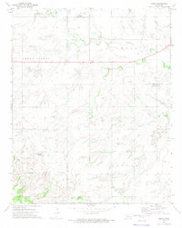 1972 Omega1974 Print · USGSThe Oklahoma prairie during the early 1970s reveals a landscape of small agricultural settlements and emerging energy infrastructure. Researchers can locate community centers like Omega and Altona, identify local burial grounds at Zion Cem, and trace the winding course of Kingfisher Creek.
 - 1972 Map of Canton, 1974 Print
 1972 Canton1974 Print · USGSBlaine County, Oklahoma, is shown in the early seventies as a landscape of energy production and lakefront recreation. Researchers can trace the Atchison Topeka and Santa Fe rails, the small settlement of Carlton, and the Canton Cem.
 - 1972 Map of Watonga SE, 1974 Print
 1972 Watonga SE1974 Print · USGSBlaine County's rolling valley floor and the North Canadian River are captured here in the early 1970s. Genealogists and local historians can locate family burial sites at Evergreen Cem and East Mt Pleasant Cem or trace the early energy development of Cedar Valley.
 - 1972 Map of Canton SW, 1974 Print
 1972 Canton SW1974 Print · USGSNorthwestern Oklahoma in the early seventies shows a landscape where energy production meets public recreation along the Dewey County line. Researchers can trace the Atchison Topeka and Santa Fe rail line, locate Fountain Cem, and explore the Oil Field surrounding Canton Lake.
 - 1972 Map of Loyal NW, 1974 Print
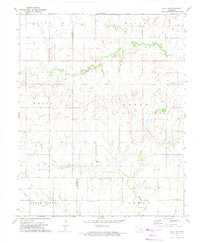 1972 Loyal NW1974 Print · USGSThe Oklahoma prairie on the Blaine and Kingfisher county line is captured here in the early 1970s during a period of active oil exploration. Researchers can find many family landmarks and community sites, including the Lomega Sch, Omega Cem, and the Venable Cem.
 - 1972 Map of Southard, 1974 Print
 1972 Southard1974 Print · USGSBlaine County industrial sites and rural townships are captured in the early seventies, featuring the gypsum mining hub of Southard. Trace the St Louis-San Francisco line and find old landmarks like Ruby Mill Can or the Mount Henquent Gas Well.2 unique versions available
 - 1972 Map of Okeene, 1974 Print
 1972 Okeene1974 Print · USGSOklahoma's northern prairie at the start of the 1970s reveals a landscape defined by intersectional rail lines and energy exploration. Local historians can trace the routes of the St Louis - San Francisco and locate family landmarks like Tulles Cem or Peaceful Cem.
 - 1972 Map of Homestead, 1974 Print
 1972 Homestead1974 Print · USGSNorthwestern Oklahoma’s rural landscape is captured here in the early seventies, showing a region where rail transit and the gas industry shaped local life. Genealogists and historians can trace local families through Cedar Cemetery, Mennonite Cemetery, and the Homestead settlement.
Showing maps 1-25 of 190
Top cities of Blaine County
- Watonga historical maps
- Okeene historical maps
- Canton historical maps
- Longdale historical maps
- Hitchcock historical maps
- Greenfield historical maps
Frequently asked questions
- What are the different types of historical maps available for Blaine County?
- What is the oldest map of Blaine County?
- Where can I purchase historical maps of Blaine County for my home or office?
- Where can I download high-res historical maps of Blaine County?
- Are there historical topographic maps available for Blaine County?
- Is there historical aerial imagery available for Blaine County?
- Where are historical maps of Blaine County sourced from?