1980s Maps of Blaine County, Oklahoma
Explore 12 historic maps of Blaine County from the 1980s. These maps offer a rare glimpse into what life looked like during the 1980s — showing old roads, neighborhoods, homes, and landmarks that have changed or disappeared over time.
Whether you're researching your family's past, planning a metal detecting trip, or studying how Blaine County's landscape evolved across the 1980s, these high-resolution maps are a powerful tool for exploring the history of this region.
- Focus on a specific era: All maps on this page are from the 1980s, giving you a focused view of this time period.
- See what’s changed: Compare century-old streets, trails, and buildings to today's modern landscape using overlays and satellite layers.
- Research with precision: Use these maps for genealogy, historical research, land use analysis, or educational projects.
- View, download, or print: Maps are fully viewable online in high resolution, and can be downloaded or printed for your own records.
Start exploring Blaine County's history through authentic maps from the 1980s. This is your window into the past.
Blaine County, OK maps
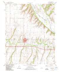
(12)- 1982 Map of Ames, 1983 Print
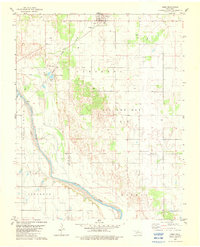 1982 Ames1983 Print · USGSAmes and the surrounding Major County oil fields are captured here in the early eighties as industrial and historical boundaries intersected. Genealogists and researchers can trace the Major Co Old Indian Treaty Boundary and locate landmarks like the Burlington Northern rail line and Crystal Lakes.
 - 1982 Map of Parvin, 1983 Print
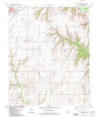
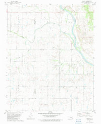 1982 Parvin1983 Print · USGSOklahoma's river-bottom energy country is documented here in the early eighties along the Cimarron River and the Blaine-Kingfisher county line. Researchers can pinpoint rural landmarks like Parvin, the East Cooper Cem, and numerous active Gravel Pits.
 - 1985 Map of Weatherford
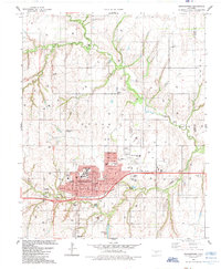 1985 Weatherford1985 Print · USGSWeatherford expanded as a center of education and industry in Western Oklahoma during the mid-eighties. Researchers can locate local landmarks like Southwestern State Univ, the Thomas P Stafford Airport, and historic burial grounds including Bradley Cem.
 - 1985 Map of Eagle City
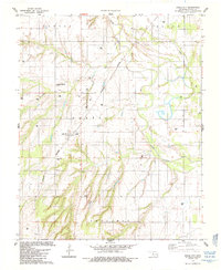 1985 Eagle City1985 Print · USGSMid-1980s Blaine County comes into focus through this survey of Eagle City and its agricultural surroundings during a period of active energy exploration. Genealogists and researchers can pinpoint the Eagle City Cem or trace the Burlington Northern rail line and the winding North Canadian River.
 - 1985 Map of Hydro
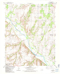
 1985 Hydro1985 Print · USGSHydro and its surrounding Caddo County ranch lands are detailed in the mid-1980s, showcasing the intersection of energy production and rural life. Researchers can locate the Townhall and Hydro Cem, or trace the Farmrail corridor through the hills of Mound Valley.
 - 1985 Map of Watonga
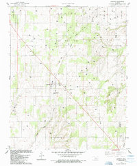
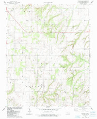
 1985 Watonga1985 Print · USGSCentral Oklahoma in the mid-eighties shows a robust network of river-valley settlements and rural rail lines. Genealogists and historians can trace the footprint of Southwestern State College, the historic Fort Reno, and family-named landmarks like Dead Women Crossing.2 unique versions available
 - 1985 Map of Oakwood
 1985 Oakwood1985 Print · USGSOakwood and the surrounding Dewey County plains are captured in the mid-1980s during a peak of regional energy production. Researchers can locate family sites near Oakwood Cem or trace the path of the Atchison Topeka and Santa Fe railroad.
 - 1985 Map of Weatherford NW
 1985 Weatherford NW1985 Print · USGSCuster County was a hub of energy production and rail transport in the mid-1980s. Historians and genealogists can trace the intersection of the Burlington railroad with rural life at St Johns Cem, Jefferson Sch, and the extensive Deer Creek Oil Field.
 - 1985 Map of Fay
 1985 Fay1985 Print · USGSThe Canadian River valley in the mid-1980s reveals a landscape defined by deep-cut creeks and major rail infrastructure. Genealogists and historians can trace family plots at Mt Hope Cem or follow the paths of the Burlington Northern and Atchison Topeka and Santa Fe railroads through Fay and Nobscot.
 - 1985 Map of Squaw Creek
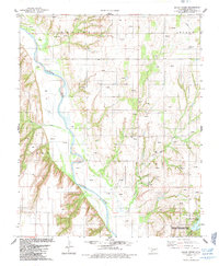 1985 Squaw Creek1985 Print · USGSBlaine County in the mid-1980s was a landscape of deep river valleys and active energy production. Local history researchers can locate rural landmarks like Whirlwind Cem, the Etna Ch, and the American Horse Lake State Hunting and Fishing Area.
 - 1985 Map of Oakwood SE
 1985 Oakwood SE1985 Print · USGSWestern Oklahoma’s energy and agricultural landscape is captured here in the mid-1980s. Genealogists and local historians can trace rural roots at Mt Pleasant Cem or the Church of the First Born while mapping the heavy distribution of Gas Wells.
 - 1986 Map of Fairview
 1986 Fairview1986 Print · USGSMajor County and the Cimarron River valley are shown here in the mid-1980s as the rail networks of the Atchison Topeka and Santa Fe still linked the plains. Researchers can trace rural lineages through settlements like Cheyenne Valley, Bouse Junction, and the terrain surrounding Canton Lake.2 unique versions available
End of results
Showing maps 1-12 of 12
Top cities of Blaine County
- Watonga historical maps
- Okeene historical maps
- Canton historical maps
- Longdale historical maps
- Hitchcock historical maps
- Greenfield historical maps
Frequently asked questions
- What are the different types of historical maps available for Blaine County?
- What is the oldest map of Blaine County?
- Where can I purchase historical maps of Blaine County for my home or office?
- Where can I download high-res historical maps of Blaine County?
- Are there historical topographic maps available for Blaine County?
- Is there historical aerial imagery available for Blaine County?
- Where are historical maps of Blaine County sourced from?