2020s Maps of Caddo County, Oklahoma
Explore 33 historic maps of Caddo County from the 2020s. These maps offer a rare glimpse into what life looked like during the 2020s — showing old roads, neighborhoods, homes, and landmarks that have changed or disappeared over time.
Whether you're researching your family's past, planning a metal detecting trip, or studying how Caddo County's landscape evolved across the 2020s, these high-resolution maps are a powerful tool for exploring the history of this region.
- Focus on a specific era: All maps on this page are from the 2020s, giving you a focused view of this time period.
- See what’s changed: Compare century-old streets, trails, and buildings to today's modern landscape using overlays and satellite layers.
- Research with precision: Use these maps for genealogy, historical research, land use analysis, or educational projects.
- View, download, or print: Maps are fully viewable online in high resolution, and can be downloaded or printed for your own records.
Start exploring Caddo County's history through authentic maps from the 2020s. This is your window into the past.
Caddo County, OK maps
(33)- 2022 Map of Carnegie, 2022 Print
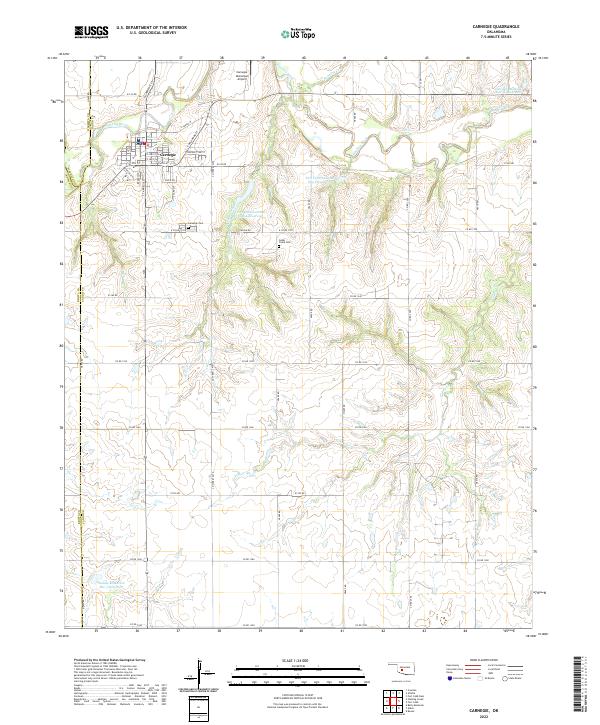 2022 Carnegie2022 Print · USGSCarnegie and the Washita River valley are captured in this modern survey, showing the intersection of Caddo, Washita, and Kiowa counties. Local researchers can locate family plots at Carnegie Cem or trace water management at Saddle Mountain Site 3 Reservoir.
 - 2022 Map of Anadarko West, 2022 Print
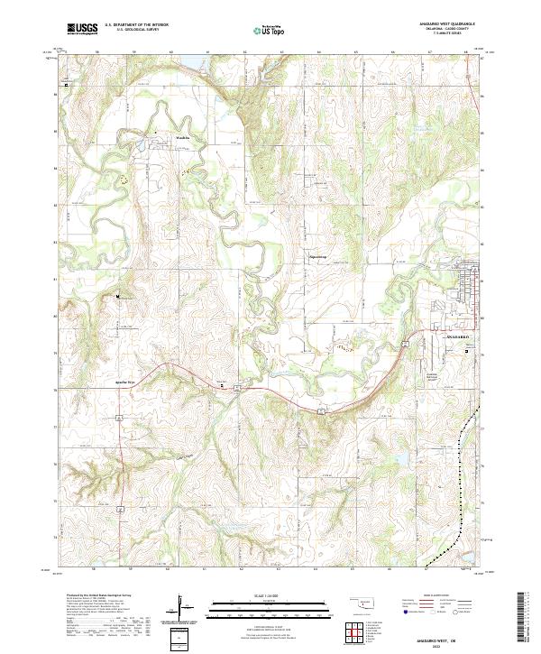 2022 Anadarko West2022 Print · USGSCaddo County in the early twenty-first century reveals a landscape defined by the winding Washita River and its rural outposts. Genealogists can trace family connections at Red Stone Cem or Ware Cem and locate landmarks like Apache Wye.
 - 2022 Map of Rock Mary, 2022 Print
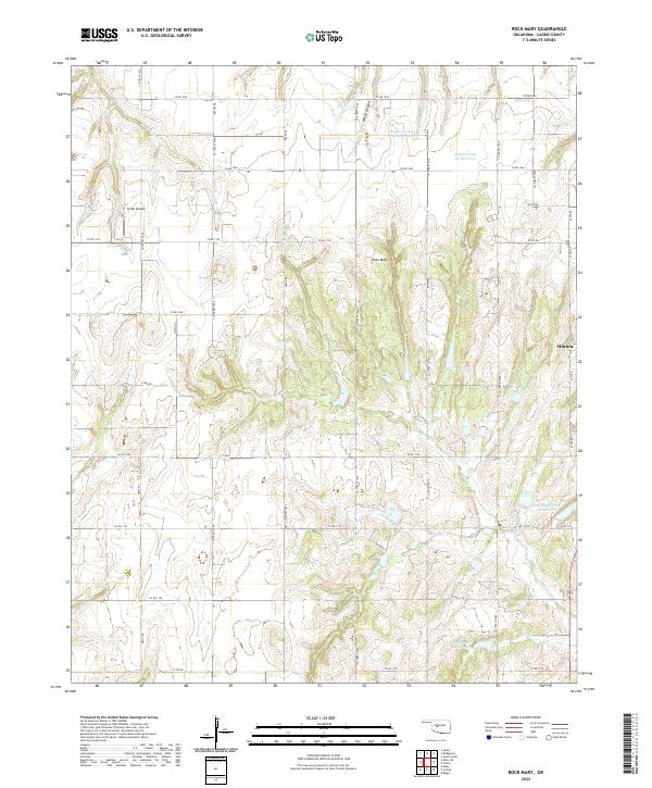 2022 Rock Mary2022 Print · USGSCaddo County's distinctive landmarks and rural water systems are documented in this contemporary survey of the area west of Hinton. Researchers can locate family-named features and local landmarks like Rock Mary, Smith Airpark, and the deep recesses of White Canyon.
 - 2022 Map of Cogar, 2022 Print
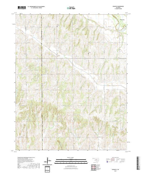
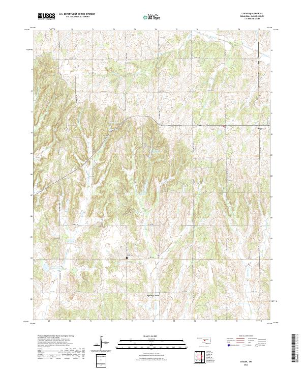 2022 Cogar2022 Print · USGSCentral Oklahoma's rural Caddo County is captured here in the early twenty-first century, showing a landscape defined by ranching and small-town roots. Researchers can locate Spring Creek Cem and the community of Cogar among the many forks of White Bread Cr.
 - 2022 Map of Eakly, 2022 Print
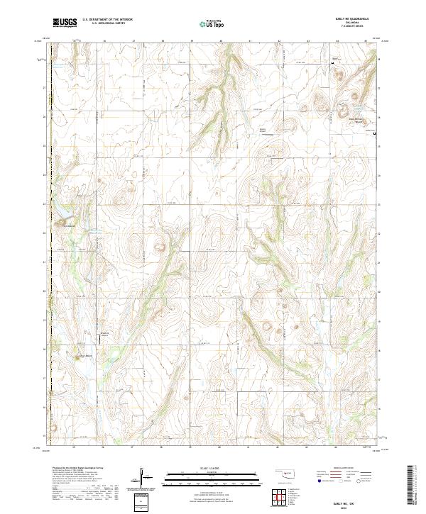
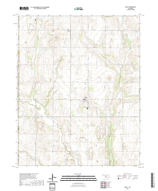 2022 Eakly2022 Print · USGSCaddo County's agricultural heartland is documented here in the early 2020s, centered on the settlement of Eakly. Researchers can trace local heritage at the Eakly Cem and Poage Cem or follow the natural drainage of Cobb Cr and Fivemile Cr.
 - 2022 Map of Cogar SE, 2022 Print
 2022 Cogar SE2022 Print · USGSGrady County's agricultural heartland is documented here in the early twenty-first century, showing a landscape defined by rolling creek drainages and section-line roads. Researchers can locate family landmarks like Hazel Dell Cemetery and Center View Cemetery or trace the winding path of Buggy Creek.
 - 2022 Map of Anadarko East, 2022 Print
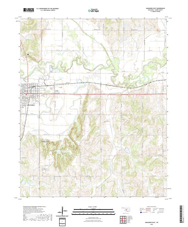 2022 Anadarko East2022 Print · USGSThe community of ANADARKO and its surrounding river valley are detailed in this 2022 survey. Researchers can locate the Caddo County Courthouse, the Riverside Cem, and landmarks like Indian City among the South Hills.
 - 2022 Map of Verden, 2022 Print
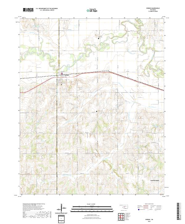 2022 Verden2022 Print · USGSThe Oklahoma prairie surrounding Verden is captured in this recent survey, showcasing the town's position along the Washita River and the rail line. Researchers can locate local landmarks like Half Moon Ranch Cem, Plainview Cem, and Spring Cr Site 103 Reservoir.
 - 2022 Map of Bridgeport, 2022 Print
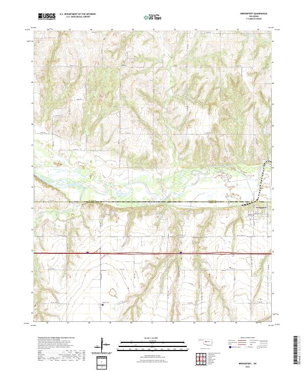 2022 Bridgeport2022 Print · USGSThe Oklahoma prairie meets the winding Canadian River in the early 2020s, showing a landscape shaped by deep canyons and historic transit. Trace the route of Old US Hwy 66 near Bridgeport and locate family history at Bethel Cem.
 - 2022 Map of Hinton, 2022 Print
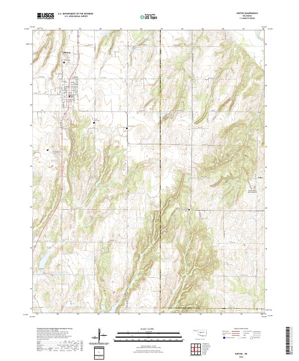 2022 Hinton2022 Print · USGSThe community of Hinton and the surrounding Caddo County farmland are captured here in the early 2020s. Researchers can locate several rural burial sites like Sacred Heart Cem and Saint Johns Cem, or trace the rugged breaks of Devils Canyon.
 - 2022 Map of Fort Cobb, 2022 Print
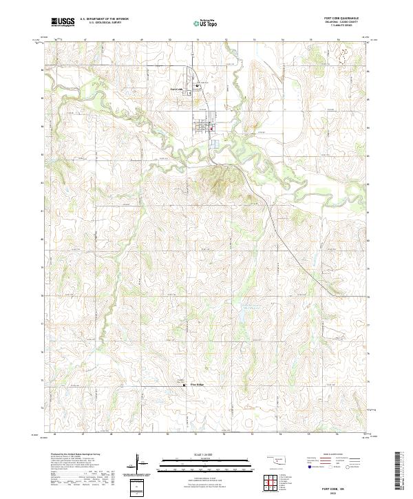 2022 Fort Cobb2022 Print · USGSCaddo County's agricultural heartland is documented here in the early 2020s, centered on the confluence of the Washita River and Cobb Cr. Genealogists and local historians can trace family ties at the Fort Cobb Cem and Pleasant View Cem or explore the street grid of Fort Cobb.
 - 2022 Map of Cogar NW, 2022 Print
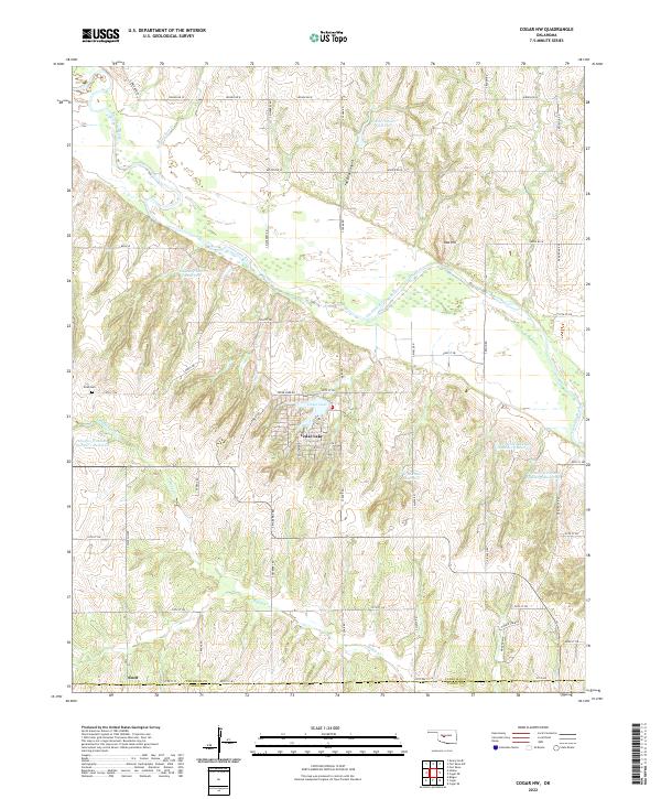 2022 Cogar NW2022 Print · USGSThe Canadian and Caddo county line area is defined by its rural water systems and the wandering Canadian River during this modern era. Researchers can find family landmarks like the Niles Cem and several private reservoirs including the Chester Chiles Reservoir.
 - 2022 Map of Gracemont, 2022 Print
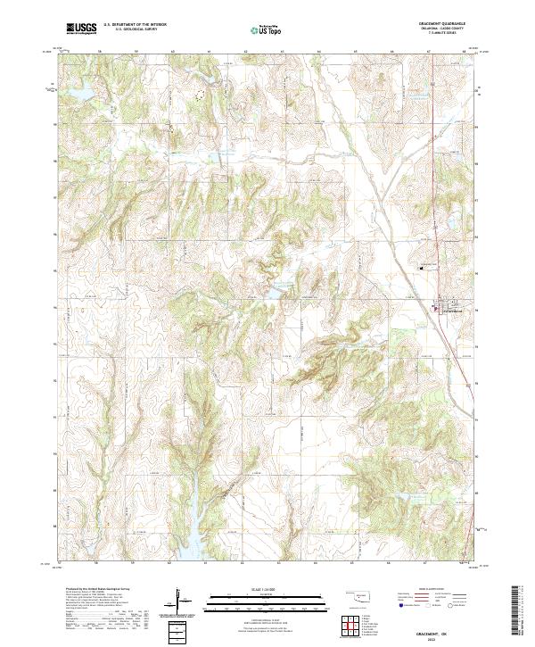 2022 Gracemont2022 Print · USGSGracemont and the surrounding Caddo County countryside are shown here in the 2020s, highlighting a landscape defined by water conservation and rural township roads. Researchers can trace local landmarks like Gracemont Cem and the drainages of Keechi Cr and Stockton Canyon.
 - 2022 Map of Sickles, 2022 Print
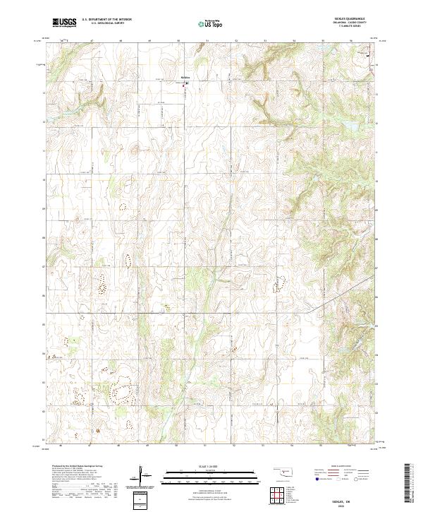 2022 Sickles2022 Print · USGSCaddo County's agricultural landscape is captured here in the early 2020s, showing the rural crossroads of Sickles and its surrounding homesteads. Genealogists can locate family sites near Sickles Cem or Lookeba Cem and trace the deep draws of Horseshoe Canyon.
 - 2022 Map of Binger, 2022 Print
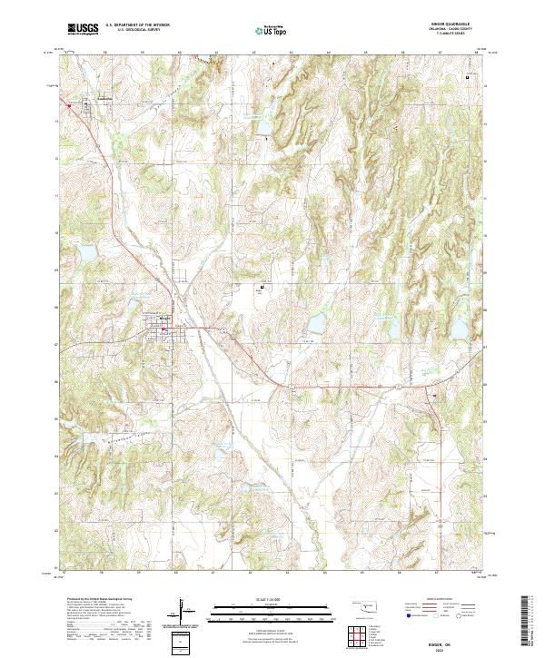 2022 Binger2022 Print · USGSCaddo County's agricultural heartland is documented here in the early twenty-first century, centered on the communities of Binger and Lookeba. Researchers can trace local lineage and land use near Binger Cem or explore the terrain of Devils Canyon.
 - 2022 Map of Anadarko NE, 2022 Print
 2022 Anadarko NE2022 Print · USGSThe Oklahoma prairie at the Caddo and Grady county line is detailed here in the early 2020s, showing a landscape of rural intersections and family land. Researchers can locate the Dutton settlement and trace ancestral roots at the Friendship Cem or Liberty Cem.
 - 2022 Map of Rocky Ford, 2022 Print
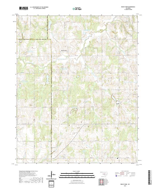 2022 Rocky Ford2022 Print · USGSThe rural landscapes of Grady and Caddo counties are captured here in the early twenty-first century, centered on the communities of Rocky Ford and Acme. Researchers can trace local genealogy at Simpson Cem or follow the managed waters of the Little Washita River.
 - 2022 Map of Richards Spur, 2022 Print
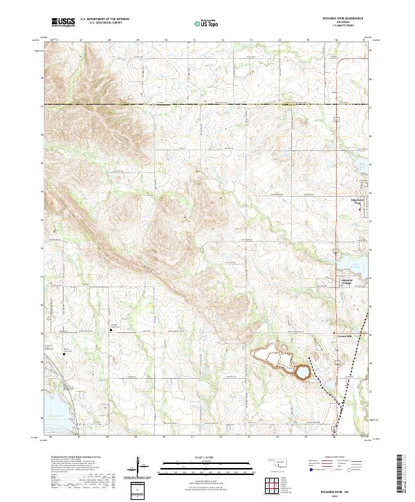 2022 Richards Spur2022 Print · USGSNorth of Lawton in the early 2020s, the boundary between Comanche and Caddo counties is defined by the expansive waters of Lake Ellsworth and Lake Lawtonka. Genealogists and local researchers can pinpoint family burial sites like Paradise Valley Cem and Mountain Scott Cem amidst the residential growth at Lakeside Village.
 - 2022 Map of Fletcher, 2022 Print
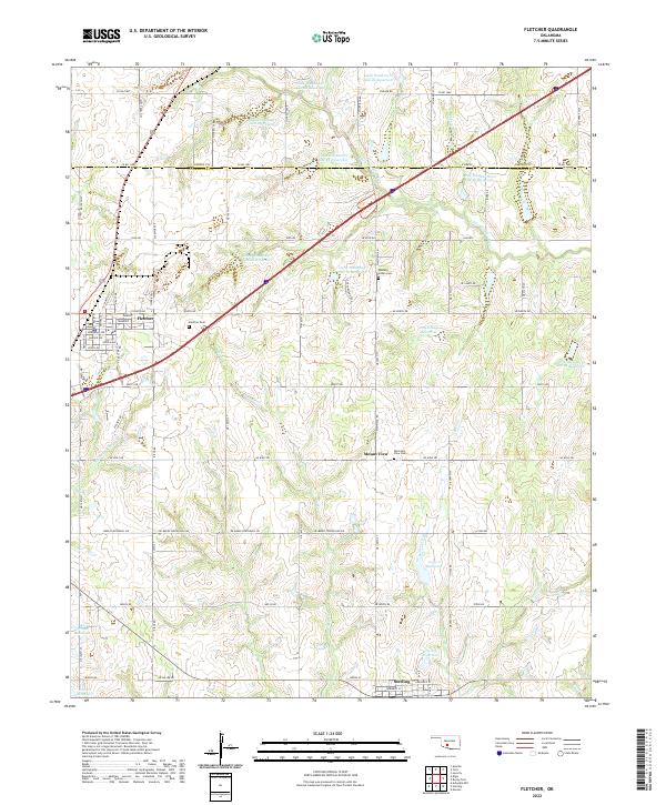 2022 Fletcher2022 Print · USGSThe Oklahoma prairie between Fletcher and Sterling is captured here as a landscape of managed waterways and historic settlements. Genealogists and researchers can locate family sites at the Washita Indian Cem or trace the path of the old Ozark Trl.
 - 2022 Map of Laverty, 2022 Print
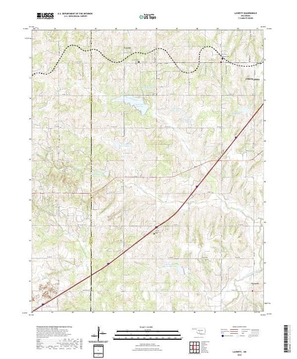 2022 Laverty2022 Print · USGSThe rural landscapes of Grady and Caddo Counties are documented here in the early twenty-first century. Researchers can trace family roots through local sites like Pioneer Cemetery, Laverty Cemetery, and the settlement of Norge.
 - 2022 Map of Boone, 2022 Print
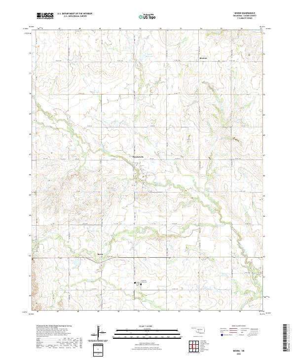 2022 Boone2022 Print · USGSCaddo County's rural landscape is documented here in the early 2020s, centered on the historic crossroads of Boone and Hatchetville. Researchers can trace local heritage at the Comanche Indian Cem and follow the drainage of East Cache Creek and Mission Cr.
 - 2022 Map of Cyril, 2022 Print
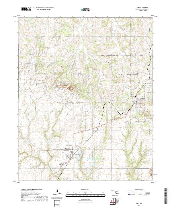 2022 Cyril2022 Print · USGSCyril and Cement are shown here in the 2020s, highlighting the enduring road networks and watercourses of Caddo County. Researchers can trace local heritage at Celestial Gardens Cem, follow the Little Washita River, or locate homesteads along Ware & Hollarn Rd.
 - 2022 Map of Apache, 2022 Print
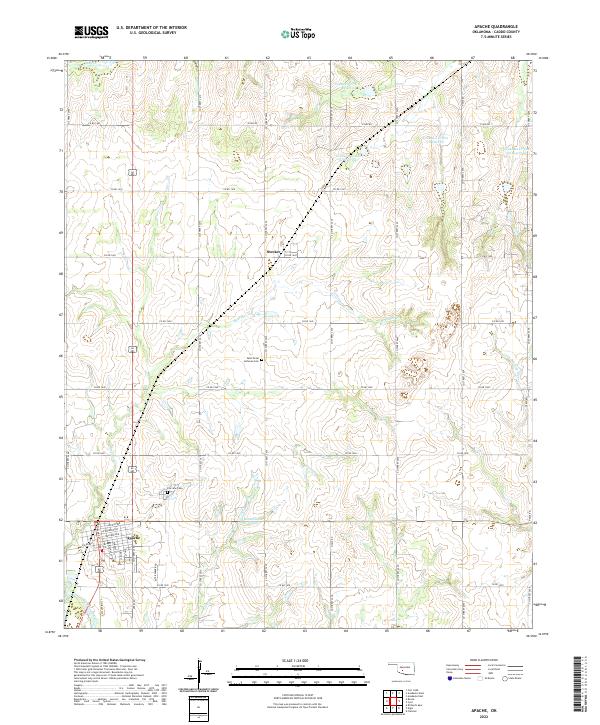 2022 Apache2022 Print · USGSThe community of Apache and its rural Caddo County surroundings are documented here in the early twenty-first century. Researchers can trace local lineage at Fairview Cem or explore the network of reservoirs including Weidenmaier Lakes.
 - 2022 Map of Alden, 2022 Print
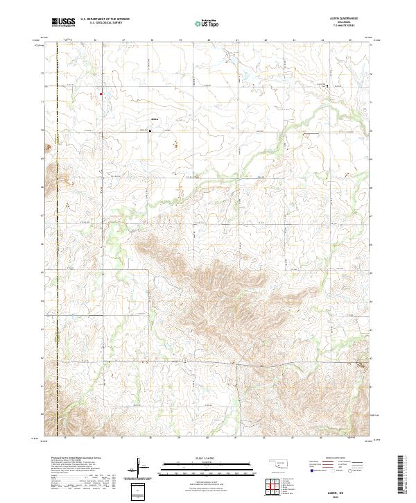 2022 Alden2022 Print · USGSThe rural landscape of Caddo County comes into focus in this recent survey of the prairie near the Kiowa County border. Genealogists and local historians can trace family roots through Alden Cem and Greenfield Cem or follow the winding courses of E Cache Cr and Tahoe Cr.
 - 2022 Map of Eakly NE, 2022 Print
 2022 Eakly NE2022 Print · USGSCaddo County's agricultural landscape is documented here in the early twenty-first century, featuring a grid of section-line roads and prairie landmarks. Genealogists and local historians can locate Mound Valley Cem and prominent local features like Dead Woman Mound and Ghost Mound.
Showing maps 1-25 of 33
Top cities of Caddo County
- Anadarko historical maps
- Hinton historical maps
- Carnegie historical maps
- Apache historical maps
- Cyril historical maps
- Fort Cobb historical maps
See more
Frequently asked questions
- What are the different types of historical maps available for Caddo County?
- What is the oldest map of Caddo County?
- Where can I purchase historical maps of Caddo County for my home or office?
- Where can I download high-res historical maps of Caddo County?
- Are there historical topographic maps available for Caddo County?
- Is there historical aerial imagery available for Caddo County?
- Where are historical maps of Caddo County sourced from?