1950s Maps of Caddo County, Oklahoma
Explore 19 historic maps of Caddo County from the 1950s. These maps offer a rare glimpse into what life looked like during the 1950s — showing old roads, neighborhoods, homes, and landmarks that have changed or disappeared over time.
Whether you're researching your family's past, planning a metal detecting trip, or studying how Caddo County's landscape evolved across the 1950s, these high-resolution maps are a powerful tool for exploring the history of this region.
- Focus on a specific era: All maps on this page are from the 1950s, giving you a focused view of this time period.
- See what’s changed: Compare century-old streets, trails, and buildings to today's modern landscape using overlays and satellite layers.
- Research with precision: Use these maps for genealogy, historical research, land use analysis, or educational projects.
- View, download, or print: Maps are fully viewable online in high resolution, and can be downloaded or printed for your own records.
Start exploring Caddo County's history through authentic maps from the 1950s. This is your window into the past.
Caddo County, OK maps
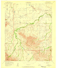
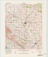
(19)- 1950 Map of Saddle Mountain, 1953 Print
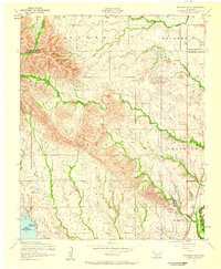
 1950 Saddle Mountain1953 Print · USGSSouthwestern Oklahoma in the early fifties shows a landscape where high granite peaks meet missionary history and early wildlife conservation. Researchers can trace rural school locations like Dixie Sch or find the remote Saddle Mountain Indian Mission and Kiowa Mission tucked among the foothills.2 unique versions available
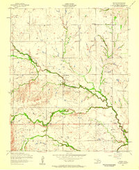
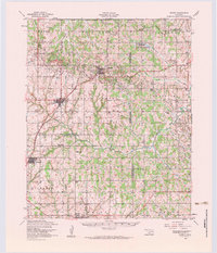
 - 1951 Map of Binger, 1952 Print
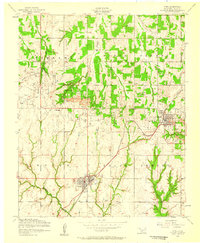
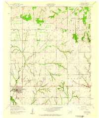
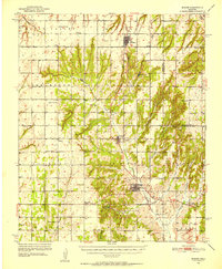 1951 Binger1952 Print · USGSCaddo County's agricultural and social landscape is captured here in the early fifties, showing a dense web of rural school districts and crossroads. Researchers can trace family roots through numerous sites like Sickles Sch, Hinton Cem, and the Indian Community House.3 unique versions available
 - 1951 Map of Fort Cobb, 1952 Print
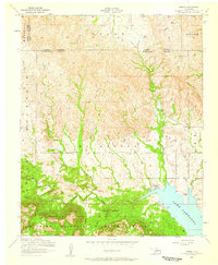
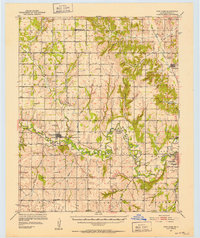 1951 Fort Cobb1952 Print · USGSCaddo County's agricultural and rail-driven landscape is captured here in the early fifties, centered on the Washita River valley. Genealogists and historians can trace the foundations of local life through rural landmarks like St Patricks Indian Mission, Oak Grove Cem, and the Riverside Indian Sch.5 unique versions available
 - 1955 Map of Lawton, 1958 Print
 1955 Lawton1958 Print · USGSSouthwestern Oklahoma and North Texas are shown here in the mid-fifties, dominated by the Wichita Mountains and the vital Red River watershed. Genealogists and historians can trace the foundations of Lawton alongside rural landmarks like Rainy Mountain Church and Pleasant Hill School.5 unique versions available
 - 1955 Map of Clinton, 1964 Print
 1955 Clinton1964 Print · USGSWestern Oklahoma during the mid-century transition shows a landscape of growing reservoirs and active military flight lines. Genealogists and historians can locate rural landmarks such as Mountain View Church, Berlin School, and the Riverside Indian School Reserve.3 unique versions available
 - 1956 Map of Laverty, 1959 Print
 1956 Laverty1959 Print · USGSGrady and Caddo counties are captured here in the mid-1950s, showing a landscape defined by the petroleum industry and rural settlement. Genealogists can trace family roots through sites like Pioneer Cemetery, Kechi School, and the community of Laverty.2 unique versions available
 - 1956 Map of Fletcher, 1959 Print
 1956 Fletcher1959 Print · USGSMid-century Oklahoma comes alive here as the St Louis San Francisco railroad passes through Fletcher. Researchers can find family landmarks like the Little Washita Indian Church, Mount View, and the Washita Indian Cemetery.2 unique versions available
 - 1956 Map of Alden, 1959 Print
 1956 Alden1959 Print · USGSCaddo County's agricultural prairies meet the rising slopes of the Wichita Mountains during the mid-fifties. Researchers can locate family landmarks like the Alden School, Cache Indian Mission, and the Greenfield Church near East Cache Creek.2 unique versions available
 - 1956 Map of Boone, 1959 Print
 1956 Boone1959 Print · USGSCaddo County's rural landscape is captured here in the mid-fifties, showing a community built around small settlements and seasonal creeks. Genealogists can locate family sites near Boone Memorial Church, the Comanche Indian Cemetery, or the rural crossroads of Hatchetville.2 unique versions available
 - 1956 Map of Rocky Ford, 1959 Print
 1956 Rocky Ford1959 Print · USGSThe rural borders of Grady, Caddo, and Comanche Counties come into focus during the mid-fifties. Researchers can trace ancestral locations near the Washita River or find local landmarks like Cedar Grove Church, Ridley Cemetery, and the settlement of Rocky Ford.2 unique versions available
 - 1956 Map of Elgin, 1959 Print
 1956 Elgin1959 Print · USGSThe rail-and-ranching landscape of Oklahoma comes alive in the mid-fifties, centered on the junction of two major western railroads. Genealogists and historians can trace the local community through St Anthonys Church, the Elgin Cemetery, and the northern perimeter of the Fort Sill Military Reservation.3 unique versions available
 - 1956 Map of Richards Spur, 1959 Print
 1956 Richards Spur1959 Print · USGSOklahoma's Comanche County terrain is captured here in the mid-fifties, showing the intersection of heavy industry and rural life at the edge of the military reservation. Genealogists can locate Mount Scott Cemetery, Stony Point School, and the Cache Creek Mission.2 unique versions available
 - 1956 Map of Meers, 1959 Print
 1956 Meers1959 Print · USGSOklahoma's Wichita Mountains meet the plains in the mid-1950s as the small community of Meers anchors the local landscape. Genealogists and historians can trace sites like the Meers Cemetery, the Mount Scott Kiowa Mission, and the shores of Lake Lawtonka.2 unique versions available
 - 1956 Map of Cyril, 1959 Print
 1956 Cyril1959 Print · USGSCaddo County during the mid-1950s was a hub of petroleum production and rail transport. Researchers can trace the industrial footprint of the North Cement Oil and Gas Field, locate the Oil Refinery at Cyril, and find local landmarks like the Tonkawa Mission.2 unique versions available
 - 1956 Map of Apache, 1959 Print
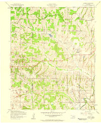
 1956 Apache1959 Print · USGSCaddo County's agricultural and industrial landscape comes into focus in the mid-1950s, centered on the hub of Apache. Genealogists and historians can trace the Rock Island rail line through Stecker and locate landmarks like Fairview Cemetery and the J Methvin Mission.2 unique versions available
 - 1956 Map of Apache, 1960 Print
 1956 Apache1960 Print · USGSCaddo and Comanche counties come into focus during the mid-fifties as agriculture and military operations define the local landscape. Researchers can trace rural landmarks from the Mahsetka Indian Church to the limestone works at Richards Spur and the rail sidings of Stecker.2 unique versions available
 - 1956 Map of Cement, 1960 Print
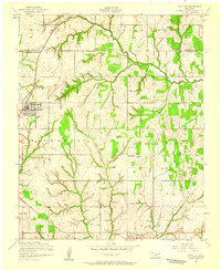
 1956 Cement1960 Print · USGSMid-century Caddo and Comanche counties are defined here by a blend of industrial growth and tribal heritage. Genealogists and historians can trace family locations near the Washita Indian Cemetery, the local Oil Refinery, and schools like Pioneer School.3 unique versions available
 - 1956 Map of Saddle Mountain, 1960 Print
 1956 Saddle Mountain1960 Print · USGSThe Wichita Mountains and surrounding plains are captured in the mid-fifties, featuring the Wichita Mountains Wildlife Refuge and its dramatic peaks. Genealogy researchers can trace community roots at the Cache Indian Mission, Alden School, and Meers Cemetery.
 - 1957 Map of Clinton
 1957 Clinton1957 Print · USGSWestern Oklahoma in the mid-fifties is captured here as a landscape of river-valley settlements and emerging energy fields. Genealogists can trace family roots through numerous rural landmarks like the Swapping Back Indian School, Hebron Church, and the Riverside Indian School Reserve.
End of results
Showing maps 1-19 of 19
Top cities of Caddo County
- Anadarko historical maps
- Hinton historical maps
- Carnegie historical maps
- Apache historical maps
- Cyril historical maps
- Fort Cobb historical maps
See more
Frequently asked questions
- What are the different types of historical maps available for Caddo County?
- What is the oldest map of Caddo County?
- Where can I purchase historical maps of Caddo County for my home or office?
- Where can I download high-res historical maps of Caddo County?
- Are there historical topographic maps available for Caddo County?
- Is there historical aerial imagery available for Caddo County?
- Where are historical maps of Caddo County sourced from?