
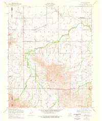
1956 Map of Alden
USGS Topo · Published 1959About this map
Alden anchors the northern portion of this Caddo County survey, serving as a hub for the surrounding agricultural and ranching landscape. The community structure of the mid-1950s is well-defined by its local institutions, including the Alden School, Community Church, and nearby Greenfield Church. To the south, the topography shifts dramatically as the terrain rises into the distinctive heights of Saddle Mountain, Banner, and Cache. The drainage of East Cache Creek carves through these uplands, providing a natural corridor for the Cache Indian Mission and the Cache School. This map captures a rural Oklahoma settlement pattern where small schools and missions were strategically located along the creek valleys to serve the population living between the Kiowa and Caddo county lines.
Find a feature on this map
15 named features on this map. Tap any name to fly to it.
Don’t see what you’re looking for? This feature index may not catch every label — zoom into the map to look around manually.
Map Details
Editions of this 1956 Alden Map
2 editions found
Other maps of this area

1950 · Saddle Mountain
USGS Topo · 1:62,500

1951 · Fort Cobb
USGS Topo · 1:62,500

1955 · Lawton
USGS Topo · 1:250,000

1955 · Clinton
USGS Topo · 1:250,000

1956 · Saddle Mountain
USGS Topo · 1:24,000

1956 · Boone
USGS Topo · 1:24,000

1956 · Richards Spur
USGS Topo · 1:24,000

1956 · Bally Mountain
USGS Topo · 1:24,000

1956 · Meers
USGS Topo · 1:24,000

1956 · Apache
USGS Topo · 1:62,500