2020s Maps of Cotton County, Oklahoma
Explore 18 historic maps of Cotton County from the 2020s. These maps offer a rare glimpse into what life looked like during the 2020s — showing old roads, neighborhoods, homes, and landmarks that have changed or disappeared over time.
Whether you're researching your family's past, planning a metal detecting trip, or studying how Cotton County's landscape evolved across the 2020s, these high-resolution maps are a powerful tool for exploring the history of this region.
- Focus on a specific era: All maps on this page are from the 2020s, giving you a focused view of this time period.
- See what’s changed: Compare century-old streets, trails, and buildings to today's modern landscape using overlays and satellite layers.
- Research with precision: Use these maps for genealogy, historical research, land use analysis, or educational projects.
- View, download, or print: Maps are fully viewable online in high resolution, and can be downloaded or printed for your own records.
Start exploring Cotton County's history through authentic maps from the 2020s. This is your window into the past.
Cotton County, OK maps
(18)- 2022 Map of Temple NW, 2022 Print
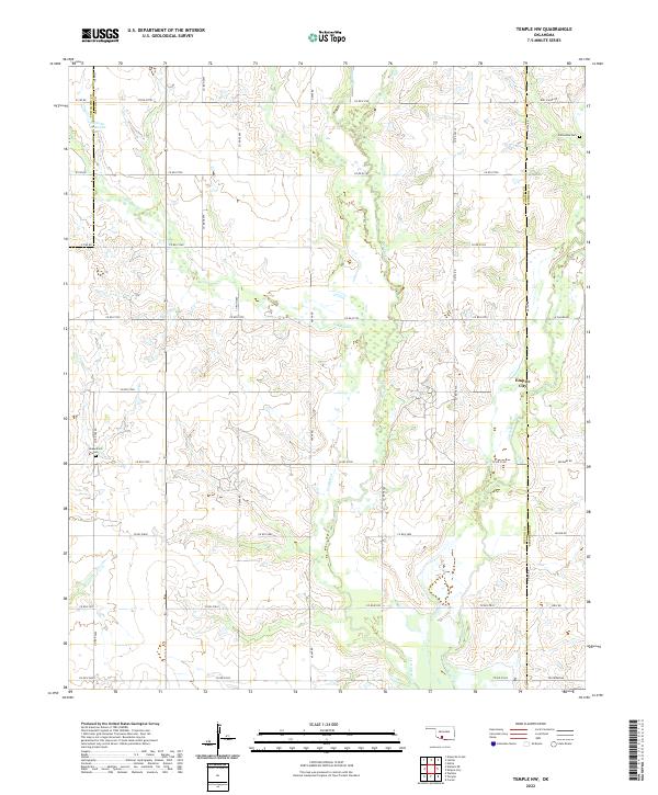 2022 Temple NW2022 Print · USGSThe Cotton County landscape north of Temple shows its established oil and agricultural character in the 2020s. Genealogists and historians can locate Comanche Cem and Shakelford Cem or trace the drainage of Beaver Cr near Empire City.
 - 2022 Map of Walters, 2022 Print
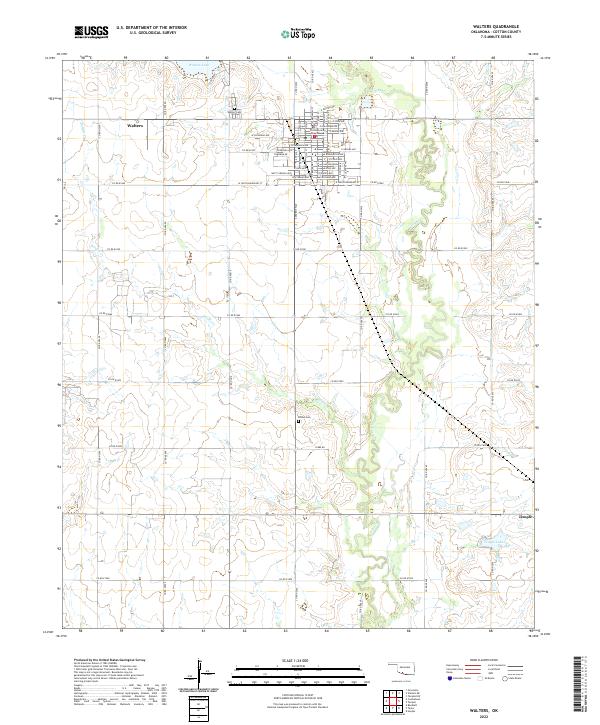 2022 Walters2022 Print · USGSCotton County comes into focus in this recent survey of the Oklahoma plains. Genealogists and local historians can trace family locations near Walters Cem and Brown Cem, or locate the Cotton County Courthouse in the heart of Walters.
 - 2022 Map of Hooper, 2022 Print
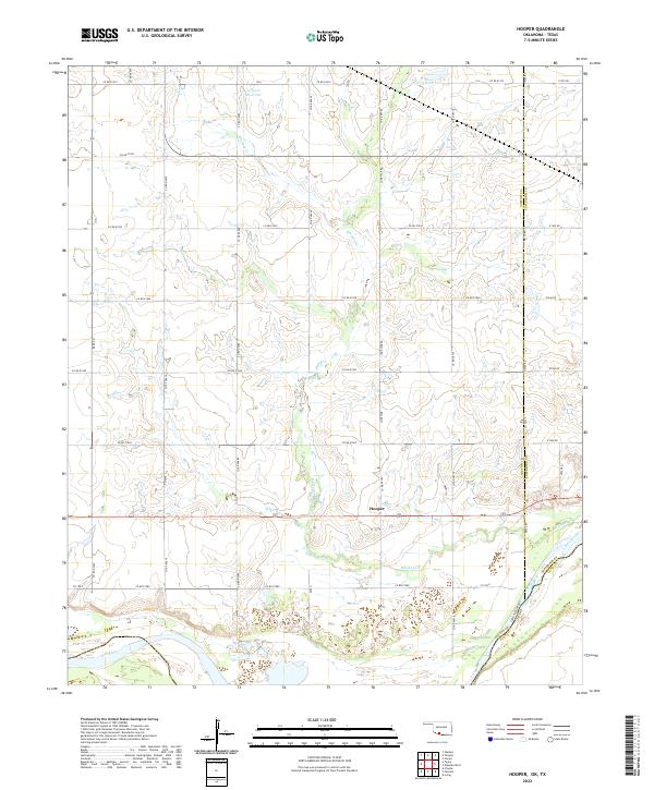 2022 Hooper2022 Print · USGSThe Oklahoma-Texas border along the Red River is captured here during the early twenty-first century. Researchers can trace the rural landscape around Hooper and follow the path of Whiskey Cr through the heart of Cotton County.
 - 2022 Map of Letitia, 2022 Print
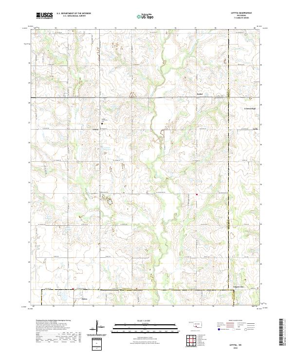 2022 Letitia2022 Print · USGSSoutheastern Oklahoma's rural section lines and creek drainages are mapped here in the modern era. Genealogists can locate family landmarks like the Letitia Community Cem or trace the small settlements of Letitia, Bethel, and Central High.
 - 2022 Map of Taylor, 2022 Print
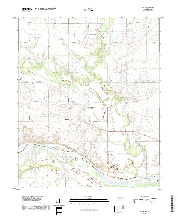 2022 Taylor2022 Print · USGSThe Oklahoma-Texas border comes into focus in this recent survey of the lands where Cotton County meets the Red River. Researchers can trace the rural settlement of Taylor and the serpentine paths of Cache Creek and W Cache Cr as they flow south toward the state line.
 - 2022 Map of Whites Lake, 2022 Print
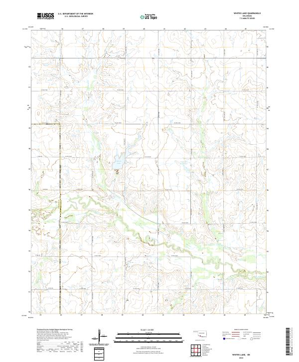 2022 Whites Lake2022 Print · USGSCotton County ranchlands and rural section roads come into focus in this modern survey of the Oklahoma prairie. Genealogists and land researchers can trace the waters of Whites Lake and the confluence of Sanatag Cr and Deep Red Cr.
 - 2022 Map of Chattanooga SW, 2022 Print
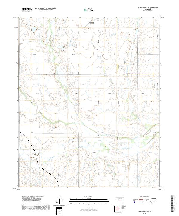 2022 Chattanooga SW2022 Print · USGSThe borderlands of Tillman and Cotton Counties are shown here in the 2020s, dominated by the rolling plains and section-line roads. Researchers can trace the hydrography of Deep Red Cr and locate local landmarks like the Chattanooga Sky Harbor Airport and Jack Cr Site 7 Reservoir.
 - 2022 Map of Randlett, 2022 Print
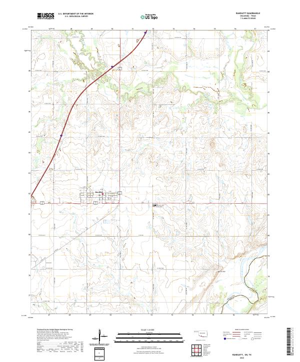 2022 Randlett2022 Print · USGSThe borderlands of Cotton County come into focus in this recent survey of Randlett, where the Red River separates Oklahoma from Texas. Researchers can trace local history through the grid of town streets and the Fairview Cem of Randlett.
 - 2022 Map of Cookietown, 2022 Print
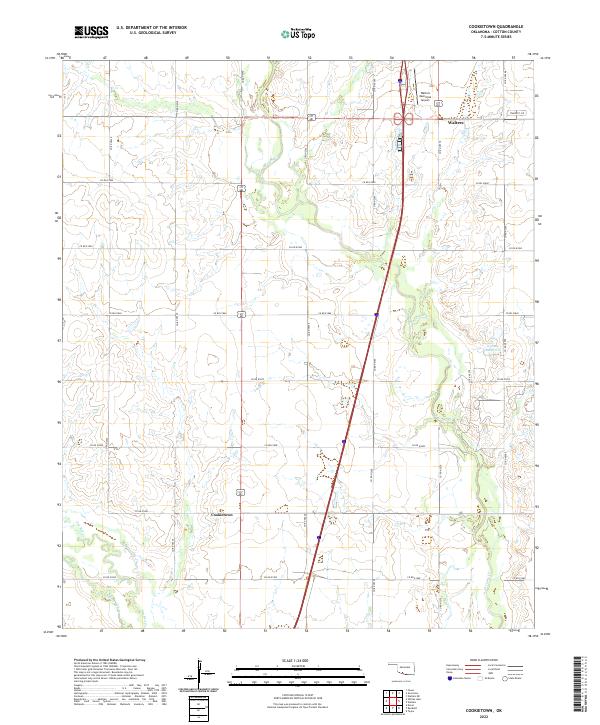 2022 Cookietown2022 Print · USGSCotton County prairie life in the early 2020s is defined by its rural intersections and creek drainages. Researchers can trace the section-line roads connecting Cookietown and Walters while locating local landmarks like the Walters Municipal Airport and W Cache Cr.
 - 2022 Map of Devol, 2022 Print
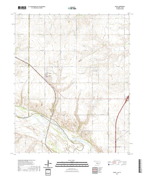 2022 Devol2022 Print · USGSSouthern Oklahoma at the Texas border shows a landscape organized by section-line roads and the winding Red River. Genealogists and local historians can trace the townsite of Devol, locating the PO and Devol Cem near the river's north bank.
 - 2022 Map of Faxon, 2022 Print
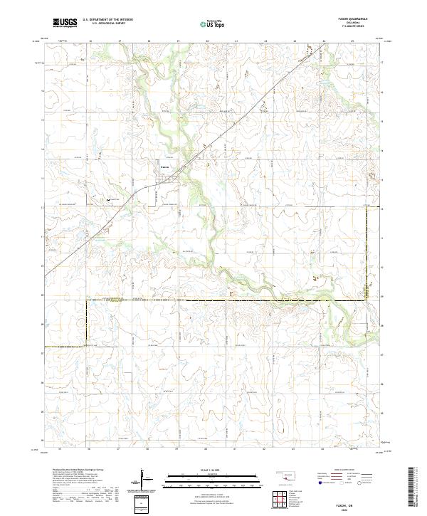 2022 Faxon2022 Print · USGSFaxon and the surrounding Comanche County prairie are captured here in the early twenty-first century. Researchers can locate family plots at Faxon Cem and trace the drainage of the local watershed along W Cache Cr and Blue Beaver Cr.
 - 2022 Map of Walters NE, 2022 Print
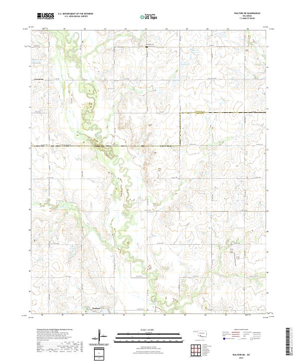 2022 Walters NE2022 Print · USGSCotton and Comanche Counties in the early 2020s remain defined by a deep-rooted agricultural grid centered on the drainage of E Cache Cr. Local researchers can trace family landmarks and burial sites including Allendale Cem, Devine Cem, and the Jones Farm Field.
 - 2022 Map of Geronimo, 2022 Print
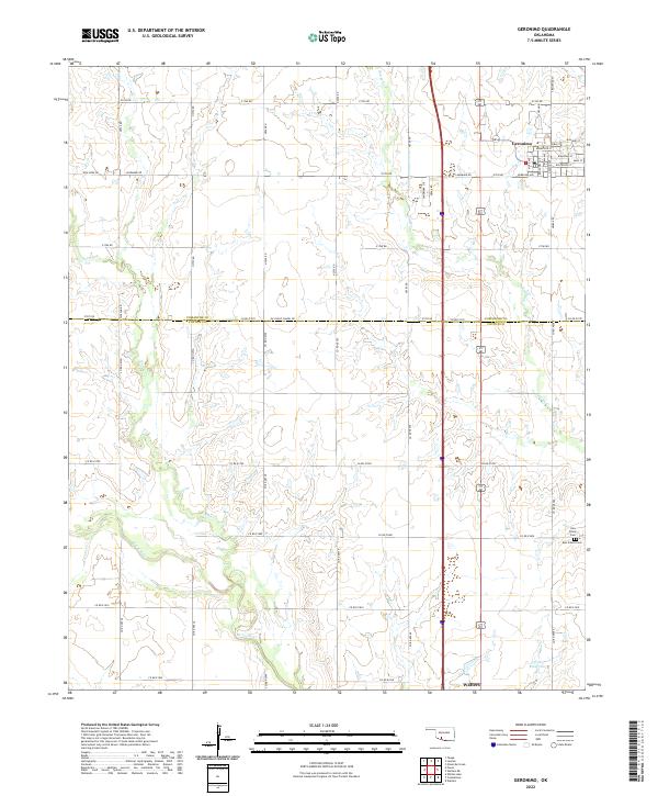 2022 Geronimo2022 Print · USGSGeronimo and the surrounding prairie of Comanche and Cotton Counties are captured here at a time when traditional section-line farming still defines the landscape. Trace local heritage and early family sites at Elm Grove Cem, New Salem Cem, or along the banks of Snake Cr.
 - 2022 Map of Temple, 2022 Print
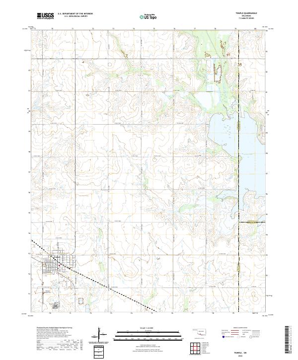 2022 Temple2022 Print · USGSTemple and the surrounding plains of Cotton County are captured here just as the modern reservoir system defines the eastern landscape. Genealogists and local historians can trace the town’s grid from W Main St to the Temple Cem, while following the original courses of Beaver Creek and Whiskey Cr.
 - 2022 Map of Chattanooga, 2022 Print
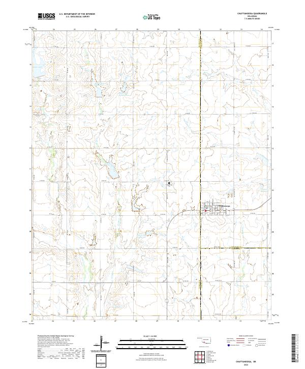 2022 Chattanooga2022 Print · USGSChattanooga and the intersection of Comanche and Tillman counties are captured here in the early twenty-first century. Genealogists and local historians can trace family plots at Chattanooga Cem or study the water systems at Jack Cr Site 2a Reservoir and Kinder Lake.
 - 2022 Map of Burkburnett, 2022 Print
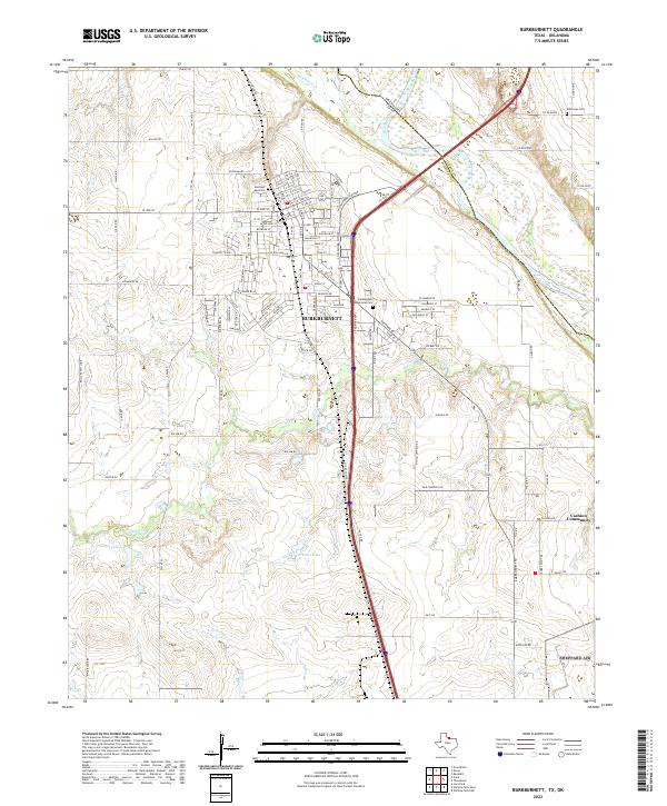 2022 Burkburnett2022 Print · USGSNorth Texas and the Oklahoma borderlands are detailed here in the 2020s, showcasing the urban layout of Burkburnett along the Red River. Researchers can trace local heritage through sites like Cashion Community, Wilkerson Cem, and Preston Lake.
 - 2022 Map of Petrolia, 2022 Print
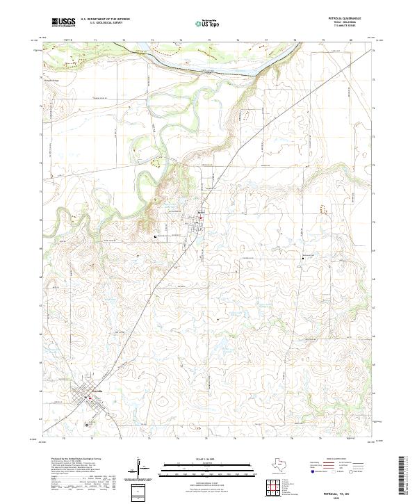 2022 Petrolia2022 Print · USGSThe Clay County borderlands at the turn of the 2020s show a landscape shaped by the Red River and the rural communities of Byers and Petrolia. Researchers can trace local lineage at Riverside Cem or locate the site of the Valentine School near Pumpkin Ridge.
 - 2022 Map of Thornberry, 2022 Print
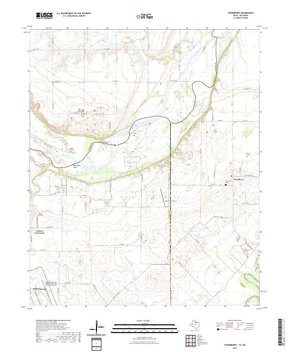 2022 Thornberry2022 Print · USGSThe Texas-Oklahoma borderlands come alive in this study of the Red River valley during the early twenty-first century. Researchers can trace family roots at Thornberry Cem or explore the landscape around the Cashion Community and McFarland Island.
End of results
Showing maps 1-18 of 18
Top cities of Cotton County
Frequently asked questions
- What are the different types of historical maps available for Cotton County?
- What is the oldest map of Cotton County?
- Where can I purchase historical maps of Cotton County for my home or office?
- Where can I download high-res historical maps of Cotton County?
- Are there historical topographic maps available for Cotton County?
- Is there historical aerial imagery available for Cotton County?
- Where are historical maps of Cotton County sourced from?